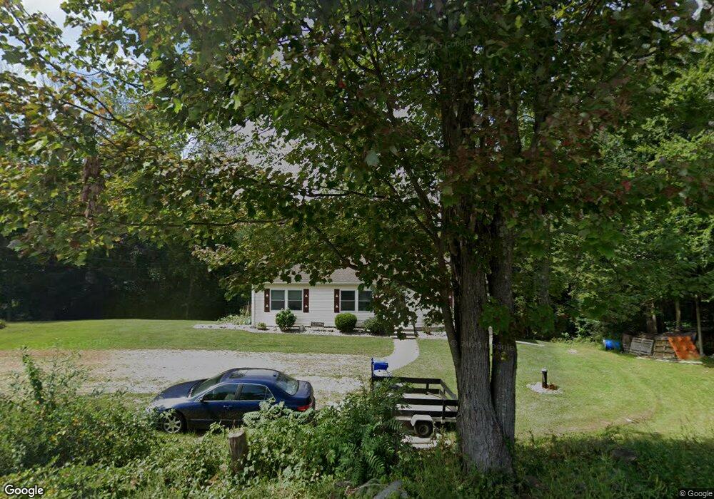
701 Cedar Swamp Rd Coventry, CT 06238
Estimated Value: $378,000 - $438,779
3
Beds
2
Baths
1,352
Sq Ft
$305/Sq Ft
Est. Value
About This Home
This home is located at 701 Cedar Swamp Rd, Coventry, CT 06238 and is currently estimated at $412,945, approximately $305 per square foot. 701 Cedar Swamp Rd is a home located in Tolland County with nearby schools including Coventry Grammar School, George Hersey Robertson School, and Capt. Nathan Hale School.
Ownership History
Date
Name
Owned For
Owner Type
Purchase Details
Closed on
Nov 14, 2003
Sold by
Steady Jeffrey and Steady Deborah
Bought by
Girard Christopher and Girard Beverly
Current Estimated Value
Purchase Details
Closed on
Aug 27, 2001
Sold by
Block Michael S
Bought by
Steady Jeffrey and Steady Deborah
Purchase Details
Closed on
Aug 21, 2000
Sold by
Villar Patricia
Bought by
Block Michael
Purchase Details
Closed on
Jun 24, 1997
Sold by
Hightower Corp
Bought by
S R Blanchard Inc
Purchase Details
Closed on
Aug 1, 1996
Sold by
Whittle Stuart and Whittle Karen
Bought by
Lerch Arnold and Lerch Elaine
Purchase Details
Closed on
May 24, 1995
Sold by
Haberern Robert
Bought by
Country Way Dev
Purchase Details
Closed on
Jun 30, 1994
Sold by
Therriein Donald and Therrien Betty
Bought by
Towne & Country Bldrs
Purchase Details
Closed on
Mar 24, 1993
Sold by
Dyber John A Est and Dyber
Bought by
Gessay Norman
Purchase Details
Closed on
Jun 4, 1992
Sold by
Colonial Dev
Bought by
Whittle Stuart and Whittle Karen
Purchase Details
Closed on
Jun 10, 1991
Sold by
Leblanc George
Bought by
Leblanc Jean Paul and Leblanc Francis
Purchase Details
Closed on
Dec 5, 1989
Sold by
Colonial Devel
Bought by
Gordon John
Purchase Details
Closed on
Apr 6, 1989
Sold by
Rizy Frank
Bought by
Colonial Devel Inc
Purchase Details
Closed on
Oct 23, 1987
Sold by
Bavier Paul
Bought by
Robinson Charles
Create a Home Valuation Report for This Property
The Home Valuation Report is an in-depth analysis detailing your home's value as well as a comparison with similar homes in the area
Home Values in the Area
Average Home Value in this Area
Purchase History
| Date | Buyer | Sale Price | Title Company |
|---|---|---|---|
| Girard Christopher | $205,000 | -- | |
| Steady Jeffrey | $153,100 | -- | |
| Block Michael | $25,000 | -- | |
| S R Blanchard Inc | $160,000 | -- | |
| Hightower Corp | $25,000 | -- | |
| Lerch Arnold | $45,000 | -- | |
| Country Way Dev | $41,800 | -- | |
| Country Way Dev | $167,200 | -- | |
| Towne & Country Bldrs | $42,000 | -- | |
| Gessay Norman | $80,000 | -- | |
| Whittle Stuart | $43,000 | -- | |
| Leblanc Jean Paul | $14,000 | -- | |
| Girard Christopher | $205,000 | -- | |
| Steady Jeffrey | $153,100 | -- | |
| Block Michael | $25,000 | -- | |
| Hightower Corp | $25,000 | -- | |
| Lerch Arnold | $45,000 | -- | |
| Country Way Dev | $167,200 | -- | |
| Towne & Country Bldrs | $42,000 | -- | |
| Gessay Norman | $80,000 | -- | |
| Whittle Stuart | $43,000 | -- | |
| Leblanc Jean Paul | $14,000 | -- | |
| Gordon John | $59,900 | -- | |
| Colonial Devel Inc | $390,000 | -- | |
| Robinson Charles | $142,000 | -- |
Source: Public Records
Mortgage History
| Date | Status | Borrower | Loan Amount |
|---|---|---|---|
| Open | Robinson Charles | $100,000 |
Source: Public Records
Tax History
| Year | Tax Paid | Tax Assessment Tax Assessment Total Assessment is a certain percentage of the fair market value that is determined by local assessors to be the total taxable value of land and additions on the property. | Land | Improvement |
|---|---|---|---|---|
| 2025 | $5,816 | $244,800 | $73,500 | $171,300 |
| 2024 | $5,709 | $171,400 | $75,200 | $96,200 |
| 2023 | $5,440 | $171,400 | $75,200 | $96,200 |
| 2022 | $5,339 | $171,400 | $75,200 | $96,200 |
| 2021 | $5,339 | $171,400 | $75,200 | $96,200 |
| 2020 | $5,343 | $171,400 | $75,200 | $96,200 |
| 2019 | $5,519 | $171,400 | $75,200 | $96,200 |
| 2018 | $5,268 | $163,600 | $77,100 | $86,500 |
| 2017 | $5,235 | $163,600 | $77,100 | $86,500 |
| 2016 | $5,104 | $163,600 | $77,100 | $86,500 |
| 2015 | $5,104 | $163,600 | $77,100 | $86,500 |
| 2014 | $5,546 | $194,800 | $99,500 | $95,300 |
Source: Public Records
Map
Nearby Homes
- 7 Laurelwood Ln Unit Lot 15
- 12 Laurelwood Ln Unit lot 8
- 5 Laurelwood Ln Unit lot 16
- 720 Bolton Rd
- 23 Neville St
- 93 Dockerel Rd
- 16 Higgins Way
- 0 Mile Hill Rd
- 279 Mark Dr
- 939 Boston Turnpike
- 61 Stone Hedge Ln
- 0 Boston Turnpike Unit 24128587
- 361 Dunn Rd
- 395 Grant Hill (Mill Race Drive) Lot #21 Rd
- 395 Grant Hill Rd Unit Lot21
- 37 Wolf Hill Rd Unit Lot 40
- 37 Wolf Hill Lot (#40) Rd
- 2 Vine Dr
- 25 Wolf Hill Rd
- 64 Columbine Rd
- 733 Cedar Swamp Rd
- 704 Cedar Swamp Rd
- 692 Cedar Swamp Rd
- 0 Cedar Swamp Rd Unit B
- 750 Cedar Swamp Rd
- 662 Cedar Swamp Rd
- 698 Cedar Swamp Rd
- 655 Cedar Swamp Rd
- 650 Cedar Swamp Rd
- 770 Cedar Swamp Rd
- 630 Cedar Swamp Rd
- 0 Vernon Branch Rd
- 612 Cedar Swamp Rd
- 684 Cedar Swamp Rd
- 830 Cedar Swamp Rd
- 571 Cedar Swamp Rd
- 840 Cedar Swamp Rd
- 592 Cedar Swamp Rd
- 41 High Meadow Ln
- 762 Cedar Swamp Rd
Your Personal Tour Guide
Ask me questions while you tour the home.