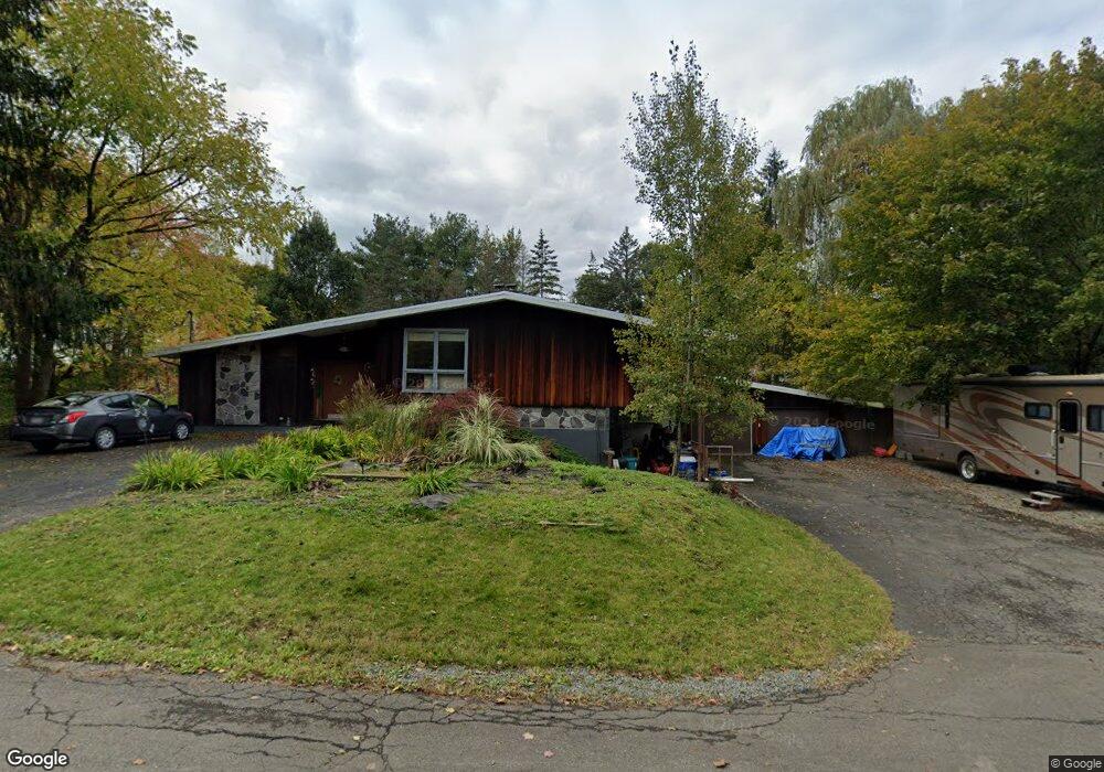
701 Cieri Dr Unit 705 Endicott, NY 13760
Estimated Value: $205,000 - $276,000
3
Beds
2
Baths
1,616
Sq Ft
$154/Sq Ft
Est. Value
About This Home
This home is located at 701 Cieri Dr Unit 705, Endicott, NY 13760 and is currently estimated at $248,484, approximately $153 per square foot. 701 Cieri Dr Unit 705 is a home located in Broome County with nearby schools including Union-Endicott High School, All Saints School, and All Saints.
Ownership History
Date
Name
Owned For
Owner Type
Purchase Details
Closed on
Sep 27, 2019
Sold by
Angelastro Gale
Bought by
Wahl Bryan and Wahl Jacqueline
Current Estimated Value
Home Financials for this Owner
Home Financials are based on the most recent Mortgage that was taken out on this home.
Original Mortgage
$113,960
Outstanding Balance
$99,835
Interest Rate
3.5%
Mortgage Type
New Conventional
Estimated Equity
$148,649
Purchase Details
Closed on
Oct 25, 2002
Sold by
Eggleston John H and Eggleston Regina S
Bought by
Thompson Brian D
Create a Home Valuation Report for This Property
The Home Valuation Report is an in-depth analysis detailing your home's value as well as a comparison with similar homes in the area
Home Values in the Area
Average Home Value in this Area
Purchase History
| Date | Buyer | Sale Price | Title Company |
|---|---|---|---|
| Wahl Bryan | $112,000 | Title Insurance | |
| Thompson Brian D | $145,000 | Earl Butler | |
| Thompson Brian D | $145,000 | Earl Butler |
Source: Public Records
Mortgage History
| Date | Status | Borrower | Loan Amount |
|---|---|---|---|
| Open | Wahl Bryan | $113,960 |
Source: Public Records
Tax History
| Year | Tax Paid | Tax Assessment Tax Assessment Total Assessment is a certain percentage of the fair market value that is determined by local assessors to be the total taxable value of land and additions on the property. | Land | Improvement |
|---|---|---|---|---|
| 2024 | $7,425 | $6,900 | $800 | $6,100 |
| 2023 | $7,260 | $6,900 | $800 | $6,100 |
| 2022 | $7,226 | $6,900 | $800 | $6,100 |
| 2021 | $7,066 | $6,900 | $800 | $6,100 |
| 2020 | $6,832 | $6,900 | $800 | $6,100 |
| 2019 | $0 | $6,900 | $800 | $6,100 |
| 2018 | $5,889 | $6,900 | $800 | $6,100 |
| 2017 | $5,767 | $6,900 | $800 | $6,100 |
| 2016 | $5,662 | $6,900 | $800 | $6,100 |
| 2015 | -- | $6,900 | $800 | $6,100 |
| 2014 | -- | $6,900 | $800 | $6,100 |
Source: Public Records
Map
Nearby Homes
- 713 Wilson Ave
- 2608 Yale St
- 401 Taft Ave
- 819 N Rogers Ave
- 2714 Magnolia St
- 1202 Syracuse St
- 951 Southern Pines Dr
- 507 Odell Ave
- 932 Squires Ave
- 412 Oak Hill Ave
- 321 Hill Ave
- 211 Taft Ave
- 301 Squires Ave
- 326 Oak Hill Ave
- 721 Rogers Ave
- 222 Harding Ave
- 228 Hastings Ave
- 720 Squires Ave
- 128 Squires Ave
- 113 Hayes Ave
- 702 Christopher St Unit 704
- 700 Christopher St
- 706 Christopher St
- 706 Cieri Dr
- 608 Cieri Dr
- 714 Christopher St
- 603 Cieri Dr
- 1805 Newell Rd
- 716 Christopher St Unit 718
- 707 Columbus Ave
- 604 Cieri Dr Unit 1
- 604 Cieri Dr Unit 1 FL
- 604 Cieri Dr
- 1907 Newell Rd
- 609 Columbus Ave
- 1705 Summit St
- 1710 Summit St
- 707 Christopher St
- 2009 Newell Rd
- 709 Christopher St
Your Personal Tour Guide
Ask me questions while you tour the home.