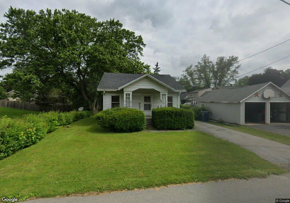
701 Davis Dr Newark, NY 14513
Estimated Value: $94,000 - $141,000
2
Beds
1
Bath
768
Sq Ft
$147/Sq Ft
Est. Value
About This Home
This home is located at 701 Davis Dr, Newark, NY 14513 and is currently estimated at $112,762, approximately $146 per square foot. 701 Davis Dr is a home located in Wayne County with nearby schools including Norman R. Kelley Intermediate School, Newark Middle School, and Newark Senior High School.
Ownership History
Date
Name
Owned For
Owner Type
Purchase Details
Closed on
Jun 17, 2025
Sold by
Close Timothy S
Bought by
Dejohn Jeffrey M
Current Estimated Value
Purchase Details
Closed on
May 23, 2014
Sold by
Kantor Teena Rose
Bought by
Close Timothy
Purchase Details
Closed on
Jan 13, 2000
Sold by
Estate Eligh Alice R
Bought by
Sistek Richard F
Create a Home Valuation Report for This Property
The Home Valuation Report is an in-depth analysis detailing your home's value as well as a comparison with similar homes in the area
Home Values in the Area
Average Home Value in this Area
Purchase History
| Date | Buyer | Sale Price | Title Company |
|---|---|---|---|
| Dejohn Jeffrey M | $25,000 | -- | |
| Close Timothy | -- | -- | |
| Sistek Richard F | $43,500 | Arthur B Williams |
Source: Public Records
Tax History
| Year | Tax Paid | Tax Assessment Tax Assessment Total Assessment is a certain percentage of the fair market value that is determined by local assessors to be the total taxable value of land and additions on the property. | Land | Improvement |
|---|---|---|---|---|
| 2024 | $2,158 | $74,000 | $7,400 | $66,600 |
| 2023 | $2,101 | $39,900 | $8,100 | $31,800 |
| 2022 | $2,064 | $39,900 | $8,100 | $31,800 |
| 2021 | $2,036 | $39,900 | $8,100 | $31,800 |
| 2020 | $2,349 | $39,900 | $8,100 | $31,800 |
| 2019 | $536 | $39,900 | $8,100 | $31,800 |
| 2018 | -- | $39,900 | $8,100 | $31,800 |
| 2017 | -- | $39,900 | $8,100 | $31,800 |
| 2016 | -- | $39,900 | $8,100 | $31,800 |
| 2015 | -- | $39,900 | $8,100 | $31,800 |
| 2014 | -- | $55,500 | $8,100 | $47,400 |
Source: Public Records
Map
Nearby Homes
- 604 Davis Dr
- 506 W Union St
- L36 State 31
- 717 S Main St
- 108 Van Dusen St
- 135 Wilson St
- 105 Prospect St
- 128 Prospect St
- 132 Highland Ave
- 206 N Orchard St
- 146 South Ave
- 224 Norton St
- 1140 N Main St
- 119 Daniel
- 0 Blue Cut Rd
- 606 Silver Hill Rd
- 516 County Road 26
- 6901 Blue Cut Rd
- 6414 Mud Mills Rd
- 6928 State Route 31 E
- 165 Peirson Ave
- 163 Peirson Ave
- 159 Peirson Ave
- 155 Peirson Ave
- 201 Peirson Ave
- 164 Peirson Ave
- 160 Peirson Ave
- 153 Peirson Ave
- 205 Peirson Ave
- 262 Edgett St
- 622 Davis Dr
- 258 Edgett St
- 149 Peirson Ave
- 710 Davis Dr
- 209 Peirson Ave
- 616 Davis Dr
- 254 Edgett St
- 154 Peirson Ave
- 147 Peirson Ave
- 211 Peirson Ave
Your Personal Tour Guide
Ask me questions while you tour the home.