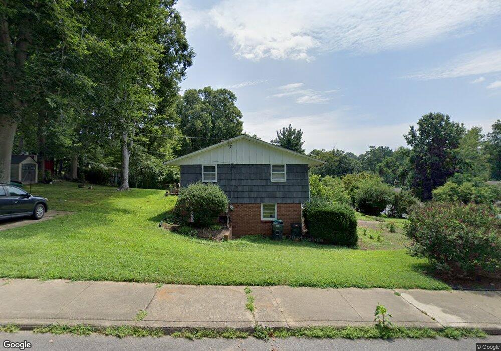
701 Dell Ln Charlottesville, VA 22901
Locust Grove NeighborhoodEstimated Value: $460,928 - $502,000
3
Beds
2
Baths
1,878
Sq Ft
$255/Sq Ft
Est. Value
About This Home
This home is located at 701 Dell Ln, Charlottesville, VA 22901 and is currently estimated at $478,982, approximately $255 per square foot. 701 Dell Ln is a home located in Charlottesville City with nearby schools including Burnley-Moran Elementary School, Buford Middle School, and Charlottesville High School.
Ownership History
Date
Name
Owned For
Owner Type
Purchase Details
Closed on
Feb 21, 2017
Sold by
Griffith Charlotte B
Bought by
Homyk Andrew D
Current Estimated Value
Home Financials for this Owner
Home Financials are based on the most recent Mortgage that was taken out on this home.
Original Mortgage
$241,900
Outstanding Balance
$199,833
Interest Rate
4.12%
Mortgage Type
New Conventional
Estimated Equity
$279,149
Purchase Details
Closed on
Jul 17, 1970
Bought by
Baltins Guntis U and Baltins Shirley B
Create a Home Valuation Report for This Property
The Home Valuation Report is an in-depth analysis detailing your home's value as well as a comparison with similar homes in the area
Home Values in the Area
Average Home Value in this Area
Purchase History
| Date | Buyer | Sale Price | Title Company |
|---|---|---|---|
| Homyk Andrew D | $281,900 | Chicago Title Ins Co | |
| Baltins Guntis U | $22,000 | -- |
Source: Public Records
Mortgage History
| Date | Status | Borrower | Loan Amount |
|---|---|---|---|
| Open | Homyk Andrew D | $241,900 |
Source: Public Records
Tax History Compared to Growth
Tax History
| Year | Tax Paid | Tax Assessment Tax Assessment Total Assessment is a certain percentage of the fair market value that is determined by local assessors to be the total taxable value of land and additions on the property. | Land | Improvement |
|---|---|---|---|---|
| 2025 | $4,473 | $449,100 | $120,000 | $329,100 |
| 2024 | $4,473 | $401,000 | $120,000 | $281,000 |
| 2023 | $3,882 | $396,900 | $120,000 | $276,900 |
| 2022 | $3,635 | $371,100 | $115,000 | $256,100 |
| 2021 | $3,052 | $313,700 | $84,000 | $229,700 |
| 2020 | $2,927 | $300,500 | $84,000 | $216,500 |
| 2019 | $2,873 | $294,800 | $80,000 | $214,800 |
| 2018 | $1,331 | $272,700 | $80,000 | $192,700 |
| 2017 | $2,507 | $256,300 | $74,900 | $181,400 |
| 2016 | $2,303 | $234,800 | $58,500 | $176,300 |
| 2015 | $2,028 | $228,100 | $51,800 | $176,300 |
| 2014 | $2,028 | $228,100 | $51,800 | $176,300 |
Source: Public Records
Map
Nearby Homes
- 1018 Ashby Place
- 1018 Glendale Rd
- 623 North Ave
- 1115 Cottonwood Rd
- Lot A Saint Charles Ave
- 1105 Saint Charles Ct
- 1210 Agnese St
- 608 Davis Ave
- 900 Locust Ln
- 106 Melbourne Park Cir Unit E
- 106 Melbourne Park Cir Unit F
- 960 Locust Ave
- 1234 Holmes Ave
- 807 Watson Ave
- 583 Southampton Ct
- 1007 Saint Clair Ave
- 0 Saint Charles Ave Unit 656217
- 703 Dell Ln
- 1018 Cottonwood Rd
- 705 Dell Ln
- 1017 Cottonwood Rd
- 1019 Cottonwood Rd
- 1013 Glendale Rd
- 1015 Cottonwood Rd
- 1020 Cottonwood Rd
- 700 Dell Ln
- 1021 Cottonwood Rd
- 702 Dell Ln
- 1013 Cottonwood Rd
- 105E Glissdale Ln
- 1015 Glendale Rd
- 1022 Cottonwood Rd
- 1011 Cottonwood Rd
- 614 Beechwood Dr
- 1017 Glendale Rd
- 1010 Glendale Rd
- 1008 Cottonwood Rd