Estimated Value: $284,000 - $326,000
4
Beds
3
Baths
2,112
Sq Ft
$146/Sq Ft
Est. Value
About This Home
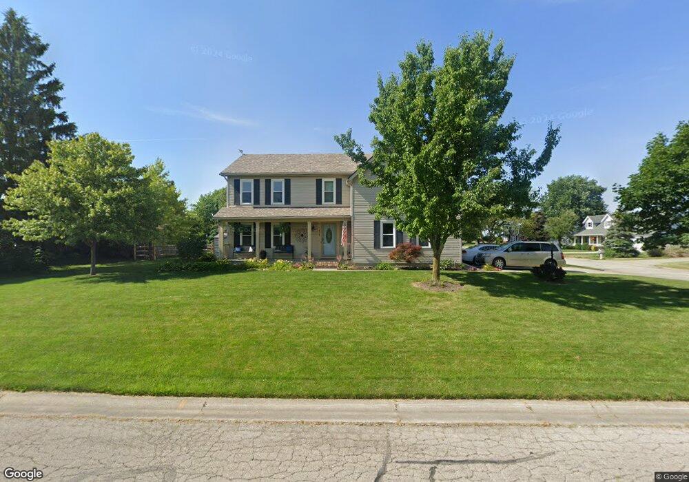
This home is located at 701 Harvest Ln, Delta, OH 43515 and is currently estimated at $308,625, approximately $146 per square foot. 701 Harvest Ln is a home located in Fulton County with nearby schools including Delta Elementary School, Pike-Delta-York Middle School, and Pike-Delta-York High School.
Ownership History
Date
Name
Owned For
Owner Type
Purchase Details
Closed on
Jul 2, 2015
Sold by
Ford Michael P and Ford Jessica A
Bought by
Cone James and Cone Kimberly
Current Estimated Value
Home Financials for this Owner
Home Financials are based on the most recent Mortgage that was taken out on this home.
Original Mortgage
$191,468
Outstanding Balance
$149,348
Interest Rate
3.87%
Mortgage Type
FHA
Estimated Equity
$159,277
Purchase Details
Closed on
Sep 26, 2006
Sold by
Bauman James D and Bauman Denise K
Bought by
Ford Michael P and Ford Jessica A
Home Financials for this Owner
Home Financials are based on the most recent Mortgage that was taken out on this home.
Original Mortgage
$164,000
Interest Rate
6.58%
Mortgage Type
Purchase Money Mortgage
Purchase Details
Closed on
Jan 1, 1990
Bought by
Bauman James D and Bauman Denise K
Create a Home Valuation Report for This Property
The Home Valuation Report is an in-depth analysis detailing your home's value as well as a comparison with similar homes in the area
Home Values in the Area
Average Home Value in this Area
Purchase History
| Date | Buyer | Sale Price | Title Company |
|---|---|---|---|
| Cone James | $195,000 | Attorney | |
| Ford Michael P | $205,000 | Attorney | |
| Bauman James D | -- | -- |
Source: Public Records
Mortgage History
| Date | Status | Borrower | Loan Amount |
|---|---|---|---|
| Open | Cone James | $191,468 | |
| Closed | Ford Michael P | $164,000 |
Source: Public Records
Tax History Compared to Growth
Tax History
| Year | Tax Paid | Tax Assessment Tax Assessment Total Assessment is a certain percentage of the fair market value that is determined by local assessors to be the total taxable value of land and additions on the property. | Land | Improvement |
|---|---|---|---|---|
| 2024 | $3,993 | $94,330 | $10,010 | $84,320 |
| 2023 | $3,993 | $94,330 | $10,010 | $84,320 |
| 2022 | $4,070 | $73,190 | $8,330 | $64,860 |
| 2021 | $4,134 | $73,190 | $8,330 | $64,860 |
| 2020 | $4,027 | $70,530 | $8,330 | $62,200 |
| 2019 | $3,664 | $66,010 | $8,330 | $57,680 |
| 2018 | $3,628 | $66,010 | $8,330 | $57,680 |
| 2017 | $3,582 | $66,010 | $8,330 | $57,680 |
| 2016 | $3,525 | $60,760 | $8,330 | $52,430 |
| 2015 | $3,468 | $60,760 | $8,330 | $52,430 |
| 2014 | $3,370 | $60,760 | $8,330 | $52,430 |
| 2013 | $2,843 | $51,730 | $6,440 | $45,290 |
Source: Public Records
Map
Nearby Homes
- 500 Sandalwood Ln
- 452 Monroe St
- 434 Monroe St
- 413 Fernwood St
- 600 Fernwood St
- 11 Meadow Lane Dr
- 703 Linwood Ave
- 305 Mckinley St
- 308 Monroe St
- 929 Linwood Ave
- 701 Palmwood St
- 421 Providence St
- 518 Providence St
- 9163 County Road F
- 5390 County Road D
- 6854 County Road 3
- 3121 County Road Ef
- 3893 County Road L
- 7620 County Road 12
- 106 Redbud Dr
- 703 Harvest Ln
- 700 Hickory Ln
- 700 Harvest Ln
- 702 Hickory Ln
- 616 Northwood Dr
- 702 Harvest Ln
- 705 Harvest Ln
- 614 Northwood Dr
- 704 Harvest Ln
- 704 Hickory Ln
- 703 Holly Ln
- 701 Hickory Ln
- 618 Northwood Dr
- 705 Holly Ln
- 612 Northwood Dr
- 703 Hickory Ln
- 700 Holly Ln
- 610 Northwood Dr
- 702 Holly Ln
- 620 Northwood Dr