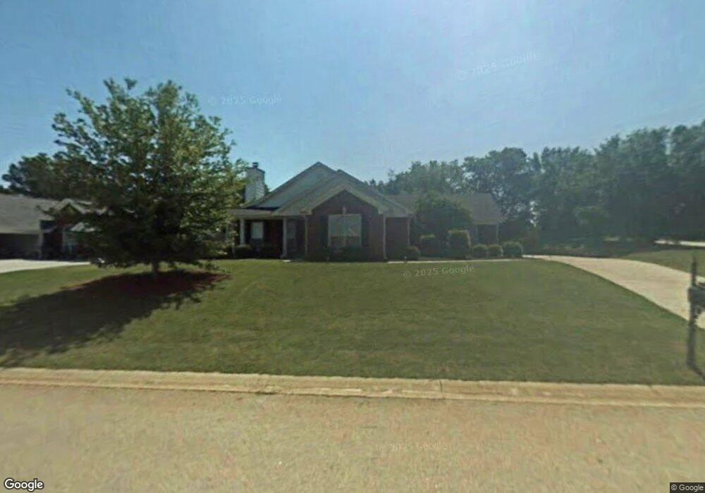
701 High Point Dr Winder, GA 30680
Estimated Value: $360,000 - $376,000
3
Beds
2
Baths
1,844
Sq Ft
$199/Sq Ft
Est. Value
About This Home
This home is located at 701 High Point Dr, Winder, GA 30680 and is currently estimated at $366,262, approximately $198 per square foot. 701 High Point Dr is a home located in Barrow County with nearby schools including County Line Elementary School, Russell Middle School, and Winder-Barrow High School.
Ownership History
Date
Name
Owned For
Owner Type
Purchase Details
Closed on
Aug 24, 2020
Sold by
Bailey Justin Michael
Bought by
Morrow Brandon
Current Estimated Value
Home Financials for this Owner
Home Financials are based on the most recent Mortgage that was taken out on this home.
Original Mortgage
$242,424
Outstanding Balance
$214,077
Interest Rate
3%
Mortgage Type
New Conventional
Estimated Equity
$152,185
Purchase Details
Closed on
Jul 26, 2006
Sold by
Sever James W
Bought by
Patrick Justin M and Patrick Ashley K
Home Financials for this Owner
Home Financials are based on the most recent Mortgage that was taken out on this home.
Original Mortgage
$165,000
Interest Rate
6.68%
Mortgage Type
New Conventional
Purchase Details
Closed on
Mar 11, 2003
Sold by
Garrett Earl E
Bought by
Sever James W
Home Financials for this Owner
Home Financials are based on the most recent Mortgage that was taken out on this home.
Original Mortgage
$110,700
Interest Rate
5.88%
Mortgage Type
New Conventional
Create a Home Valuation Report for This Property
The Home Valuation Report is an in-depth analysis detailing your home's value as well as a comparison with similar homes in the area
Home Values in the Area
Average Home Value in this Area
Purchase History
| Date | Buyer | Sale Price | Title Company |
|---|---|---|---|
| Morrow Brandon | $240,000 | -- | |
| Patrick Justin M | $165,000 | -- | |
| Sever James W | $123,000 | -- |
Source: Public Records
Mortgage History
| Date | Status | Borrower | Loan Amount |
|---|---|---|---|
| Open | Morrow Brandon | $242,424 | |
| Previous Owner | Patrick Justin M | $165,000 | |
| Previous Owner | Sever James W | $110,700 |
Source: Public Records
Tax History
| Year | Tax Paid | Tax Assessment Tax Assessment Total Assessment is a certain percentage of the fair market value that is determined by local assessors to be the total taxable value of land and additions on the property. | Land | Improvement |
|---|---|---|---|---|
| 2025 | $3,848 | $143,557 | $28,000 | $115,557 |
| 2024 | $3,858 | $140,166 | $28,000 | $112,166 |
| 2023 | $3,370 | $140,166 | $28,000 | $112,166 |
| 2022 | $2,856 | $83,892 | $16,400 | $67,492 |
| 2021 | $3,033 | $83,892 | $16,400 | $67,492 |
| 2020 | $2,312 | $70,722 | $16,400 | $54,322 |
| 2019 | $2,343 | $70,722 | $16,400 | $54,322 |
| 2018 | $2,144 | $64,620 | $15,200 | $49,420 |
| 2017 | $1,649 | $55,263 | $15,200 | $40,063 |
| 2016 | $1,672 | $53,718 | $15,200 | $38,518 |
| 2015 | $1,689 | $54,156 | $15,200 | $38,956 |
| 2014 | $1,390 | $45,816 | $6,860 | $38,956 |
| 2013 | -- | $43,372 | $6,860 | $36,512 |
Source: Public Records
Map
Nearby Homes
- 719 Mallard Dr
- 0 Hal Jackson Rd Unit 23011875
- 617 Teal Dr
- 469 Plantation Dr
- 74 Shoal Ct
- 460 Flyway Ln
- 76 Shoal Ct
- 78 Shoal Ct
- 80 Shoal Ct
- 367 Cedar Wood Trace
- 355 Cedar Wood Trace
- 0 E Northcrest Dr Unit 10648147
- 374 Cedar Wood Trace
- 362 Cedar Wood Trace
- 341 Cedar Wood Trace
- 326 Cedar Wood Trace
- 338 Cedar Wood Trace
- 314 Cedar Wood Trace
- 845 Idlewood Rd
- 10 Cannondale Dr
- 703 High Point Dr
- 700 Highpoint Dr Unit 9
- 700 High Point Dr
- 700 Overlook Dr
- 705 High Point Dr
- 702 Overlook Dr
- 702 High Point Dr Unit 1
- 704 Overlook Dr Unit 1
- 707 Highpoint Dr
- 707 High Point Dr
- 704 High Point Dr
- 706 Overlook Dr
- 706 High Point Dr
- 711 Mallard Dr
- 708 Overlook Dr
- 715 Mallard Dr Unit 13B
- 715 Mallard Dr Unit 1
- 717 Mallard Dr Unit 1
- 717 Mallard Dr
- 719 Mallard Dr Unit 15
Your Personal Tour Guide
Ask me questions while you tour the home.