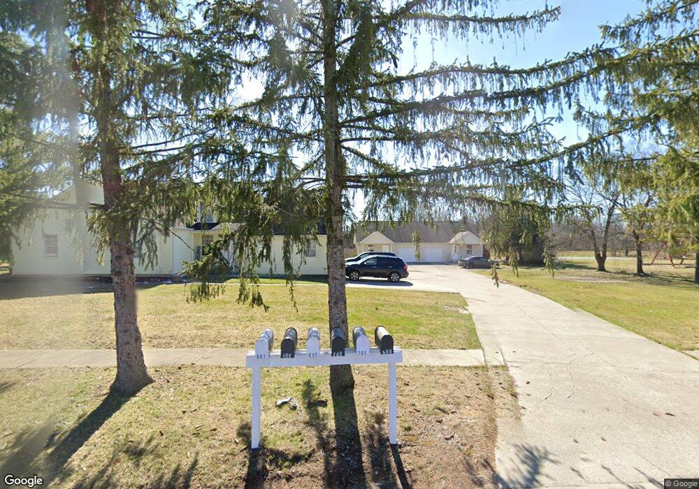
701 Kenny Ln Marysville, OH 43040
Estimated Value: $309,000 - $598,000
2
Beds
2
Baths
6,223
Sq Ft
$71/Sq Ft
Est. Value
About This Home
This home is located at 701 Kenny Ln, Marysville, OH 43040 and is currently estimated at $439,600, approximately $70 per square foot. 701 Kenny Ln is a home located in Union County with nearby schools including Edgewood Elementary School, Creekview Intermediate Elementary School, and Bunsold Middle School.
Ownership History
Date
Name
Owned For
Owner Type
Purchase Details
Closed on
Aug 20, 2004
Sold by
Hill Robert Frank and Boyd Maxine Lea
Bought by
Andrews Development Co Inc
Current Estimated Value
Home Financials for this Owner
Home Financials are based on the most recent Mortgage that was taken out on this home.
Original Mortgage
$440,000
Outstanding Balance
$219,348
Interest Rate
6.08%
Mortgage Type
Construction
Estimated Equity
$220,252
Create a Home Valuation Report for This Property
The Home Valuation Report is an in-depth analysis detailing your home's value as well as a comparison with similar homes in the area
Home Values in the Area
Average Home Value in this Area
Purchase History
| Date | Buyer | Sale Price | Title Company |
|---|---|---|---|
| Andrews Development Co Inc | $160,000 | -- |
Source: Public Records
Mortgage History
| Date | Status | Borrower | Loan Amount |
|---|---|---|---|
| Open | Andrews Development Co Inc | $440,000 |
Source: Public Records
Tax History Compared to Growth
Tax History
| Year | Tax Paid | Tax Assessment Tax Assessment Total Assessment is a certain percentage of the fair market value that is determined by local assessors to be the total taxable value of land and additions on the property. | Land | Improvement |
|---|---|---|---|---|
| 2024 | $6,522 | $152,510 | $13,620 | $138,890 |
| 2023 | $6,522 | $152,510 | $13,620 | $138,890 |
| 2022 | $6,409 | $152,510 | $13,620 | $138,890 |
| 2021 | $6,642 | $138,130 | $10,480 | $127,650 |
| 2020 | $6,631 | $138,130 | $10,480 | $127,650 |
| 2019 | $6,711 | $138,130 | $10,480 | $127,650 |
| 2018 | $7,687 | $147,320 | $8,880 | $138,440 |
| 2017 | $7,529 | $147,320 | $8,880 | $138,440 |
| 2016 | $7,504 | $147,320 | $8,880 | $138,440 |
| 2015 | $7,721 | $141,750 | $8,880 | $132,870 |
| 2014 | $5,895 | $108,240 | $8,880 | $99,360 |
| 2013 | $5,554 | $108,240 | $8,880 | $99,360 |
Source: Public Records
Map
Nearby Homes
- 1220 Ashford Dr
- 840 Autumn Chase Ln
- 876 Hickory Hill Dr
- 820 Timbers Edge
- 1042 Van Kirk Dr
- 801 Timbers Edge
- 426 Timberview Dr
- 715 Milcrest Dr
- 525 Ash St
- 780 Bermuda Way
- 675 Bermuda Way
- 366 Hickory Dr
- 1191 Woodline Dr
- 403 Palm Dr
- 409 Prairie Dr
- 1530 Carmel Dr
- 1096 Greenfield Dr
- 1055 Greenfield Dr
- 1136 Greenfield Dr
- 521 Dove St
- 691 Kenny Ln
- 601 Kenny Ln
- 597 Kenny Ln Unit 603
- 1039 Milford Ave
- 705 Kenny Ln
- 1057 Milford Ave
- 0 Kenny Ln
- 979 Milford Ave
- 725 Kenny Ln
- 1083 Milford Ave
- 1050 Milford Ave
- 1064 Milford Ave
- 1018 Milford Ave
- 959 Milford Ave
- 988 Milford Ave
- 968 Milford Ave
- 1107 Milford Ave
- 648 Wood Run Dr Unit 45
- 911 Kenny Ln
- 947 Milford Ave
