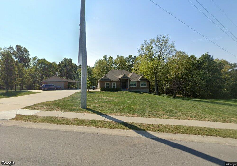
701 Mulberry St Pleasant Hill, MO 64080
Estimated Value: $398,967 - $507,000
4
Beds
2
Baths
1,922
Sq Ft
$235/Sq Ft
Est. Value
About This Home
This home is located at 701 Mulberry St, Pleasant Hill, MO 64080 and is currently estimated at $452,242, approximately $235 per square foot. 701 Mulberry St is a home located in Cass County with nearby schools including Pleasant Hill Primary School, Pleasant Hill Elementary School, and Pleasant Hill Middle School.
Ownership History
Date
Name
Owned For
Owner Type
Purchase Details
Closed on
Sep 7, 2006
Sold by
Rockwell Construction Inc
Bought by
Sheppard Edward F and Sheppard Sharon L
Current Estimated Value
Home Financials for this Owner
Home Financials are based on the most recent Mortgage that was taken out on this home.
Original Mortgage
$266,000
Outstanding Balance
$158,527
Interest Rate
6.72%
Mortgage Type
Construction
Estimated Equity
$293,715
Create a Home Valuation Report for This Property
The Home Valuation Report is an in-depth analysis detailing your home's value as well as a comparison with similar homes in the area
Home Values in the Area
Average Home Value in this Area
Purchase History
| Date | Buyer | Sale Price | Title Company |
|---|---|---|---|
| Sheppard Edward F | -- | -- |
Source: Public Records
Mortgage History
| Date | Status | Borrower | Loan Amount |
|---|---|---|---|
| Open | Sheppard Edward F | $266,000 |
Source: Public Records
Tax History
| Year | Tax Paid | Tax Assessment Tax Assessment Total Assessment is a certain percentage of the fair market value that is determined by local assessors to be the total taxable value of land and additions on the property. | Land | Improvement |
|---|---|---|---|---|
| 2025 | $3,643 | $57,470 | $4,310 | $53,160 |
| 2024 | $3,643 | $50,520 | $3,910 | $46,610 |
| 2023 | $3,617 | $50,520 | $3,910 | $46,610 |
| 2022 | $3,276 | $44,900 | $3,910 | $40,990 |
| 2021 | $3,186 | $44,900 | $3,910 | $40,990 |
| 2020 | $3,087 | $44,560 | $3,910 | $40,650 |
| 2019 | $3,046 | $44,560 | $3,910 | $40,650 |
| 2018 | $2,825 | $40,770 | $3,910 | $36,860 |
| 2017 | $2,698 | $40,770 | $3,910 | $36,860 |
| 2016 | $2,698 | $38,780 | $3,910 | $34,870 |
| 2015 | $2,732 | $38,780 | $3,910 | $34,870 |
| 2014 | $2,744 | $38,780 | $3,910 | $34,870 |
| 2013 | -- | $38,780 | $3,910 | $34,870 |
Source: Public Records
Map
Nearby Homes
- 1203 Mulberry St
- 1302 Mulberry St
- 1404 Mulberry St
- 1403 Mulberry St
- 1301 Mulberry St
- 1405 Mulberry St
- 1406 Mulberry St
- 1202 Mulberry St
- 1400 Mulberry St
- 1402 Mulberry St
- 1407 Mulberry St
- 1305 Mulberry St
- 803 Mulberry St
- 608 Mulberry St
- 601 Hickory Hills Dr
- 902 Buckeye Ln
- 1401 Mulberry St
- 812 Buckeye Ln
- 2000 Aspen St
- 1403 Red Bud Ave
- 615 Birch St
- 613 Birch St
- 801 Mulberry St
- 613 Hickory Hills Dr
- 611 Birch St
- 700 Mulberry St
- 608 Hickory Hills Dr
- 612 Birch St
- 2004 Redwood Cir
- 611 Hickory Hills Dr
- 901 Mulberry St
- 804 Mulberry St
- 708 Mulberry St
- 2006 Redwood Cir
- 606 Hickory Hills Dr
- 609 Birch St
- 610 Birch St
- 900 Mulberry St
- 903 Mulberry St
- 2303 Mulberry Ct
Your Personal Tour Guide
Ask me questions while you tour the home.