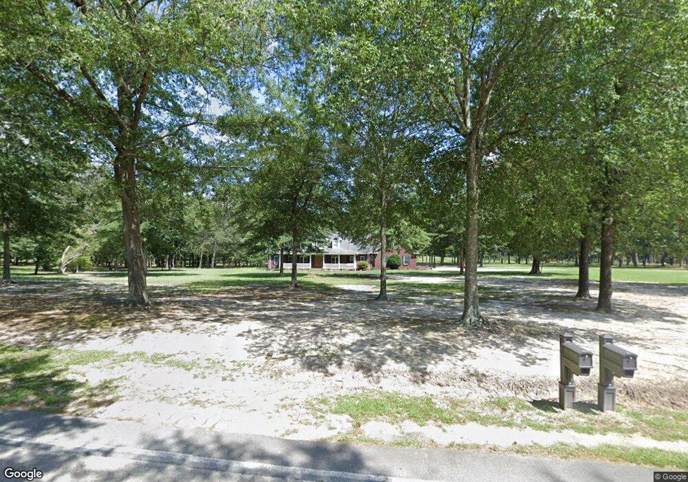
701 N Edisto Rd Leesville, SC 29070
Estimated Value: $411,000 - $653,000
3
Beds
3
Baths
2,990
Sq Ft
$194/Sq Ft
Est. Value
About This Home
This home is located at 701 N Edisto Rd, Leesville, SC 29070 and is currently estimated at $578,800, approximately $193 per square foot. 701 N Edisto Rd is a home located in Lexington County with nearby schools including Batesburg-Leesville Primary School, Batesburg-Leesville Elementary School, and Batesburg-Leesville Middle School.
Ownership History
Date
Name
Owned For
Owner Type
Purchase Details
Closed on
Sep 6, 2016
Sold by
Jdoy K Gunter
Bought by
Scruggs Jennifer and Scruggs Joseph
Current Estimated Value
Home Financials for this Owner
Home Financials are based on the most recent Mortgage that was taken out on this home.
Original Mortgage
$515,000
Outstanding Balance
$411,758
Interest Rate
3.46%
Estimated Equity
$167,042
Create a Home Valuation Report for This Property
The Home Valuation Report is an in-depth analysis detailing your home's value as well as a comparison with similar homes in the area
Home Values in the Area
Average Home Value in this Area
Purchase History
| Date | Buyer | Sale Price | Title Company |
|---|---|---|---|
| Scruggs Jennifer | -- | -- |
Source: Public Records
Mortgage History
| Date | Status | Borrower | Loan Amount |
|---|---|---|---|
| Open | Scruggs Jennifer | $515,000 | |
| Closed | Scruggs Jennifer | -- |
Source: Public Records
Tax History Compared to Growth
Tax History
| Year | Tax Paid | Tax Assessment Tax Assessment Total Assessment is a certain percentage of the fair market value that is determined by local assessors to be the total taxable value of land and additions on the property. | Land | Improvement |
|---|---|---|---|---|
| 2024 | $2,057 | $13,320 | $195 | $13,125 |
| 2023 | $2,057 | $11,962 | $195 | $11,767 |
| 2022 | $1,851 | $11,962 | $195 | $11,767 |
| 2020 | $1,547 | $11,962 | $195 | $11,767 |
| 2019 | $1,459 | $10,371 | $215 | $10,156 |
| 2018 | $1,409 | $10,371 | $215 | $10,156 |
| 2017 | $1,440 | $11,312 | $1,156 | $10,156 |
| 2016 | $1,142 | $11,312 | $1,156 | $10,156 |
| 2014 | $1,178 | $11,574 | $1,000 | $10,574 |
| 2013 | -- | $11,570 | $1,000 | $10,570 |
Source: Public Records
Map
Nearby Homes
- 480 Tom Adams Rd
- 341 Frontage Rd Unit Lot 1
- 340 Tarpon Rd
- 182 Barefoot Rd
- 165 Carlton Dr
- Lot 5 Quattlebaum Rd Unit 5
- 0 Huckleberry Finn Rd
- 0 Palomino Rd Unit Lot 9 599764
- 216 Shumpert Hill Rd
- 0 Bagpipe Rd
- 151 Latitude Rd
- 01 Goose Platter Rd
- 00 Goose Platter Rd
- 0 Whiskey Rd Unit 592238
- 0 Marcellus Rd
- 520 Senterfeit Rd
- 345 Gary Hallman Cir
- 335 Gary Hallman Cir
- 325 Gary Hallman Cir
- 315 Gary Hallman Cir
- 1949 Samaria Hwy
- 1949 Samaria Hwy
- 1949 Samaria Hwy
- 1938 Samaria Hwy
- 1938 Samaria Hwy
- 1938 Samaria Hwy
- 1974 Samaria Hwy
- 1928 Samaria Hwy
- 783 N Edisto Rd
- 820 N Edisto Rd
- 820 N Edisto Rd
- 819 N Edisto Rd
- 827 N Edisto Rd
- 836 N Edisto Rd
- 836 N Edisto Rd
- 833 N Edisto Rd
- 520 N Edisto Rd
- 841 N Edisto Rd
- 4737 Fairview Rd
- 4737 Fairview Rd