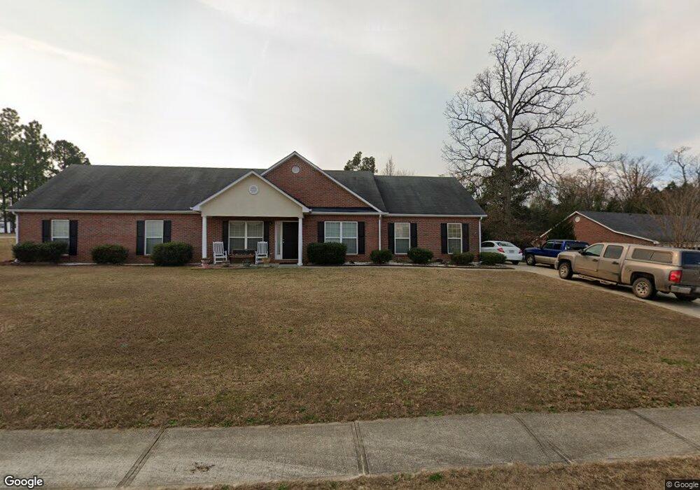
701 Porter Ln Grovetown, GA 30813
Estimated Value: $278,000 - $305,000
5
Beds
3
Baths
2,091
Sq Ft
$140/Sq Ft
Est. Value
About This Home
This home is located at 701 Porter Ln, Grovetown, GA 30813 and is currently estimated at $292,442, approximately $139 per square foot. 701 Porter Ln is a home located in Columbia County with nearby schools including Grovetown Elementary School, Grovetown Middle School, and Grovetown High School.
Ownership History
Date
Name
Owned For
Owner Type
Purchase Details
Closed on
May 30, 2008
Sold by
R & B Const Inc
Bought by
Knight James Mark
Current Estimated Value
Home Financials for this Owner
Home Financials are based on the most recent Mortgage that was taken out on this home.
Original Mortgage
$159,863
Outstanding Balance
$101,979
Interest Rate
6.02%
Mortgage Type
VA
Estimated Equity
$190,463
Create a Home Valuation Report for This Property
The Home Valuation Report is an in-depth analysis detailing your home's value as well as a comparison with similar homes in the area
Home Values in the Area
Average Home Value in this Area
Purchase History
| Date | Buyer | Sale Price | Title Company |
|---|---|---|---|
| Knight James Mark | $156,500 | -- |
Source: Public Records
Mortgage History
| Date | Status | Borrower | Loan Amount |
|---|---|---|---|
| Open | Knight James Mark | $159,863 |
Source: Public Records
Tax History Compared to Growth
Tax History
| Year | Tax Paid | Tax Assessment Tax Assessment Total Assessment is a certain percentage of the fair market value that is determined by local assessors to be the total taxable value of land and additions on the property. | Land | Improvement |
|---|---|---|---|---|
| 2025 | $3,215 | $114,823 | $20,604 | $94,219 |
| 2024 | $3,214 | $108,953 | $18,804 | $90,149 |
| 2023 | $3,214 | $107,052 | $18,804 | $88,248 |
| 2022 | $2,863 | $92,946 | $16,404 | $76,542 |
| 2021 | $2,691 | $83,622 | $14,304 | $69,318 |
| 2020 | $2,512 | $76,696 | $13,004 | $63,692 |
| 2019 | $2,479 | $74,984 | $12,904 | $62,080 |
| 2018 | $2,441 | $72,652 | $12,204 | $60,448 |
| 2017 | $2,362 | $72,470 | $12,204 | $60,266 |
| 2016 | $2,106 | $66,306 | $12,480 | $53,826 |
| 2015 | $1,991 | $62,388 | $14,980 | $47,408 |
| 2014 | $2,046 | $63,452 | $10,080 | $53,372 |
Source: Public Records
Map
Nearby Homes
- 5056 Captain Dr
- 636 Butler Springs Cir
- Hayden Plan at Captain's Corner
- Elle Plan at Captain's Corner
- Allex Plan at Captain's Corner
- Cali Plan at Captain's Corner
- Somerset Plan at Captain's Corner
- Ansley Plan at Captain's Corner
- Elston Plan at Captain's Corner
- 1399 Admiral Ave
- 1352 Admiral Ave
- 1392 Admiral Ave
- 1384 Admiral Ave Unit 117
- 1348 Admiral Ave
- 1380 Admiral Ave Unit 116
- 1388 Admiral Ave
- 1380 Admiral Ave
- 1384 Admiral Ave
- 1376 Admiral Ave
- 824 Shirez Dr
- 703 Porter Ln
- 700 Porter Ln
- 3019 Pepperhill Dr
- 3020 Pepperhill Dr
- 3020 Pepper Hill Dr
- 679 Butler Springs Cir
- 702 Porter Ln
- 697 Butler Springs Cir Unit 2
- 705 Porter Ln
- 3022 Pepperhill Dr
- 3022 Pepper Hill Dr
- 3018 Pepperhill Dr
- 3018 Pepper Hill Dr
- 704 Porter Ln
- 677 Butler Springs Cir
- 3024 Pepperhill Dr
- 3024 Pepper Hill Dr
- 1248 Admiral Ave Unit 83
- 675 Butler Springs Cir
- 670 Butler Springs Cir