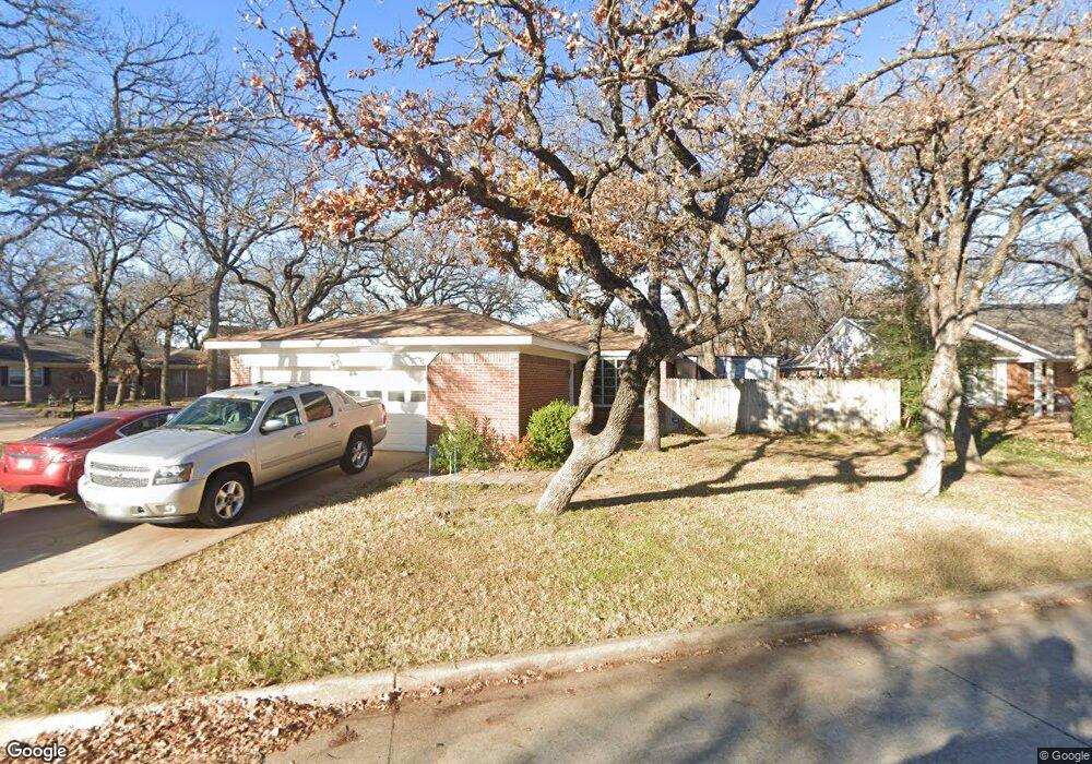
701 Queens Way Bedford, TX 76021
Estimated Value: $351,040 - $362,000
4
Beds
2
Baths
1,822
Sq Ft
$196/Sq Ft
Est. Value
About This Home
This home is located at 701 Queens Way, Bedford, TX 76021 and is currently estimated at $357,260, approximately $196 per square foot. 701 Queens Way is a home located in Tarrant County with nearby schools including Shady Brook Elementary School, Bedford Junior High School, and L.D. Bell High School.
Ownership History
Date
Name
Owned For
Owner Type
Purchase Details
Closed on
May 29, 2007
Sold by
Lasalle Bank Na
Bought by
Castle Robert L and Castle Jacqueline R
Current Estimated Value
Home Financials for this Owner
Home Financials are based on the most recent Mortgage that was taken out on this home.
Original Mortgage
$120,500
Outstanding Balance
$73,613
Interest Rate
6.16%
Mortgage Type
Purchase Money Mortgage
Estimated Equity
$283,647
Purchase Details
Closed on
Mar 6, 2007
Sold by
Long Amy Michelle and Long Kevin Wayne
Bought by
Lasalle Bank Na and The Structured Asset Investment Loan Tru
Purchase Details
Closed on
Jun 29, 2004
Sold by
Home & Note Solutions
Bought by
Long Kevin Wayne and Long Amy Michelle
Home Financials for this Owner
Home Financials are based on the most recent Mortgage that was taken out on this home.
Original Mortgage
$147,250
Interest Rate
7.8%
Mortgage Type
Purchase Money Mortgage
Create a Home Valuation Report for This Property
The Home Valuation Report is an in-depth analysis detailing your home's value as well as a comparison with similar homes in the area
Home Values in the Area
Average Home Value in this Area
Purchase History
| Date | Buyer | Sale Price | Title Company |
|---|---|---|---|
| Castle Robert L | -- | First American Title | |
| Lasalle Bank Na | $135,023 | None Available | |
| Long Kevin Wayne | -- | -- |
Source: Public Records
Mortgage History
| Date | Status | Borrower | Loan Amount |
|---|---|---|---|
| Open | Castle Robert L | $120,500 | |
| Previous Owner | Long Kevin Wayne | $147,250 |
Source: Public Records
Tax History Compared to Growth
Tax History
| Year | Tax Paid | Tax Assessment Tax Assessment Total Assessment is a certain percentage of the fair market value that is determined by local assessors to be the total taxable value of land and additions on the property. | Land | Improvement |
|---|---|---|---|---|
| 2025 | $3,330 | $232,427 | $70,000 | $162,427 |
| 2024 | $3,330 | $232,427 | $70,000 | $162,427 |
| 2023 | $4,351 | $240,945 | $60,000 | $180,945 |
| 2022 | $4,504 | $206,228 | $60,000 | $146,228 |
| 2021 | $4,510 | $191,453 | $60,000 | $131,453 |
| 2020 | $4,618 | $212,044 | $60,000 | $152,044 |
| 2019 | $4,290 | $213,465 | $60,000 | $153,465 |
| 2018 | $3,518 | $160,519 | $60,000 | $100,519 |
| 2017 | $3,530 | $207,274 | $19,000 | $188,274 |
| 2016 | $3,209 | $165,280 | $19,000 | $146,280 |
| 2015 | $2,754 | $120,600 | $19,500 | $101,100 |
| 2014 | $2,754 | $120,600 | $19,500 | $101,100 |
Source: Public Records
Map
Nearby Homes
- 2116 Tamworth Ct
- 93 Regents Park
- 140 Stonegate Ct
- 258 Somerset Terrace
- 345 Somerset Cir
- 2420 Stonegate Dr N
- 2436 Brookgreen Ct
- 1740 Brown Trail
- 2225 Shady Brook Dr
- 817 Shady Lake Dr
- 49 Coffee Tavern Rd
- 1732 Jeannie Ln
- 2317 Shady Grove Dr
- 124 Jeannie Ct
- 113 Sunnyvale Terrace
- 121 Kay Ct
- 100 Hillview Ct
- 2501 Shady Grove Dr
- 18 Park Ln
- 6 Park Ln
- 705 Queens Ct
- 608 Kentwood Cir
- 620 Queens Way
- 616 Queens Way
- 721 Queens Ct
- 624 Queens Way
- 717 Queens Ct
- 709 Queens Ct
- 612 Kentwood Cir
- 725 Queens Way
- 713 Queens Ct
- 700 Queens Way
- 624 Kentwood Cir
- 609 Kentwood Cir
- 736 Kentwood Cir
- 632 Kentwood Cir
- 405 Airport Fwy Unit Private Offices
- 405 Airport Fwy Unit 3
- 405 Airport Fwy Unit 4-1
- 405 Airport Fwy Unit 4