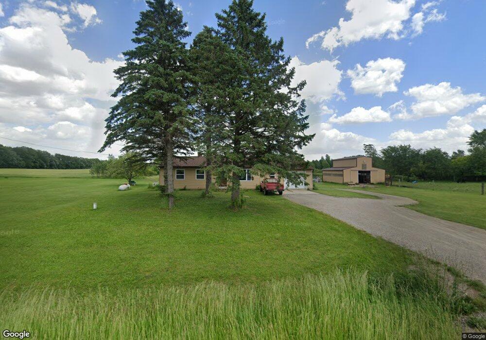
701 S Smith Rd Owosso, MI 48867
Estimated Value: $240,000 - $290,341
3
Beds
4
Baths
1,350
Sq Ft
$197/Sq Ft
Est. Value
About This Home
This home is located at 701 S Smith Rd, Owosso, MI 48867 and is currently estimated at $266,585, approximately $197 per square foot. 701 S Smith Rd is a home located in Shiawassee County with nearby schools including Owosso High School, Spring Vale Christian School, and Salem Lutheran School.
Ownership History
Date
Name
Owned For
Owner Type
Purchase Details
Closed on
Nov 14, 2017
Sold by
Siminson James H and Siminson Audrey E
Bought by
Scharphorn Timothy J and Scharphorn Morganj
Current Estimated Value
Home Financials for this Owner
Home Financials are based on the most recent Mortgage that was taken out on this home.
Original Mortgage
$148,265
Outstanding Balance
$127,073
Interest Rate
4.75%
Mortgage Type
FHA
Estimated Equity
$139,512
Purchase Details
Closed on
Mar 29, 2015
Sold by
Matznick John H
Bought by
Bandkau Jeri A and Bandkau David B
Create a Home Valuation Report for This Property
The Home Valuation Report is an in-depth analysis detailing your home's value as well as a comparison with similar homes in the area
Home Values in the Area
Average Home Value in this Area
Purchase History
| Date | Buyer | Sale Price | Title Company |
|---|---|---|---|
| Scharphorn Timothy J | $151,000 | Cislo Title Company | |
| Bandkau Jeri A | $18,400 | None Available |
Source: Public Records
Mortgage History
| Date | Status | Borrower | Loan Amount |
|---|---|---|---|
| Open | Scharphorn Timothy J | $148,265 |
Source: Public Records
Tax History Compared to Growth
Tax History
| Year | Tax Paid | Tax Assessment Tax Assessment Total Assessment is a certain percentage of the fair market value that is determined by local assessors to be the total taxable value of land and additions on the property. | Land | Improvement |
|---|---|---|---|---|
| 2025 | $2,424 | $113,800 | $0 | $0 |
| 2024 | $2,471 | $111,000 | $0 | $0 |
| 2023 | $904 | $107,200 | $0 | $0 |
| 2022 | $860 | $101,000 | $0 | $0 |
| 2021 | $2,028 | $91,300 | $0 | $0 |
| 2020 | $2,025 | $68,300 | $0 | $0 |
| 2019 | $1,988 | $65,100 | $0 | $0 |
| 2018 | $2,069 | $64,500 | $0 | $0 |
| 2017 | $1,485 | $62,900 | $0 | $0 |
| 2016 | -- | $62,900 | $0 | $0 |
| 2015 | -- | $60,700 | $0 | $0 |
| 2014 | $6 | $57,700 | $0 | $0 |
Source: Public Records
Map
Nearby Homes
- 3006 W M 21
- 982 S Chestnut St
- N Chestnut Street N Chestnut St
- 539 W Wildwood Dr
- Vacant Ash St
- 1318 W Stewart St
- 411 Robbins St
- 1510 S Chipman St
- V/L W South St
- 1610 W South St
- 818 S Lyon St
- 1444 W King St
- 309 State St
- 810 Grace St
- 821 Fletcher St
- 607 S Cedar St
- 440 Curwood Dr
- 1046 S Pearce St
- 1300 S Pearce St
- 1560 S M 52
- 625 S Smith Rd
- 741 S Smith Rd
- 741 S Smith Rd
- 814 S Smith Rd
- 814 S Smith Rd
- 480 S Smith Rd
- 480 S Smith Rd
- 480 S Smith Rd
- 300 S Smith Rd
- 950 S Smith Rd
- 2802 Krouse Rd
- 280 S Smith Rd
- 280 S Smith Rd
- 2730 Krouse Rd
- 2721 Krouse Rd
- 3005 Simpson Rd
- 0 Smith Rd Unit 62447
- 2 N Smith Rd
- 3 N Smith Rd
- 3247 Krouse Rd