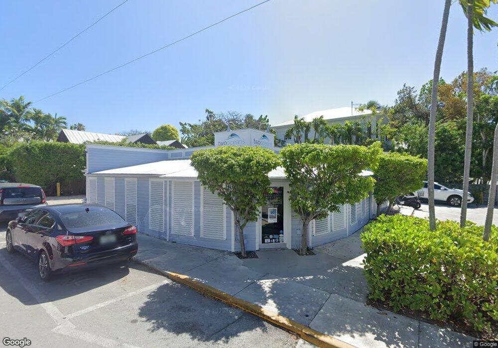
701 Simonton St Key West, FL 33040
Old Town NeighborhoodEstimated Value: $2,453,964
--
Bed
--
Bath
1,745
Sq Ft
$1,406/Sq Ft
Est. Value
About This Home
This home is located at 701 Simonton St, Key West, FL 33040 and is currently estimated at $2,453,964, approximately $1,406 per square foot. 701 Simonton St is a home located in Monroe County with nearby schools including Horace O'Bryant School, Key West High School, and May Sands Montessori School.
Ownership History
Date
Name
Owned For
Owner Type
Purchase Details
Closed on
Oct 31, 2007
Sold by
701 Simonton Llc
Bought by
Cooke Communications Llc
Current Estimated Value
Purchase Details
Closed on
Aug 28, 2006
Sold by
Blum James A
Bought by
701 Simonton Llc
Purchase Details
Closed on
Jun 9, 1997
Sold by
Halpin Williac C
Bought by
James A Blum Revocable Trust
Purchase Details
Closed on
Oct 1, 1986
Bought by
Cooke Communications Llc
Create a Home Valuation Report for This Property
The Home Valuation Report is an in-depth analysis detailing your home's value as well as a comparison with similar homes in the area
Home Values in the Area
Average Home Value in this Area
Purchase History
| Date | Buyer | Sale Price | Title Company |
|---|---|---|---|
| Cooke Communications Llc | $1,437,500 | None Available | |
| 701 Simonton Llc | $338,900 | Attorney | |
| James A Blum Revocable Trust | $120,000 | -- | |
| Cooke Communications Llc | $155,000 | -- |
Source: Public Records
Mortgage History
| Date | Status | Borrower | Loan Amount |
|---|---|---|---|
| Previous Owner | James A Blum Revocable Trust | $350,000 |
Source: Public Records
Tax History Compared to Growth
Tax History
| Year | Tax Paid | Tax Assessment Tax Assessment Total Assessment is a certain percentage of the fair market value that is determined by local assessors to be the total taxable value of land and additions on the property. | Land | Improvement |
|---|---|---|---|---|
| 2025 | $10,154 | $1,335,472 | $1,174,404 | $161,068 |
| 2024 | $9,751 | $1,426,172 | $1,260,336 | $165,836 |
| 2023 | $9,751 | $1,422,294 | $1,260,336 | $161,958 |
| 2022 | $7,603 | $882,877 | $716,100 | $166,777 |
| 2021 | $7,413 | $825,589 | $658,812 | $166,777 |
| 2020 | $7,030 | $832,817 | $658,812 | $174,005 |
| 2019 | $7,292 | $1,004,681 | $830,676 | $174,005 |
| 2018 | $6,965 | $971,265 | $802,358 | $168,907 |
| 2017 | $5,315 | $545,185 | $0 | $0 |
| 2016 | $5,525 | $537,233 | $0 | $0 |
| 2015 | $5,206 | $492,367 | $0 | $0 |
| 2014 | $5,402 | $491,945 | $0 | $0 |
Source: Public Records
Map
Nearby Homes
- 611 Simonton St
- 511 Tabby Way
- 703 Elizabeth St
- 719 Elizabeth St
- 524 Southard St
- 600 Elizabeth St
- 529 Simonton St
- 525 Simonton St
- 711 Galveston Ln
- 613 Olivia St
- 729 Windsor Ln
- 400 Aronovitz Ln
- 626A Fleming St
- 405 Petronia St
- 625 Whitehead St
- 806 Southard St
- 416 Applerouth Ln
- 421-423 Simonton St
- 732 Olivia St
- 418 Olivia St
- 707 Simonton St
- 608 Angela St
- 601 Angela St Unit 3
- 605 Angela St Unit 1
- 605 Angela St
- 612 Angela St
- 711 Simonton St
- 710 Whitmarsh Ln
- 515 Angela St
- 609 Angela St
- 618 Angela St
- 713 Whitmarsh Ln
- 625 Simonton St Unit 5
- 625 Simonton St
- 627 Simonton St Unit 4
- 603 Angela St Unit 2
- 623 Simonton St
- 617 Simonton St
- 627 Simonton St
- 603 Angela St