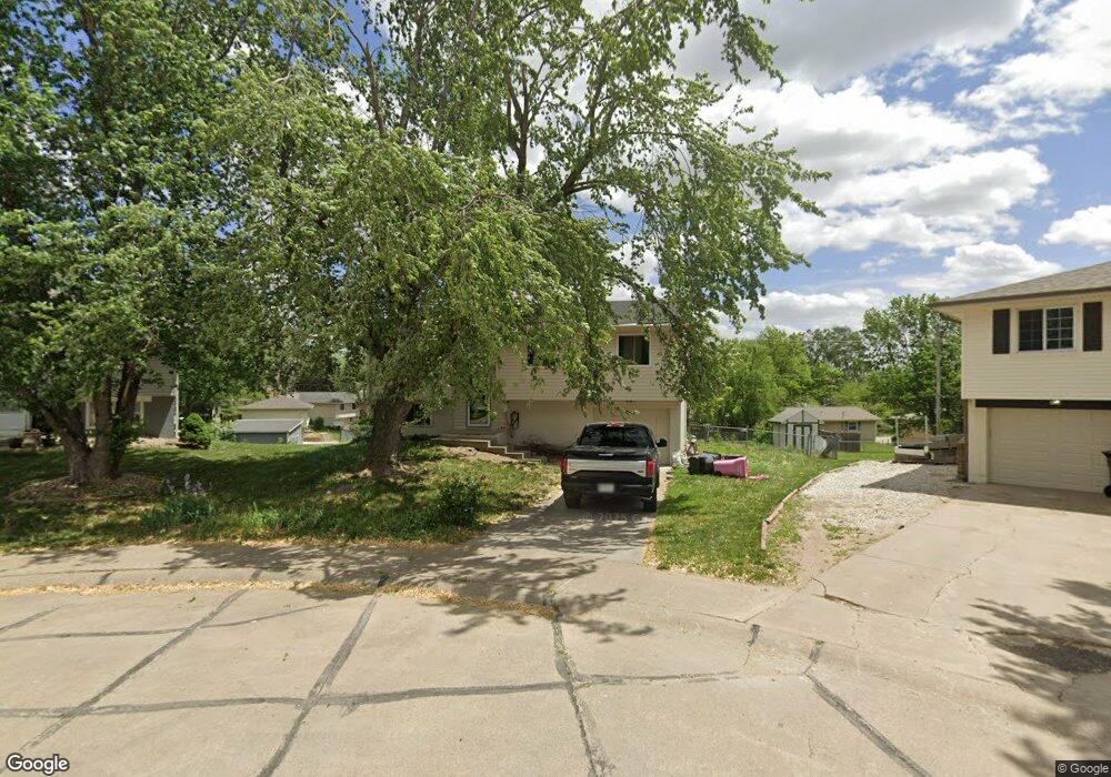
701 Spruce Cir Ceresco, NE 68017
Estimated Value: $232,946 - $318,000
3
Beds
2
Baths
1,700
Sq Ft
$154/Sq Ft
Est. Value
About This Home
This home is located at 701 Spruce Cir, Ceresco, NE 68017 and is currently estimated at $261,987, approximately $154 per square foot. 701 Spruce Cir is a home located in Saunders County with nearby schools including Raymond Central High School.
Ownership History
Date
Name
Owned For
Owner Type
Purchase Details
Closed on
May 21, 2010
Sold by
Hudkins Bryan B and Hudkins Renee M
Bought by
Plante Brian E
Current Estimated Value
Home Financials for this Owner
Home Financials are based on the most recent Mortgage that was taken out on this home.
Original Mortgage
$113,350
Outstanding Balance
$75,724
Interest Rate
5.14%
Estimated Equity
$186,263
Create a Home Valuation Report for This Property
The Home Valuation Report is an in-depth analysis detailing your home's value as well as a comparison with similar homes in the area
Purchase History
| Date | Buyer | Sale Price | Title Company |
|---|---|---|---|
| Plante Brian E | $112,000 | -- | |
| Plante Brian E | $112,000 | -- |
Source: Public Records
Mortgage History
| Date | Status | Borrower | Loan Amount |
|---|---|---|---|
| Open | Plante Brian E | $113,350 | |
| Closed | Plante Brian E | $113,350 |
Source: Public Records
Tax History
| Year | Tax Paid | Tax Assessment Tax Assessment Total Assessment is a certain percentage of the fair market value that is determined by local assessors to be the total taxable value of land and additions on the property. | Land | Improvement |
|---|---|---|---|---|
| 2025 | $2,650 | $183,550 | $28,200 | $155,350 |
| 2024 | $2,650 | $174,145 | $21,620 | $152,525 |
| 2023 | $2,986 | $168,351 | $21,620 | $146,731 |
| 2022 | $3,176 | $161,852 | $21,620 | $140,232 |
| 2021 | $2,653 | $132,273 | $21,620 | $110,653 |
| 2020 | $2,664 | $132,273 | $21,620 | $110,653 |
| 2019 | $2,557 | $126,000 | $21,620 | $104,380 |
| 2018 | $2,600 | $126,000 | $21,620 | $104,380 |
| 2017 | $2,345 | $114,190 | $21,620 | $92,570 |
| 2016 | $2,355 | $96,710 | $20,000 | $76,710 |
| 2015 | $2,066 | $96,710 | $20,000 | $76,710 |
| 2014 | $2,111 | $96,710 | $20,000 | $76,710 |
| 2012 | $2,426 | $96,710 | $20,000 | $76,710 |
Source: Public Records
Map
Nearby Homes
- 704 Beech St
- 0 E Elm St
- 551 County Road 20
- 6030 Little Salt Rd
- 2118 Wilsonville Rd
- 2162 County Road A
- 8645 Agnew Rd
- 5830 Rock Creek Rd
- 135 Hunter St
- 120 Hunter St
- 8601 Agnew Lot 1 Rd
- 8601 Agnew Lot 4 Rd
- 8601 Agnew Lot 3 Rd
- 1198 County Road D
- 6531 Mill Rd
- 500 Mill Rd
- 7015 W Agnew Rd
- 12550 N 84th St
- 20201 NW 68th St
- 12500 N 84th St
- 701 Spruce Cir
- 0 Spruce Cir Unit 10070772
- 0 Spruce Cir Unit 10086203
- 0 Blk 1 Lot 20 Spruce Cir Unit 10087776
- 700 Spruce Cir
- 705 Spruce Cir
- 108 Laura Ln
- 700 Spruce Cir
- 112 Laura Ln
- 112 Laura Lane Cir
- 709 Spruce Cir
- 704 Spruce Cir
- 116 Laura Ln
- 700 Beech St
- 104 Laura Ln
- 708 Spruce Cir
- 705 W Spruce St
- 713 Spruce St
- 700 W Beech St
- 708 Spruce Cir
Your Personal Tour Guide
Ask me questions while you tour the home.