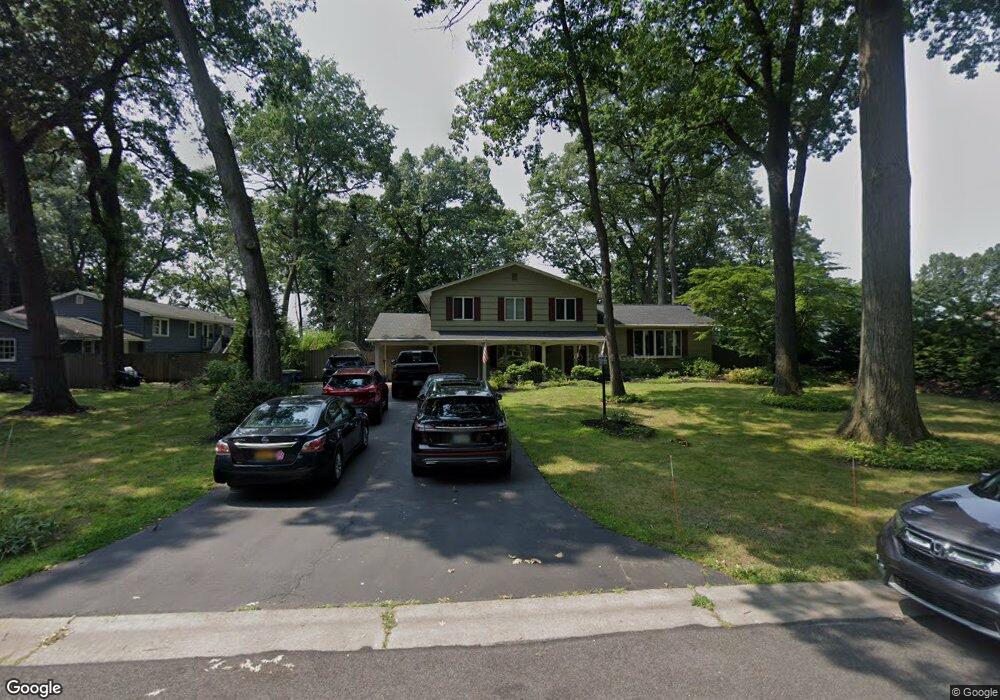
701 Summit Dr Unit W Webster, NY 14580
Estimated Value: $540,000 - $898,000
4
Beds
3
Baths
2,300
Sq Ft
$313/Sq Ft
Est. Value
About This Home
This home is located at 701 Summit Dr Unit W, Webster, NY 14580 and is currently estimated at $719,306, approximately $312 per square foot. 701 Summit Dr Unit W is a home located in Monroe County with nearby schools including DeWitt Road Elementary School, Willink Middle School, and Thomas High School.
Ownership History
Date
Name
Owned For
Owner Type
Purchase Details
Closed on
Aug 17, 2017
Sold by
Riebesehl Riebesehl H and Riebesehl Jay N
Bought by
Summit Capital Trust
Current Estimated Value
Home Financials for this Owner
Home Financials are based on the most recent Mortgage that was taken out on this home.
Original Mortgage
$340,000
Outstanding Balance
$283,474
Interest Rate
3.93%
Mortgage Type
New Conventional
Estimated Equity
$435,832
Purchase Details
Closed on
Jun 30, 1997
Bought by
Michael Riebesehlk H
Create a Home Valuation Report for This Property
The Home Valuation Report is an in-depth analysis detailing your home's value as well as a comparison with similar homes in the area
Home Values in the Area
Average Home Value in this Area
Purchase History
| Date | Buyer | Sale Price | Title Company |
|---|---|---|---|
| Summit Capital Trust | $425,000 | -- | |
| Michael Riebesehlk H | $295,000 | -- |
Source: Public Records
Mortgage History
| Date | Status | Borrower | Loan Amount |
|---|---|---|---|
| Open | Summit Capital Trust | $340,000 |
Source: Public Records
Tax History
| Year | Tax Paid | Tax Assessment Tax Assessment Total Assessment is a certain percentage of the fair market value that is determined by local assessors to be the total taxable value of land and additions on the property. | Land | Improvement |
|---|---|---|---|---|
| 2024 | $16,998 | $365,000 | $134,300 | $230,700 |
| 2023 | $16,507 | $365,000 | $134,300 | $230,700 |
| 2022 | $16,450 | $365,000 | $134,300 | $230,700 |
| 2021 | $16,286 | $365,000 | $134,300 | $230,700 |
| 2020 | $16,015 | $365,000 | $134,300 | $230,700 |
| 2019 | $13,238 | $365,000 | $134,300 | $230,700 |
| 2018 | $15,346 | $365,000 | $134,300 | $230,700 |
| 2017 | $0 | $345,000 | $134,300 | $210,700 |
| 2016 | $13,238 | $345,000 | $134,300 | $210,700 |
| 2015 | -- | $345,000 | $134,300 | $210,700 |
| 2014 | -- | $345,000 | $134,300 | $210,700 |
Source: Public Records
Map
Nearby Homes
- 703 Mariner Cir
- 260 Point Pleasant Rd
- 286 Filon Ave
- 203 Pinehill Dr
- 250 Norwood Cir
- 43 Oberlin St
- 153 Mallard Dr
- 430 Sundance Trail
- 91 Birch Hills Dr
- 207 Coolidge Rd
- 409 Newport Rd
- 407 Newport Rd
- 408 Newport Rd
- 385 Pemberton Rd
- 2340 Titus Ave
- 510 Klem Rd
- 139 Baycrest Dr
- 78 Hartsdale Rd
- 6 Newport Rd
- 524 Old Mill Ln
- 701 Summit Dr
- 705 Summit Dr
- 697 Summit Dr
- 693 Summit Dr
- 700 Summit Dr
- 140 Dickinson Rd
- 149 Dickinson Rd
- 158 Dickinson Rd
- 136 Dickinson Rd
- 142 Dickinson Rd
- 132 Dickinson Rd
- 52 Glenwood Dr
- 54 Glenwood Dr
- 162 Dickinson Rd
- 128 Dickinson Rd
- 155 Dickinson Rd
- 692 Summit Dr
- 157 Dickinson Rd
- 166 Dickinson Rd
- 124 Dickinson Rd
Your Personal Tour Guide
Ask me questions while you tour the home.