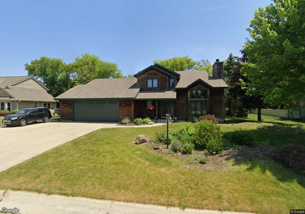
701 Sunnyview Dr Mount Pleasant, WI 53406
Estimated Value: $456,000 - $482,943
3
Beds
3
Baths
2,028
Sq Ft
$231/Sq Ft
Est. Value
About This Home
This home is located at 701 Sunnyview Dr, Mount Pleasant, WI 53406 and is currently estimated at $467,736, approximately $230 per square foot. 701 Sunnyview Dr is a home located in Racine County with nearby schools including West Ridge Elementary School, Mitchell Middle School, and Case High School.
Ownership History
Date
Name
Owned For
Owner Type
Purchase Details
Closed on
Aug 25, 2005
Sold by
Christofferson Ralph A and Christofferson Mary Ann
Bought by
Etes Amandaj and Etes Daniel A
Current Estimated Value
Home Financials for this Owner
Home Financials are based on the most recent Mortgage that was taken out on this home.
Original Mortgage
$278,350
Outstanding Balance
$149,292
Interest Rate
5.89%
Mortgage Type
New Conventional
Estimated Equity
$318,444
Create a Home Valuation Report for This Property
The Home Valuation Report is an in-depth analysis detailing your home's value as well as a comparison with similar homes in the area
Home Values in the Area
Average Home Value in this Area
Purchase History
| Date | Buyer | Sale Price | Title Company |
|---|---|---|---|
| Etes Amandaj | $293,000 | -- |
Source: Public Records
Mortgage History
| Date | Status | Borrower | Loan Amount |
|---|---|---|---|
| Open | Etes Amandaj | $278,350 |
Source: Public Records
Tax History
| Year | Tax Paid | Tax Assessment Tax Assessment Total Assessment is a certain percentage of the fair market value that is determined by local assessors to be the total taxable value of land and additions on the property. | Land | Improvement |
|---|---|---|---|---|
| 2024 | $8,462 | $467,500 | $71,600 | $395,900 |
| 2023 | $7,845 | $421,400 | $66,800 | $354,600 |
| 2022 | $7,074 | $364,900 | $66,800 | $298,100 |
| 2021 | $7,180 | $332,700 | $60,700 | $272,000 |
| 2020 | $6,721 | $304,400 | $47,300 | $257,100 |
| 2019 | $6,701 | $315,900 | $47,300 | $268,600 |
| 2018 | $6,396 | $281,900 | $45,600 | $236,300 |
| 2017 | $6,005 | $258,500 | $45,600 | $212,900 |
| 2016 | $5,946 | $242,900 | $42,700 | $200,200 |
| 2015 | $5,026 | $242,900 | $42,700 | $200,200 |
| 2014 | $4,746 | $242,900 | $42,700 | $200,200 |
| 2013 | $5,918 | $242,900 | $42,700 | $200,200 |
Source: Public Records
Map
Nearby Homes
- 6441 Kingsview Dr
- 443 Quail Point Dr
- 6351 Kinzie Ave
- 6840 Mariner Dr Unit 103
- 6611 Mariner Dr Unit 1
- Lt0 Mariner Dr
- 6330 Ptarmigan Rd
- 522 Calvin Ln
- 609 Calvin Ln
- 7225 Mariner Dr Unit 5
- 1040 Prairie Dr Unit 23
- 583 Hunter Dr
- 301 S Summerset Dr
- LT73 Lindsay Ln
- 838 Boulder Trail Unit 205
- 1429 Oakes Rd Unit 7
- 1521 Prairie Dr
- 1435 Sun Valley Dr Unit 201
- 8355 Cove Ct
- 6 Timmer Ln
- 715 Sunnyview Dr
- 645 Sunnyview Dr
- 656 Sunnyview Dr
- 708 Sunnyview Dr
- 627 Sunnyview Dr
- 644 Sunnyview Dr
- 720 Sunnyview Dr
- 731 Sunnyview Dr
- 6555 Apollo Dr
- 732 Sunnyview Dr
- 6609 Explorer Dr
- 6630 Explorer Dr
- 611 Sunnyview Dr
- 6619 Explorer Dr
- 751 Sunnyview Dr
- 6619 Apollo Dr
- 744 Sunnyview Dr
- 6629 Explorer Dr
- 6540 Apollo Dr
- Lt31 Fox Run Ln
Your Personal Tour Guide
Ask me questions while you tour the home.