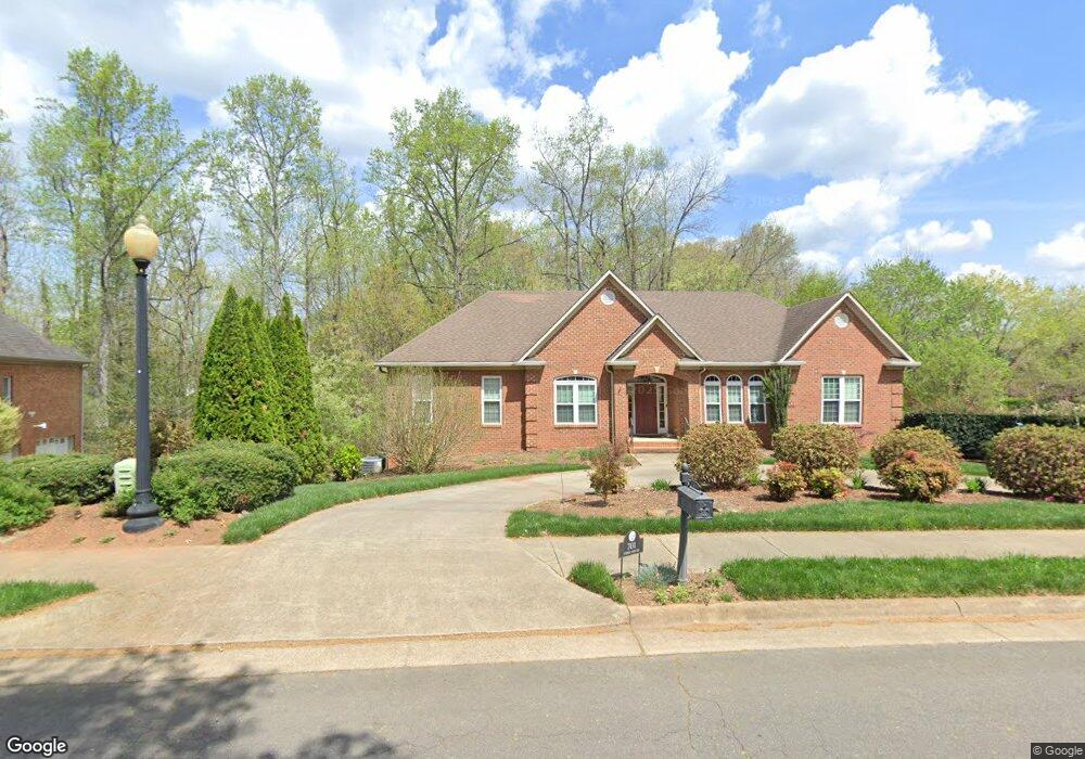
701 Surrey Path Trail Winston Salem, NC 27104
Stonebridge-Rollinghills NeighborhoodEstimated Value: $617,000 - $854,000
4
Beds
3
Baths
2,498
Sq Ft
$294/Sq Ft
Est. Value
About This Home
This home is located at 701 Surrey Path Trail, Winston Salem, NC 27104 and is currently estimated at $735,158, approximately $294 per square foot. 701 Surrey Path Trail is a home located in Forsyth County with nearby schools including Sherwood Forest Elementary School, Thomas Jefferson Middle School, and Mount Tabor High School.
Ownership History
Date
Name
Owned For
Owner Type
Purchase Details
Closed on
Apr 4, 2003
Sold by
Agnew Samuel Andrew and Agnew Elizabeth L
Bought by
Herndon Terry R and Herndon Carole T
Current Estimated Value
Home Financials for this Owner
Home Financials are based on the most recent Mortgage that was taken out on this home.
Original Mortgage
$257,400
Outstanding Balance
$109,521
Interest Rate
5.62%
Estimated Equity
$625,637
Purchase Details
Closed on
Mar 21, 2002
Sold by
The Sherwood Company
Bought by
Agnew Samuel Andrew and Agnew Elizabeth L
Home Financials for this Owner
Home Financials are based on the most recent Mortgage that was taken out on this home.
Original Mortgage
$217,000
Interest Rate
6.86%
Mortgage Type
Construction
Create a Home Valuation Report for This Property
The Home Valuation Report is an in-depth analysis detailing your home's value as well as a comparison with similar homes in the area
Home Values in the Area
Average Home Value in this Area
Purchase History
| Date | Buyer | Sale Price | Title Company |
|---|---|---|---|
| Herndon Terry R | $322,000 | -- | |
| Agnew Samuel Andrew | $40,000 | -- |
Source: Public Records
Mortgage History
| Date | Status | Borrower | Loan Amount |
|---|---|---|---|
| Open | Herndon Terry R | $257,400 | |
| Previous Owner | Agnew Samuel Andrew | $217,000 | |
| Closed | Herndon Terry R | $48,200 |
Source: Public Records
Tax History Compared to Growth
Tax History
| Year | Tax Paid | Tax Assessment Tax Assessment Total Assessment is a certain percentage of the fair market value that is determined by local assessors to be the total taxable value of land and additions on the property. | Land | Improvement |
|---|---|---|---|---|
| 2024 | $6,358 | $474,900 | $99,000 | $375,900 |
| 2023 | $6,358 | $474,900 | $99,000 | $375,900 |
| 2022 | $6,239 | $474,900 | $99,000 | $375,900 |
| 2021 | $6,127 | $474,900 | $99,000 | $375,900 |
| 2020 | $6,246 | $452,300 | $99,000 | $353,300 |
| 2019 | $6,291 | $452,300 | $99,000 | $353,300 |
| 2018 | $5,974 | $452,300 | $99,000 | $353,300 |
| 2016 | $5,257 | $399,514 | $99,000 | $300,514 |
| 2015 | $5,178 | $399,514 | $99,000 | $300,514 |
| 2014 | $5,021 | $399,514 | $99,000 | $300,514 |
Source: Public Records
Map
Nearby Homes
- 5421 High Valley Ln
- 748 Surrey Path Trail
- 753 Surrey Path Trail
- 721 Surrey Path Trail
- 316 Beechcliff Ct
- 5240 Wilson Hill Ct
- 226 Cedar Trail
- 205 Cedar Trail
- 5005 Marble Arch Rd
- 5410 Stone Crossing Dr
- 01 Stone Crossing Dr
- 305 Rockmont Dr
- 33 Carrisbrooke Ln
- 565 Knob View Dr
- 807 Meadowstone Dr
- 424 Cedar Trail
- 701 Woodbury Knolls Dr
- 900 Brintonial Way
- 801 Chancy Ln
- 157 Carrisbrooke Ln
- 613 Surrey Path Trail
- 5451 High Valley Ln
- 5430 High Valley Ln
- 5431 High Valley Ln
- 5420 High Valley Ln
- 705 Surrey Path Trail
- 700 Surrey Path Trail
- 609 Surrey Path Trail
- 709 Surrey Path Trail
- 612 Surrey Path Trail
- 704 Surrey Path Trail
- 5260 Wilson Hill Ct
- 608 Surrey Path Trail
- 324 Beechcliff Ct
- 605 Surrey Path Trail
- 713 Surrey Path Trail
- 328 Beechcliff Ct
- 5255 Wilson Hill Ct
- 708 Surrey Path Trail
- 320 Beechcliff Ct