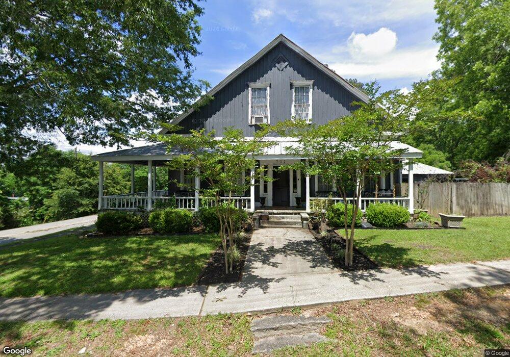
701 Thornton St Union Point, GA 30669
Estimated Value: $228,000 - $416,000
2
Beds
2
Baths
5,301
Sq Ft
$64/Sq Ft
Est. Value
About This Home
This home is located at 701 Thornton St, Union Point, GA 30669 and is currently estimated at $341,667, approximately $64 per square foot. 701 Thornton St is a home with nearby schools including Greene County High School.
Ownership History
Date
Name
Owned For
Owner Type
Purchase Details
Closed on
Jul 2, 2015
Sold by
Howell L Barden
Bought by
Moore Terry
Current Estimated Value
Purchase Details
Closed on
Jun 30, 2009
Sold by
Barden Howell Lester
Bought by
Howell L Barden Sr Estate Llc
Purchase Details
Closed on
Jan 1, 1989
Sold by
Barden Howell L
Bought by
Barden Howell L
Purchase Details
Closed on
Jan 1, 1986
Sold by
Hicks & Morgan Inc
Bought by
Barden Howell L
Purchase Details
Closed on
Jan 1, 1974
Sold by
Morgan Lusius
Bought by
Hicks & Morgan Inc
Purchase Details
Closed on
Jan 1, 1973
Bought by
Morgan Lucius
Create a Home Valuation Report for This Property
The Home Valuation Report is an in-depth analysis detailing your home's value as well as a comparison with similar homes in the area
Home Values in the Area
Average Home Value in this Area
Purchase History
| Date | Buyer | Sale Price | Title Company |
|---|---|---|---|
| Moore Terry | $90,000 | -- | |
| Howell L Barden Sr Estate Llc | -- | -- | |
| Barden Howell Lester | -- | -- | |
| Barden Howell L | -- | -- | |
| Barden Howell L | -- | -- | |
| Hicks & Morgan Inc | -- | -- | |
| Morgan Lusius | -- | -- | |
| Morgan Lucius | -- | -- |
Source: Public Records
Tax History Compared to Growth
Tax History
| Year | Tax Paid | Tax Assessment Tax Assessment Total Assessment is a certain percentage of the fair market value that is determined by local assessors to be the total taxable value of land and additions on the property. | Land | Improvement |
|---|---|---|---|---|
| 2025 | $4,290 | $188,160 | $8,120 | $180,040 |
| 2024 | $4,032 | $175,400 | $8,120 | $167,280 |
| 2023 | $2,739 | $167,400 | $8,120 | $159,280 |
| 2022 | $3,470 | $195,080 | $8,120 | $186,960 |
| 2021 | $3,249 | $170,360 | $8,120 | $162,240 |
| 2020 | $1,025 | $42,960 | $4,040 | $38,920 |
| 2019 | $1,067 | $42,960 | $4,040 | $38,920 |
| 2018 | $928 | $42,960 | $4,040 | $38,920 |
| 2017 | $968 | $42,994 | $4,050 | $38,944 |
| 2016 | $848 | $45,183 | $4,050 | $41,133 |
| 2015 | $987 | $45,182 | $4,050 | $41,133 |
| 2014 | -- | $45,125 | $4,050 | $41,075 |
Source: Public Records
Map
Nearby Homes
- 202 Veazey St
- 324 N Rhodes St
- 215 Hunter St
- 0 S Rhodes St Unit 10618488
- 0 Woodland Ct Unit 10543600
- 112 Hendry St
- 1041 Hillcrest Dr
- 1241 Old Siloam Rd
- 0 Washington Hwy Unit 7276060
- 1581 Highway 77 S Hwy
- 1581 Highway 77 S
- 1860 Washington Hwy
- 5401 Union Point Hwy
- 1201 Buffalo Lick Rd
- 0 Buffalo Lick Rd Unit 10551234
- 0 Buffalo Lick Rd Unit 10551325
- 1251 Adams Rd
- 0 Old Union Point Rd Unit 1 10557753
- 1251 Brick House Rd
- 1251 Brickhouse Rd
- 104 Thornton St
- 705 Carlton Ave
- 106 Thornton St
- 707 Carlton Ave
- 607 Carlton Ave
- 108 Thornton St
- 1144 Farm Rd
- 702 Hart Ave
- 105 Thornton St
- 624 Sibley Ave
- 704 Hart Ave
- 200 Thornton St
- 715 Carlton Ave
- 715 Carlton Ave Unit Lot 36
- 620 Sibley Ave
- 4740 Lamb Ave
- 614 Sibley Ave
- 612 Sibley Ave Unit A & B
- 612 Sibley Ave
- 201 Thornton St