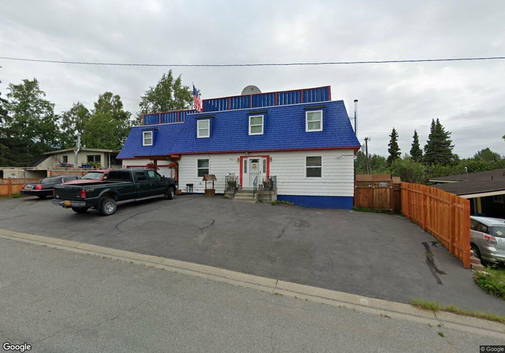
701 W 20th Ave Anchorage, AK 99503
North Star NeighborhoodEstimated Value: $470,000 - $706,549
5
Beds
5
Baths
5,168
Sq Ft
$117/Sq Ft
Est. Value
About This Home
This home is located at 701 W 20th Ave, Anchorage, AK 99503 and is currently estimated at $607,183, approximately $117 per square foot. 701 W 20th Ave is a home located in Anchorage Municipality with nearby schools including North Star Elementary School, Central Middle School of Science, and West High School.
Ownership History
Date
Name
Owned For
Owner Type
Purchase Details
Closed on
Apr 24, 2020
Sold by
Warrick Paulson Brunhilde H and Estate Of Roderic R Paulson
Bought by
Warrick Paulson Brunhilde H
Current Estimated Value
Home Financials for this Owner
Home Financials are based on the most recent Mortgage that was taken out on this home.
Original Mortgage
$169,000
Outstanding Balance
$116,439
Interest Rate
3.6%
Mortgage Type
New Conventional
Estimated Equity
$490,744
Purchase Details
Closed on
Apr 3, 2015
Sold by
Paulson Roderic R and Paulson Brunhilde H Warrick
Bought by
Paulson Roderic R and Paulson Brunhilde H Warrick
Home Financials for this Owner
Home Financials are based on the most recent Mortgage that was taken out on this home.
Original Mortgage
$225,750
Interest Rate
3.76%
Mortgage Type
New Conventional
Purchase Details
Closed on
Dec 6, 2000
Sold by
Fredenberg Herman C and Habermann Donna Marie
Bought by
Paulson Roderic R and Warrick Brunhilde H
Home Financials for this Owner
Home Financials are based on the most recent Mortgage that was taken out on this home.
Original Mortgage
$227,000
Interest Rate
7.66%
Mortgage Type
New Conventional
Purchase Details
Closed on
Oct 13, 1992
Sold by
Edwards Odel
Bought by
Fredenberg Herman C
Home Financials for this Owner
Home Financials are based on the most recent Mortgage that was taken out on this home.
Original Mortgage
$162,000
Interest Rate
7.93%
Mortgage Type
New Conventional
Purchase Details
Closed on
Jul 10, 1989
Sold by
Federal Home Loan Mtg Corp and United States Of America
Bought by
Edwards George A and Edwards Odel
Home Financials for this Owner
Home Financials are based on the most recent Mortgage that was taken out on this home.
Original Mortgage
$141,900
Interest Rate
10.6%
Mortgage Type
New Conventional
Create a Home Valuation Report for This Property
The Home Valuation Report is an in-depth analysis detailing your home's value as well as a comparison with similar homes in the area
Home Values in the Area
Average Home Value in this Area
Purchase History
| Date | Buyer | Sale Price | Title Company |
|---|---|---|---|
| Warrick Paulson Brunhilde H | -- | None Available | |
| Paulson Roderic R | -- | First American Title Ins Co | |
| Paulson Roderic R | -- | -- | |
| Fredenberg Herman C | -- | -- | |
| Edwards George A | -- | -- | |
| Edwards George A | -- | -- |
Source: Public Records
Mortgage History
| Date | Status | Borrower | Loan Amount |
|---|---|---|---|
| Open | Warrick Paulson Brunhilde H | $169,000 | |
| Closed | Paulson Roderic R | $225,750 | |
| Closed | Paulson Roderic R | $227,000 | |
| Previous Owner | Fredenberg Herman C | $162,000 | |
| Previous Owner | Edwards George A | $141,900 |
Source: Public Records
Tax History Compared to Growth
Tax History
| Year | Tax Paid | Tax Assessment Tax Assessment Total Assessment is a certain percentage of the fair market value that is determined by local assessors to be the total taxable value of land and additions on the property. | Land | Improvement |
|---|---|---|---|---|
| 2025 | $6,660 | $675,800 | $119,000 | $556,800 |
| 2024 | $6,660 | $637,500 | $119,000 | $518,500 |
| 2023 | $10,123 | $594,400 | $119,000 | $475,400 |
| 2022 | $6,527 | $587,600 | $119,000 | $468,600 |
| 2021 | $10,068 | $558,700 | $119,000 | $439,700 |
| 2020 | $6,246 | $568,600 | $119,000 | $449,600 |
| 2019 | $6,215 | $579,900 | $119,000 | $460,900 |
| 2018 | $6,137 | $574,200 | $122,400 | $451,800 |
| 2017 | $6,643 | $594,200 | $116,100 | $478,100 |
| 2016 | $6,994 | $628,500 | $116,100 | $512,400 |
| 2015 | $6,994 | $572,700 | $106,000 | $466,700 |
| 2014 | $6,994 | $550,200 | $101,800 | $448,400 |
Source: Public Records
Map
Nearby Homes
- 827 W 20th Ave
- 710 W 16th Ave
- 1024 Potlatch Cir Unit 23
- 2140 Dawson St
- 1001 W Fireweed Ln
- 1945 Spenard Rd
- 207 W 22nd Ave Unit 304
- 1113 W Fireweed Ln Unit 505
- 1113 W Fireweed Ln Unit 204
- 1310 G St
- 1016 W 25th Ave
- 201 W 24th Ave
- 2607 Arctic Blvd
- 1200 I St Unit 503
- 100 W 15th Ave Unit A
- 2201 Romig Place Unit 105
- 1430 Bridgeway St Unit 3
- 1430 Bridgeway St Unit 9
- 1327 W 25th Ave Unit 218
- 123 E 24th Ave Unit 5
- 705 W 20th Ave
- 647 W 20th Ave
- 700 W 19th Ave
- 642 W 19th Ave
- 727 W 20th Ave
- 702 W 20th Ave
- 637 W 20th Ave
- L1 B2 W 20th Ave
- 650 W 20th Ave
- 720 W 19th Ave
- 720 W 19th Ave Unit A
- 720 W 19th Ave Unit A
- 720 W 19th Ave Unit B
- 741 & 745 W 20th Ave
- 741 W 20th Ave
- 718 W 20th Ave
- 627 W 20th Ave
- 630 W 19th Ave
- 724 W 19th Ave
- 726 W 20th Ave