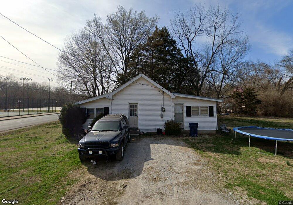
701 W Benton St Siloam Springs, AR 72761
Estimated Value: $116,732 - $179,000
--
Bed
1
Bath
844
Sq Ft
$177/Sq Ft
Est. Value
About This Home
This home is located at 701 W Benton St, Siloam Springs, AR 72761 and is currently estimated at $149,183, approximately $176 per square foot. 701 W Benton St is a home located in Benton County with nearby schools including Northside Elementary School, Delbert Pete & Pat Allen Elementary School, and Southside Elementary School.
Ownership History
Date
Name
Owned For
Owner Type
Purchase Details
Closed on
Jun 6, 2011
Sold by
Alexander Lynn N and Alexander David N
Bought by
Bunker Donald A
Current Estimated Value
Purchase Details
Closed on
Dec 21, 2006
Sold by
Morris Stella and Alexander Lynn
Bought by
Alexander David N and Alexander Lynn N
Purchase Details
Closed on
Sep 3, 2002
Bought by
Morris
Purchase Details
Closed on
May 14, 2002
Bought by
Dod 05-14-2002
Purchase Details
Closed on
Jan 29, 1996
Bought by
Morris and Morris Todd
Purchase Details
Closed on
Oct 22, 1973
Bought by
Morris
Create a Home Valuation Report for This Property
The Home Valuation Report is an in-depth analysis detailing your home's value as well as a comparison with similar homes in the area
Home Values in the Area
Average Home Value in this Area
Purchase History
| Date | Buyer | Sale Price | Title Company |
|---|---|---|---|
| Bunker Donald A | $22,000 | Stewart Title Company | |
| Alexander David N | $10,000 | Waco Title Company | |
| Morris | -- | -- | |
| Dod 05-14-2002 | -- | -- | |
| Morris | -- | -- | |
| Morris | $6,000 | -- |
Source: Public Records
Tax History Compared to Growth
Tax History
| Year | Tax Paid | Tax Assessment Tax Assessment Total Assessment is a certain percentage of the fair market value that is determined by local assessors to be the total taxable value of land and additions on the property. | Land | Improvement |
|---|---|---|---|---|
| 2025 | $473 | $17,519 | $7,400 | $10,119 |
| 2024 | $445 | $17,519 | $7,400 | $10,119 |
| 2023 | $405 | $10,000 | $5,600 | $4,400 |
| 2022 | $374 | $10,000 | $5,600 | $4,400 |
| 2021 | $342 | $10,000 | $5,600 | $4,400 |
| 2020 | $312 | $5,410 | $4,000 | $1,410 |
| 2019 | $312 | $5,410 | $4,000 | $1,410 |
| 2018 | $312 | $5,410 | $4,000 | $1,410 |
| 2017 | $279 | $5,410 | $4,000 | $1,410 |
| 2016 | $279 | $5,410 | $4,000 | $1,410 |
| 2015 | $253 | $4,400 | $1,600 | $2,800 |
| 2014 | $253 | $4,400 | $1,600 | $2,800 |
Source: Public Records
Map
Nearby Homes
- TBD South N Elm St
- 0000 N Elm St
- 411 N Maple St
- 730 N Walnut Ct
- 1050 W Garland St Unit A & B
- 114 S College St
- 503 N Wright St
- 605 N Wright St
- 607 Amanda Dr
- 101 N Dogwood St
- 606 Gail Dr
- 716 N Mount Olive St
- 402 Greenwood
- 130 Dogwood Place
- 414 N Maxwell St
- 210 E Ashley St
- 605 Teri Dr
- 1005 W Jefferson St
- 111 E Helena St
- 401 Glenwood Place
- 410 N Walnut St
- 711 W Benton St
- 621 W Benton St
- 411 Walnut St
- 704 W Tahlequah St
- 415 N Walnut St
- 605 W Benton St
- 605 W Benton St Unit D
- 605 W Benton St Unit B
- 610 W Tahlequah St
- 610 W Tahlequah St Unit D
- 460 N Garrett St Unit A
- 601 W Benton St Unit A
- 601 W Benton St
- 601 W Benton St Unit C
- 601 W Benton St Unit B
- 703 W Tahlequah St
- 707 W Tahlequah St
- 800 W Tahlequah St
- 715 W Tahlequah St