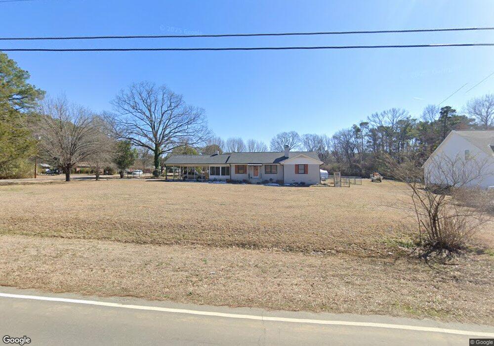
701 W D St Butner, NC 27509
Estimated Value: $319,514 - $328,000
3
Beds
2
Baths
1,643
Sq Ft
$198/Sq Ft
Est. Value
About This Home
This home is located at 701 W D St, Butner, NC 27509 and is currently estimated at $324,629, approximately $197 per square foot. 701 W D St is a home located in Granville County with nearby schools including Butner-Stem Elementary School, Butner-Stem Middle School, and Granville Central High School.
Ownership History
Date
Name
Owned For
Owner Type
Purchase Details
Closed on
Oct 28, 2021
Sold by
Ctc Solutions Llc
Bought by
Bullard Roger Leon and Clayton Barbara Renae
Current Estimated Value
Home Financials for this Owner
Home Financials are based on the most recent Mortgage that was taken out on this home.
Original Mortgage
$269,595
Outstanding Balance
$246,378
Interest Rate
2.8%
Mortgage Type
New Conventional
Estimated Equity
$78,251
Purchase Details
Closed on
Nov 3, 2020
Sold by
Crews Joseph Martin and Crews Anne Gay
Bought by
Ctc Solutions Llc
Home Financials for this Owner
Home Financials are based on the most recent Mortgage that was taken out on this home.
Original Mortgage
$175,000
Interest Rate
2.8%
Mortgage Type
Future Advance Clause Open End Mortgage
Create a Home Valuation Report for This Property
The Home Valuation Report is an in-depth analysis detailing your home's value as well as a comparison with similar homes in the area
Purchase History
| Date | Buyer | Sale Price | Title Company |
|---|---|---|---|
| Bullard Roger Leon | $267,000 | None Available | |
| Ctc Solutions Llc | $175,000 | None Available |
Source: Public Records
Mortgage History
| Date | Status | Borrower | Loan Amount |
|---|---|---|---|
| Open | Bullard Roger Leon | $269,595 | |
| Previous Owner | Ctc Solutions Llc | $175,000 |
Source: Public Records
Tax History
| Year | Tax Paid | Tax Assessment Tax Assessment Total Assessment is a certain percentage of the fair market value that is determined by local assessors to be the total taxable value of land and additions on the property. | Land | Improvement |
|---|---|---|---|---|
| 2025 | $3,127 | $284,380 | $65,768 | $218,612 |
| 2024 | $3,127 | $284,380 | $65,768 | $218,612 |
| 2023 | $2,220 | $167,352 | $52,614 | $114,738 |
| 2022 | $2,275 | $167,352 | $52,614 | $114,738 |
| 2021 | $1,903 | $145,210 | $34,800 | $110,410 |
| 2020 | $1,903 | $145,210 | $34,800 | $110,410 |
| 2019 | $1,903 | $145,210 | $34,800 | $110,410 |
| 2018 | $1,903 | $145,210 | $34,800 | $110,410 |
| 2016 | $1,845 | $135,884 | $34,800 | $101,084 |
| 2015 | $1,685 | $135,884 | $34,800 | $101,084 |
| 2014 | $1,751 | $135,884 | $34,800 | $101,084 |
| 2013 | -- | $135,884 | $34,800 | $101,084 |
Source: Public Records
Map
Nearby Homes
- 1205 W C St
- 503 Central Ave
- 600 18th St
- 1739 Cobblestone Dr
- 1098 Blackstone Dr
- 1149 Shasta Ct
- 1693 Will Suitt Rd
- Lot 4 Will Suitt Rd
- 1171 Jackson Ct
- 1180 Andrews Ct
- 1198 E Middleton Dr
- 1214 Hunter Ct
- 1495 Concord Church Rd
- 2040 Applewood Dr
- 1613 Hunters Trail
- 1576 Munns Rd
- 1580 Rogers Pointe Ln
- 1589 Rogers Pointe Ln
- 100 Ross Dr
- 102 Ross Dr
Your Personal Tour Guide
Ask me questions while you tour the home.