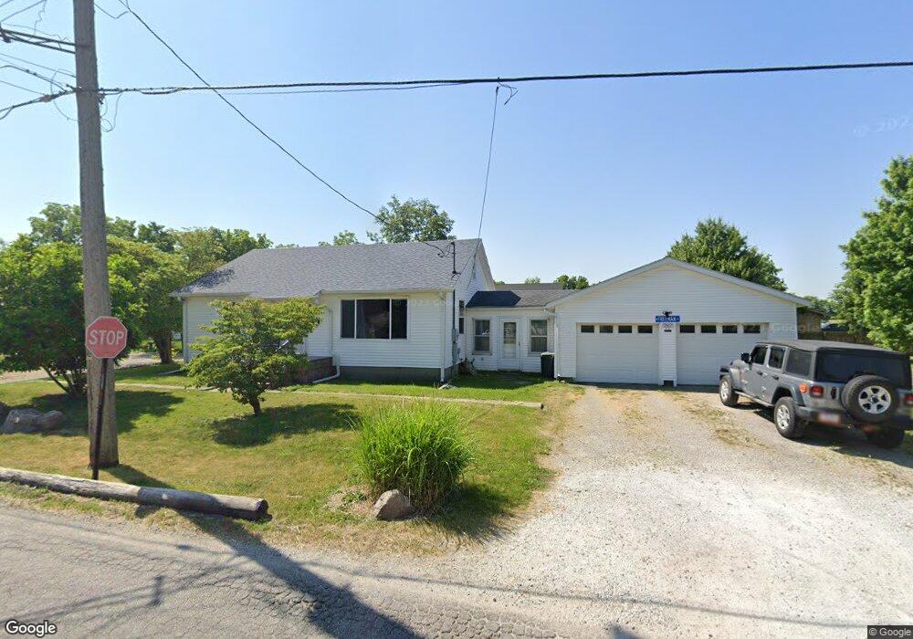
701 W Freeman St Frankfort, IN 46041
Estimated Value: $106,000 - $197,574
3
Beds
1
Bath
1,299
Sq Ft
$115/Sq Ft
Est. Value
About This Home
This home is located at 701 W Freeman St, Frankfort, IN 46041 and is currently estimated at $149,894, approximately $115 per square foot. 701 W Freeman St is a home located in Clinton County with nearby schools including Frankfort Senior High School and Frankfort Covenant Academy.
Ownership History
Date
Name
Owned For
Owner Type
Purchase Details
Closed on
Oct 26, 2020
Sold by
Calvin Vincent A and Frazier Brittney A
Bought by
Calvin Richard Mark and Calvin Terri Ruth
Current Estimated Value
Home Financials for this Owner
Home Financials are based on the most recent Mortgage that was taken out on this home.
Original Mortgage
$135,000
Interest Rate
2.8%
Mortgage Type
New Conventional
Purchase Details
Closed on
Aug 24, 2020
Sold by
Calvin Richard Mark and Calvin Terri Ruth
Bought by
Calvin Vincent A and Frazier Brittney A
Home Financials for this Owner
Home Financials are based on the most recent Mortgage that was taken out on this home.
Original Mortgage
$80,500
Interest Rate
2.9%
Mortgage Type
New Conventional
Purchase Details
Closed on
Feb 12, 1999
Sold by
Shanaberger Lucile I L
Bought by
Noris Michael E
Create a Home Valuation Report for This Property
The Home Valuation Report is an in-depth analysis detailing your home's value as well as a comparison with similar homes in the area
Home Values in the Area
Average Home Value in this Area
Purchase History
| Date | Buyer | Sale Price | Title Company |
|---|---|---|---|
| Calvin Richard Mark | -- | None Available | |
| Calvin Vincent A | -- | None Available | |
| Noris Michael E | $36,000 | -- |
Source: Public Records
Mortgage History
| Date | Status | Borrower | Loan Amount |
|---|---|---|---|
| Closed | Calvin Richard Mark | $135,000 | |
| Closed | Calvin Vincent A | $80,500 |
Source: Public Records
Tax History Compared to Growth
Tax History
| Year | Tax Paid | Tax Assessment Tax Assessment Total Assessment is a certain percentage of the fair market value that is determined by local assessors to be the total taxable value of land and additions on the property. | Land | Improvement |
|---|---|---|---|---|
| 2024 | $1,402 | $126,100 | $23,200 | $102,900 |
| 2023 | $1,441 | $126,200 | $23,200 | $103,000 |
| 2022 | $1,396 | $126,200 | $23,200 | $103,000 |
| 2021 | $951 | $89,000 | $23,200 | $65,800 |
| 2020 | $973 | $89,000 | $23,200 | $65,800 |
| 2019 | $962 | $89,100 | $23,200 | $65,900 |
| 2018 | $958 | $89,100 | $23,200 | $65,900 |
| 2017 | $1,035 | $88,500 | $23,200 | $65,300 |
| 2016 | $740 | $77,100 | $23,200 | $53,900 |
| 2014 | $429 | $74,200 | $21,400 | $52,800 |
Source: Public Records
Map
Nearby Homes
- 302 W Freeman St
- 258 Main Ave Unit 1-8
- 356 S 7th St
- 862 S Jackson St
- 820 Hackberry Ct
- 652 S Jackson St
- 458 S Jackson St
- 353 Harvard Terrace
- 401 Knox St
- 552 Elmwood Dr
- 508 Glendale Dr
- 608 Ann St
- 1209 E Wabash St
- 557 E Boone St
- 708 Glendale Dr
- 458 W Morrison St
- 1257 W Morrison St
- 1401 W Morrison St
- 901 Harvard Terrace
- 509 Gentry St
- 1035 Krug Rd
- 659 W Freeman St
- 780 W Norris Way
- 780 W Norris Way Unit 4
- 790 W Norris Way
- 790 W Norris Way Unit 3
- 655 W Freeman St
- 658 W Freeman St
- 750 W Norris Way
- 652 W Freeman St
- 1053 S 5th St Unit 1055
- 608 W Freeman St
- 1052 Short 4th St
- 785 W Norris Way
- 785 W Norris Way Unit 2
- 603 W Freeman St
- 1009 S 5th St
- 1008 Short 4th St
- 775 W Norris Way
- 775 W Norris Way Unit 9