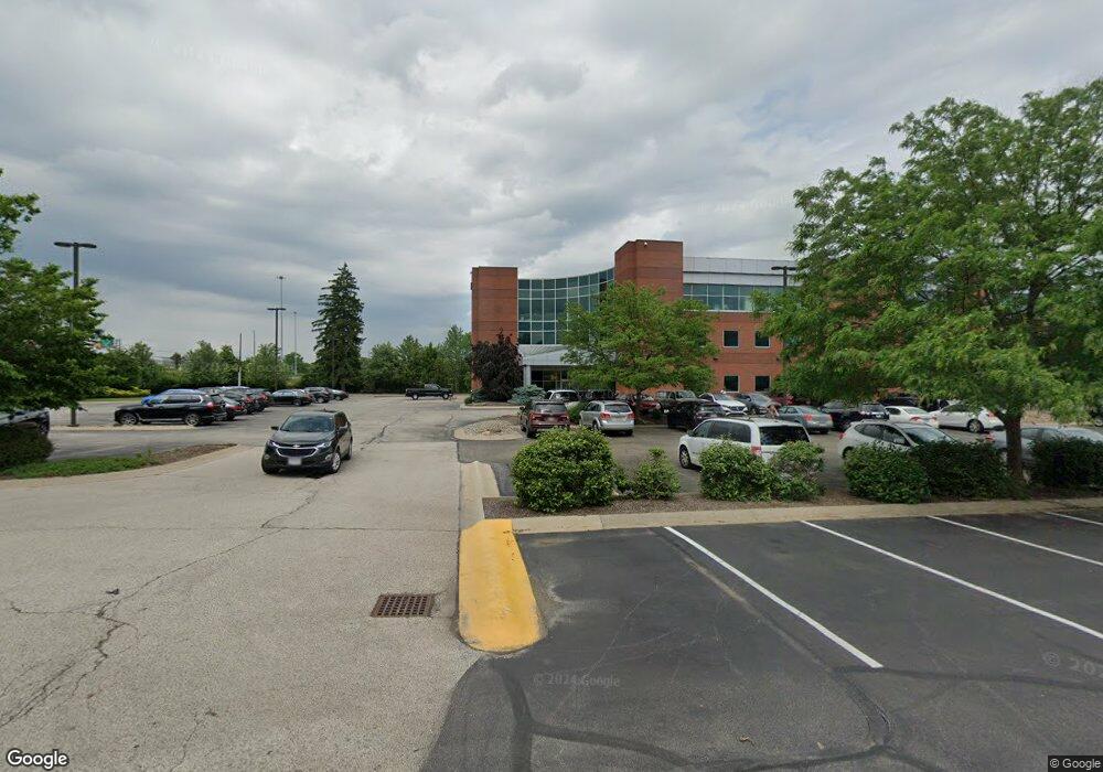
701 White Pond Dr Unit 300 Akron, OH 44320
West Akron Neighborhood
--
Bed
2
Baths
972
Sq Ft
2.32
Acres
About This Home
This home is located at 701 White Pond Dr Unit 300, Akron, OH 44320. 701 White Pond Dr Unit 300 is a home located in Summit County with nearby schools including Summit Academy School, Our Lady Of The Elms Elementary School, and The Lippman School.
Ownership History
Date
Name
Owned For
Owner Type
Purchase Details
Closed on
Mar 10, 2020
Sold by
Welltower Om Group Llc
Bought by
701 White Pond Dr Llc
Home Financials for this Owner
Home Financials are based on the most recent Mortgage that was taken out on this home.
Original Mortgage
$380,050,000
Outstanding Balance
$336,507,668
Interest Rate
3.6%
Mortgage Type
Commercial
Purchase Details
Closed on
Feb 18, 2020
Sold by
Welltower Om Group Llc
Bought by
701 White Pond Dr Llc
Home Financials for this Owner
Home Financials are based on the most recent Mortgage that was taken out on this home.
Original Mortgage
$380,050,000
Outstanding Balance
$336,507,668
Interest Rate
3.6%
Mortgage Type
Commercial
Purchase Details
Closed on
Aug 29, 2012
Sold by
Nna Property Holdings Llc
Bought by
Nna Akron Property Llc
Purchase Details
Closed on
Dec 30, 2008
Sold by
Nna Property Holdings Llc
Bought by
Nna Property Holdings Llc
Create a Home Valuation Report for This Property
The Home Valuation Report is an in-depth analysis detailing your home's value as well as a comparison with similar homes in the area
Home Values in the Area
Average Home Value in this Area
Purchase History
| Date | Buyer | Sale Price | Title Company |
|---|---|---|---|
| 701 White Pond Dr Llc | -- | New Title Company Name | |
| 701 White Pond Dr Llc | -- | New Title Company Name | |
| 701 White Pond Dr Llc | -- | None Available | |
| Nna Akron Property Llc | -- | None Available | |
| Nna Property Holdings Llc | -- | Attorney | |
| Nna Property Holdings Llc | $50,000 | Attorney |
Source: Public Records
Mortgage History
| Date | Status | Borrower | Loan Amount |
|---|---|---|---|
| Open | 701 White Pond Dr Llc | $380,050,000 | |
| Closed | 701 White Pond Dr Llc | $0 |
Source: Public Records
Tax History Compared to Growth
Tax History
| Year | Tax Paid | Tax Assessment Tax Assessment Total Assessment is a certain percentage of the fair market value that is determined by local assessors to be the total taxable value of land and additions on the property. | Land | Improvement |
|---|---|---|---|---|
| 2025 | $167,693 | $2,016,648 | $80,217 | $1,936,431 |
| 2024 | $167,693 | $2,016,648 | $80,217 | $1,936,431 |
| 2023 | $143,847 | $2,016,648 | $80,217 | $1,936,431 |
| 2022 | $143,847 | $1,691,442 | $72,923 | $1,618,519 |
| 2021 | $144,053 | $1,691,442 | $72,923 | $1,618,519 |
| 2020 | $140,622 | $1,691,440 | $72,920 | $1,618,520 |
| 2019 | $141,686 | $1,519,320 | $65,430 | $1,453,890 |
| 2018 | $139,816 | $1,519,320 | $65,430 | $1,453,890 |
| 2017 | $143,900 | $1,519,320 | $65,430 | $1,453,890 |
| 2016 | $143,900 | $1,598,180 | $68,870 | $1,529,310 |
| 2015 | $143,900 | $1,598,180 | $68,870 | $1,529,310 |
| 2014 | $142,055 | $1,598,180 | $68,870 | $1,529,310 |
| 2013 | $146,782 | $1,608,320 | $58,540 | $1,549,780 |
Source: Public Records
Map
Nearby Homes
- 1009 Oak Tree Rd
- 527 S Frank Blvd Unit 5
- 0 Schocalog Rd Unit 5155850
- V/L Idlewood Ave
- S/L 10 W Sunrise View Dr
- S/L 35 W Sunrise View Dr
- S/L 11 W Sunrise View Dr
- S/L 46 Park Ave N
- S/L 32 W Sunrise View Dr
- 511 W Fairlawn Blvd
- 1562 Marlowe Ave
- S/L 8 Sunrise View Dr
- 606 Mull Ave Unit 13
- 1644 Idlewood Ave
- 604 Mull Ave Unit 12
- 602 Mull Ave Unit 11
- S/L 9 Sunrise View Dr
- S/L 7 Sunrise View Dr
- S/L 1 Sunrise View Dr
- 763 Cordova Ave
- 787 White Pond Dr Unit 791
- 799 White Pond Dr Unit A
- 799 White Pond Dr Unit Conf Rm
- 799 White Pond Dr Unit A-1
- 799 White Pond Dr Unit A-C
- 799 White Pond Dr Unit C
- 799 White Pond Dr Unit B
- 799 White Pond Dr
- 794 & 796 White Pond Dr
- 794 White Pond Dr
- 796 White Pond Dr
- 804 White Pond Dr
- 804 White Pond Dr
- 809 White Pond Dr
- 829 White Pond Dr
- 9999 Mull Ave Unit 217
- V/L Mull Ave
- 0 Mull Ave Unit 3058280
- 0 Mull Ave Unit 3058279
- 0 Mull Ave Unit 3058278