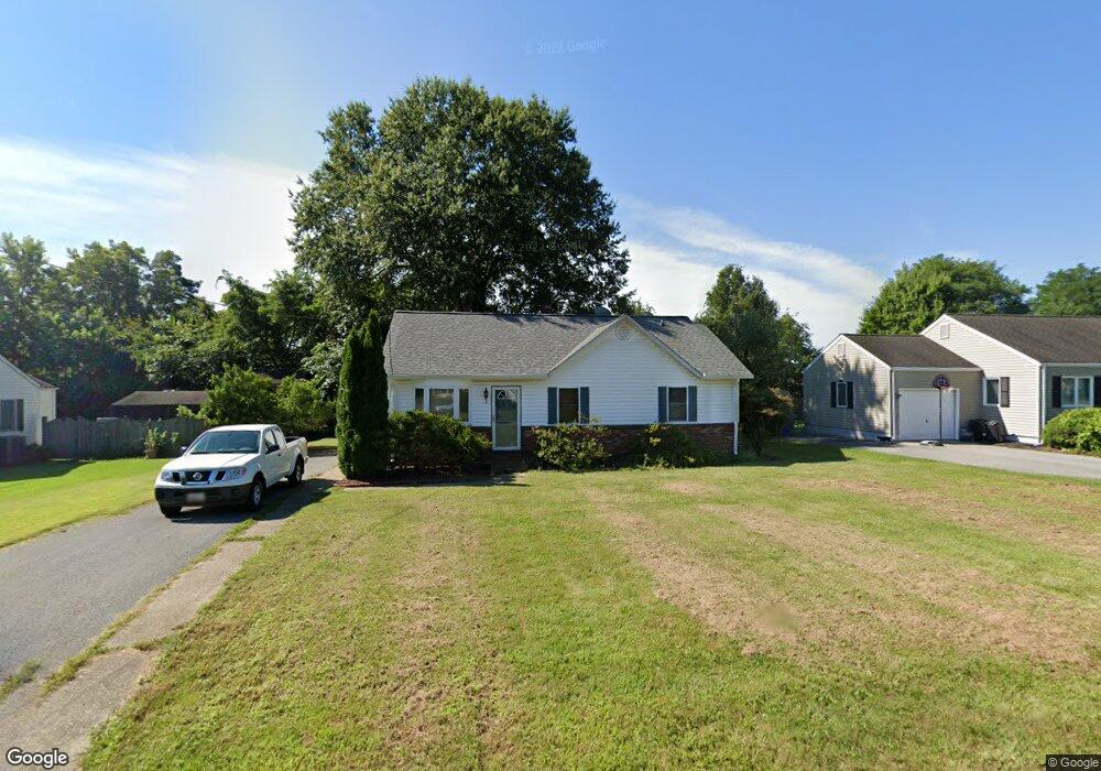
701 Worcester St La Plata, MD 20646
Estimated Value: $313,000 - $407,000
--
Bed
1
Bath
1,334
Sq Ft
$269/Sq Ft
Est. Value
About This Home
This home is located at 701 Worcester St, La Plata, MD 20646 and is currently estimated at $359,031, approximately $269 per square foot. 701 Worcester St is a home located in Charles County with nearby schools including Walter J. Mitchell Elementary School, Milton M. Somers Middle School, and La Plata High School.
Ownership History
Date
Name
Owned For
Owner Type
Purchase Details
Closed on
Jun 2, 2000
Sold by
Yates Joseph B
Bought by
Richard J
Current Estimated Value
Purchase Details
Closed on
Dec 5, 1996
Sold by
Yates Joseph B and Yates Lori Ann
Bought by
Yates Joseph B
Purchase Details
Closed on
Apr 27, 1989
Sold by
Yates Wm L and Hester Ann
Bought by
Yates Joseph B and Lori Ann
Home Financials for this Owner
Home Financials are based on the most recent Mortgage that was taken out on this home.
Original Mortgage
$74,900
Interest Rate
10.99%
Create a Home Valuation Report for This Property
The Home Valuation Report is an in-depth analysis detailing your home's value as well as a comparison with similar homes in the area
Home Values in the Area
Average Home Value in this Area
Purchase History
| Date | Buyer | Sale Price | Title Company |
|---|---|---|---|
| Richard J | $112,000 | -- | |
| Yates Joseph B | -- | -- | |
| Yates Joseph B | $75,000 | -- |
Source: Public Records
Mortgage History
| Date | Status | Borrower | Loan Amount |
|---|---|---|---|
| Previous Owner | Yates Joseph B | $74,900 | |
| Closed | Richard J | -- |
Source: Public Records
Tax History Compared to Growth
Tax History
| Year | Tax Paid | Tax Assessment Tax Assessment Total Assessment is a certain percentage of the fair market value that is determined by local assessors to be the total taxable value of land and additions on the property. | Land | Improvement |
|---|---|---|---|---|
| 2025 | $7,691 | $245,533 | -- | -- |
| 2024 | $3,562 | $231,667 | $0 | $0 |
| 2023 | $3,809 | $217,800 | $110,200 | $107,600 |
| 2022 | $3,126 | $207,633 | $0 | $0 |
| 2021 | $2,831 | $197,467 | $0 | $0 |
| 2020 | $2,831 | $187,300 | $100,200 | $87,100 |
| 2019 | $2,767 | $182,367 | $0 | $0 |
| 2018 | $2,682 | $177,433 | $0 | $0 |
| 2017 | $2,623 | $172,500 | $0 | $0 |
| 2016 | -- | $172,500 | $0 | $0 |
| 2015 | $2,401 | $172,500 | $0 | $0 |
| 2014 | $2,401 | $176,500 | $0 | $0 |
Source: Public Records
Map
Nearby Homes
- 9 Candleberry Dr
- 14 Candleberry Dr
- 13 Candleberry Dr
- The Adelina Plan at Fischer's Grant
- The Westminster Plan at Fischer's Grant
- The Brentwood Plan at Fischer's Grant
- The Lancaster Plan at Fischer's Grant
- The Winchester Plan at Fischer's Grant
- The Willow Plan at Fischer's Grant
- The Oxford Plan at Fischer's Grant
- The Fairfax Plan at Fischer's Grant
- The Belmont Plan at Fischer's Grant
- The Glenwood Plan at Fischer's Grant
- The Hampton Plan at Fischer's Grant
- The Somerset Plan at Fischer's Grant
- The Ashland Plan at Fischer's Grant
- 302 Edelen Station Place
- 600 Edelen Station Place Unit 7402
- 107 Howard St
- 45 Hibiscus Ct
- 609 Worcester St
- 703 Worcester St
- 610 Worcester St
- 626 Hemlock Ct
- 624 Hemlock Ct
- 607 Worcester St
- 608 Worcester St
- 700 Worcester St
- 622 Hemlock Ct
- 705 Worcester St
- 705 Worcester St
- 705 Worcester St Unit B
- 620 Hemlock Ct
- 606 Worcester St
- 618 Hemlock Ct
- 702A Worcester St
- 702B Worcester St
- 616 Hemlock Ct
- 707 Worcester St
- 605 Worcester St