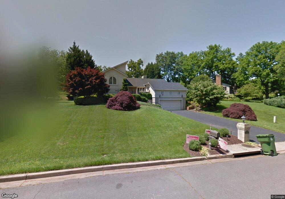
7011 Duncraig Ct McLean, VA 22101
Estimated Value: $1,755,000 - $2,204,000
3
Beds
5
Baths
2,464
Sq Ft
$826/Sq Ft
Est. Value
About This Home
This home is located at 7011 Duncraig Ct, McLean, VA 22101 and is currently estimated at $2,034,937, approximately $825 per square foot. 7011 Duncraig Ct is a home located in Fairfax County with nearby schools including Churchill Road Elementary School, Cooper Middle School, and Langley High School.
Ownership History
Date
Name
Owned For
Owner Type
Purchase Details
Closed on
Jan 23, 2003
Sold by
Alexander Lee
Bought by
Arafat Fawaz
Current Estimated Value
Purchase Details
Closed on
Aug 16, 1994
Sold by
Mahan Howard L
Bought by
Moersle Robert C
Home Financials for this Owner
Home Financials are based on the most recent Mortgage that was taken out on this home.
Original Mortgage
$350,000
Interest Rate
8.52%
Mortgage Type
Purchase Money Mortgage
Create a Home Valuation Report for This Property
The Home Valuation Report is an in-depth analysis detailing your home's value as well as a comparison with similar homes in the area
Home Values in the Area
Average Home Value in this Area
Purchase History
| Date | Buyer | Sale Price | Title Company |
|---|---|---|---|
| Arafat Fawaz | $895,000 | -- | |
| Moersle Robert C | $400,000 | -- |
Source: Public Records
Mortgage History
| Date | Status | Borrower | Loan Amount |
|---|---|---|---|
| Previous Owner | Moersle Robert C | $350,000 |
Source: Public Records
Tax History Compared to Growth
Tax History
| Year | Tax Paid | Tax Assessment Tax Assessment Total Assessment is a certain percentage of the fair market value that is determined by local assessors to be the total taxable value of land and additions on the property. | Land | Improvement |
|---|---|---|---|---|
| 2025 | $16,568 | $1,566,850 | $737,000 | $829,850 |
| 2024 | $16,568 | $1,402,270 | $627,000 | $775,270 |
| 2023 | $15,139 | $1,314,760 | $582,000 | $732,760 |
| 2022 | $15,089 | $1,293,500 | $570,000 | $723,500 |
| 2021 | $14,692 | $1,227,940 | $553,000 | $674,940 |
| 2020 | $14,471 | $1,199,450 | $553,000 | $646,450 |
| 2019 | $14,995 | $1,242,870 | $553,000 | $689,870 |
| 2018 | $13,433 | $1,168,050 | $532,000 | $636,050 |
| 2017 | $13,361 | $1,128,420 | $531,000 | $597,420 |
| 2016 | $12,824 | $1,085,440 | $511,000 | $574,440 |
| 2015 | $12,081 | $1,060,690 | $496,000 | $564,690 |
| 2014 | $11,222 | $987,450 | $472,000 | $515,450 |
Source: Public Records
Map
Nearby Homes
- 6952 Duncraig Ct
- 7009 Benjamin St
- 7008 Arbor Ln
- 6804 Benjamin St
- 7002 River Oaks Dr
- 930 Douglass Dr
- 7000 Hector Rd
- 1104 Sharon Ct
- 7004 River Oaks Dr
- 1101 Dead Run Dr
- 725 Lawton St
- 6722 Lucy Ln
- 7315 Georgetown Pike
- 6807 Lupine Ln
- 1052 Balls Hill Rd
- 1116 Randolph Rd
- 825 Whann Ave
- 1109 Ingleside Ave
- 6710 Wemberly Way
- 6707 Lupine Ln
- 7009 Duncraig Ct
- 7013 Duncraig Ct
- 7007 Duncraig Ct
- 7015 Duncraig Ct
- 7010 Duncraig Ct
- 910 Countryside Ct
- 7012 Duncraig Ct
- 7014 Duncraig Ct
- 7006 Duncraig Ct
- 7005 Duncraig Ct
- 909 Countryside Ct
- 7004 Duncraig Ct
- 7003 Duncraig Ct
- 908 Countryside Ct
- 7005 Holyrood Dr
- 908 Lawton St
- 910 Lawton St
- 7007 Holyrood Dr
- 912 Lawton St
- 7009 Holyrood Dr