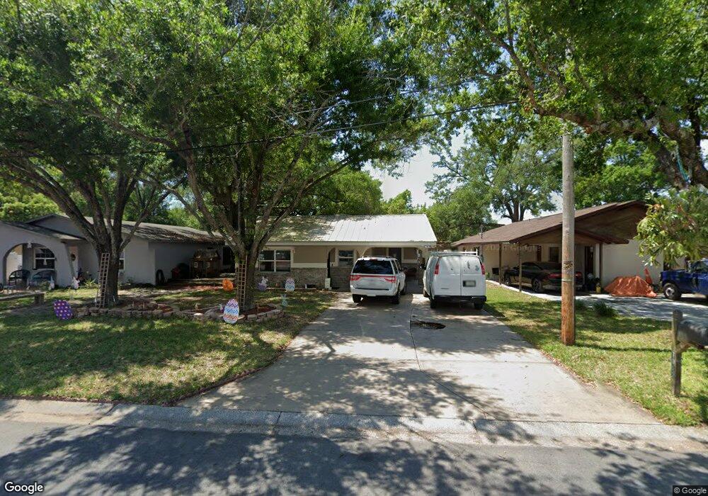
7012 N Cameron Ave Tampa, FL 33614
Pinecrest West Park NeighborhoodEstimated Value: $359,666 - $434,000
2
Beds
2
Baths
1,213
Sq Ft
$322/Sq Ft
Est. Value
About This Home
This home is located at 7012 N Cameron Ave, Tampa, FL 33614 and is currently estimated at $390,667, approximately $322 per square foot. 7012 N Cameron Ave is a home located in Hillsborough County with nearby schools including Crestwood Elementary School, Pierce Middle School, and Leto High School.
Ownership History
Date
Name
Owned For
Owner Type
Purchase Details
Closed on
Aug 31, 2022
Sold by
Mejia Carlos Eduardo
Bought by
Mejia Kimberly Irene
Current Estimated Value
Purchase Details
Closed on
Nov 9, 2007
Sold by
Mejia Edwardo and Mejia Kimberly
Bought by
Mejia Eduardo and Mejia Kimberly
Home Financials for this Owner
Home Financials are based on the most recent Mortgage that was taken out on this home.
Original Mortgage
$107,000
Interest Rate
6.29%
Mortgage Type
Unknown
Create a Home Valuation Report for This Property
The Home Valuation Report is an in-depth analysis detailing your home's value as well as a comparison with similar homes in the area
Home Values in the Area
Average Home Value in this Area
Purchase History
| Date | Buyer | Sale Price | Title Company |
|---|---|---|---|
| Mejia Kimberly Irene | -- | -- | |
| Mejia Eduardo | $45,400 | Image Title & Escrow Llc |
Source: Public Records
Mortgage History
| Date | Status | Borrower | Loan Amount |
|---|---|---|---|
| Previous Owner | Mejia Eduardo | $107,000 |
Source: Public Records
Tax History Compared to Growth
Tax History
| Year | Tax Paid | Tax Assessment Tax Assessment Total Assessment is a certain percentage of the fair market value that is determined by local assessors to be the total taxable value of land and additions on the property. | Land | Improvement |
|---|---|---|---|---|
| 2024 | $1,076 | $64,429 | -- | -- |
| 2023 | $1,027 | $62,552 | $0 | $0 |
| 2022 | $931 | $60,730 | $0 | $0 |
| 2021 | $929 | $58,961 | $0 | $0 |
| 2020 | $865 | $58,147 | $0 | $0 |
| 2019 | $808 | $56,840 | $0 | $0 |
| 2018 | $771 | $55,780 | $0 | $0 |
| 2017 | $764 | $107,596 | $0 | $0 |
| 2016 | $754 | $53,509 | $0 | $0 |
| 2015 | $745 | $53,137 | $0 | $0 |
| 2014 | $745 | $52,715 | $0 | $0 |
| 2013 | $749 | $51,936 | $0 | $0 |
Source: Public Records
Map
Nearby Homes
- 7012 N Hubert Ave
- 7216 Blossom Ave
- 3923 W Flora St
- 3916 W Broad St
- 7210 N Manhattan Ave Unit 2423
- 7210 N Manhattan Ave Unit 1724
- 7210 N Manhattan Ave Unit 1122
- 7210 N Manhattan Ave Unit 1311
- 7210 N Manhattan Ave Unit 2624
- 7210 N Manhattan Ave Unit 1822
- 3914 W Sligh Ave
- 3904 W Hamilton Ave
- 7222 N Richard Ave
- 6624 N Hubert Ave
- 3915 W Robson St
- 3801 Kimball Ave
- 0 Blossom Ave
- 3920 Cedar Limb Ct
- 6420 N Thatcher Ave
- 7908 N Thatcher Ave
- 7014 N Cameron Ave
- 7010 N Cameron Ave
- 7009 N Lois Ave
- 7008 N Cameron Ave
- 7013 N Lois Ave
- 7018 N Cameron Ave
- 7007 N Lois Ave
- 7015 N Lois Ave
- 7013 N Cameron Ave
- 7009 N Cameron Ave
- 7007 N Cameron Ave
- 7005 N Lois Ave
- 7019 N Lois Ave
- 7015 N Cameron Ave
- 7004 N Cameron Ave
- 7017 N Cameron Ave
- 7021 N Lois Ave
- 7003 N Lois Ave
- 7020 N Cameron Ave