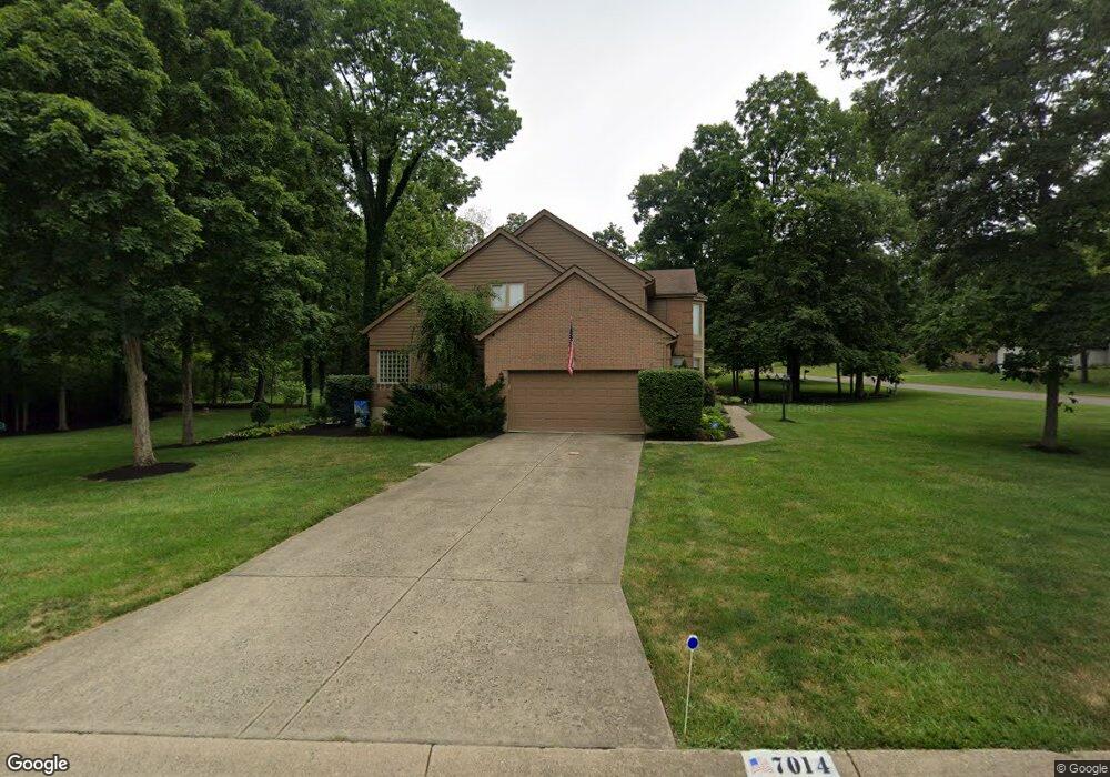
7014 Rock Springs Dr Liberty Township, OH 45011
Estimated Value: $543,000 - $647,000
5
Beds
4
Baths
4,208
Sq Ft
$142/Sq Ft
Est. Value
About This Home
This home is located at 7014 Rock Springs Dr, Liberty Township, OH 45011 and is currently estimated at $598,561, approximately $142 per square foot. 7014 Rock Springs Dr is a home located in Butler County with nearby schools including VanGorden Elementary School, Liberty Junior School, and Lakota East High School.
Ownership History
Date
Name
Owned For
Owner Type
Purchase Details
Closed on
Feb 25, 2010
Sold by
Apperson Kyle A and Apperson Laura L
Bought by
Taylor Richard T and Taylor Deborah L
Current Estimated Value
Home Financials for this Owner
Home Financials are based on the most recent Mortgage that was taken out on this home.
Original Mortgage
$110,000
Interest Rate
5.02%
Mortgage Type
Purchase Money Mortgage
Purchase Details
Closed on
Feb 25, 2005
Sold by
Shaffer Robert and Shaffer Vickie A
Bought by
Apperson Kyle A and Apperson Laura L
Home Financials for this Owner
Home Financials are based on the most recent Mortgage that was taken out on this home.
Original Mortgage
$267,200
Outstanding Balance
$136,270
Interest Rate
5.7%
Mortgage Type
Purchase Money Mortgage
Estimated Equity
$462,291
Purchase Details
Closed on
Sep 1, 1990
Create a Home Valuation Report for This Property
The Home Valuation Report is an in-depth analysis detailing your home's value as well as a comparison with similar homes in the area
Home Values in the Area
Average Home Value in this Area
Purchase History
| Date | Buyer | Sale Price | Title Company |
|---|---|---|---|
| Taylor Richard T | $310,000 | None Available | |
| Apperson Kyle A | $334,000 | -- | |
| -- | $41,900 | -- |
Source: Public Records
Mortgage History
| Date | Status | Borrower | Loan Amount |
|---|---|---|---|
| Closed | Taylor Richard T | $110,000 | |
| Open | Apperson Kyle A | $267,200 | |
| Closed | Apperson Kyle A | $66,800 |
Source: Public Records
Tax History Compared to Growth
Tax History
| Year | Tax Paid | Tax Assessment Tax Assessment Total Assessment is a certain percentage of the fair market value that is determined by local assessors to be the total taxable value of land and additions on the property. | Land | Improvement |
|---|---|---|---|---|
| 2024 | $5,698 | $155,700 | $26,900 | $128,800 |
| 2023 | $5,639 | $148,690 | $26,900 | $121,790 |
| 2022 | $5,536 | $119,290 | $26,900 | $92,390 |
| 2021 | $5,507 | $119,290 | $26,900 | $92,390 |
| 2020 | $5,648 | $119,290 | $26,900 | $92,390 |
| 2019 | $10,531 | $109,320 | $25,760 | $83,560 |
| 2018 | $5,736 | $109,320 | $25,760 | $83,560 |
| 2017 | $5,845 | $109,320 | $25,760 | $83,560 |
| 2016 | $5,500 | $102,740 | $25,760 | $76,980 |
| 2015 | $5,402 | $102,740 | $25,760 | $76,980 |
| 2014 | $5,617 | $102,740 | $25,760 | $76,980 |
| 2013 | $5,617 | $103,300 | $25,760 | $77,540 |
Source: Public Records
Map
Nearby Homes
- 6060 Loganberry Ct
- 6168 Juneberry Ct
- 7001 Tarragon Ct
- 5981 Birkdale Dr
- 6638 Ashe Knoll
- 7078 Lakota Ridge Dr
- 6335 Dewberry Ct
- 6038 Glennsbury Ct
- 5716 E Senour Dr
- 5677 E Senour Dr
- 6530 Bridgeton Manor Ct
- 5663 E Senour Dr
- 5577 Dove Ln
- 6701 Maud Hughes Rd
- 7534 Galway Ct
- 7420 Kennesaw Dr
- 7628 Lesourdsville West Chester Rd
- 7644 Eleventh Hour Ln
- 7690 Wharton Ct
- 2 Edam Ct
- 5922 Oak Grove Ct
- 7019 Rock Springs Dr
- 5934 Oak Grove Ct
- 7007 Rock Springs Dr
- 6990 Rock Springs Dr
- 7031 Rock Springs Dr
- 5929 Oakland Gardens Ct
- 6995 Rock Springs Dr
- 5911 Oak Grove Ct
- 5923 Oak Grove Ct
- 5939 Oakland Gardens Ct
- 7043 Rock Springs Dr
- 5948 Oak Grove Ct
- 5935 Oak Grove Ct
- 6979 Rock Springs Dr
- 5949 Oakland Gardens Ct
- 7055 Rock Springs Dr
- 5949 Oak Grove Ct
- 6998 Lesourdsville West Chester Rd
- 5960 Oak Grove Ct