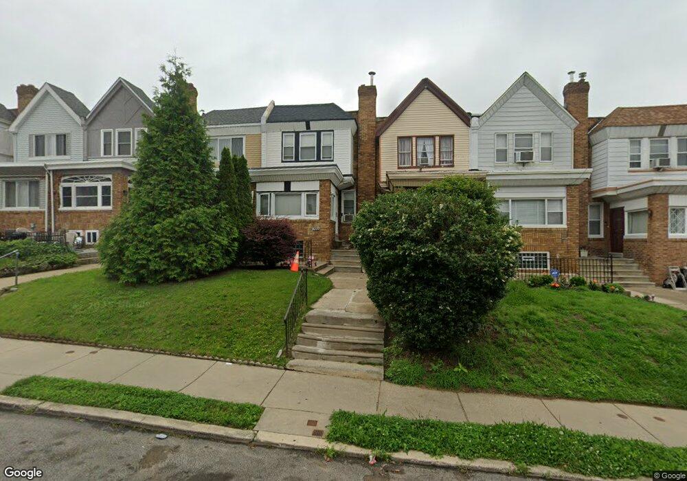
7015 Forrest Ave Philadelphia, PA 19138
West Oak Lane NeighborhoodEstimated Value: $192,000 - $274,000
3
Beds
1
Bath
1,288
Sq Ft
$175/Sq Ft
Est. Value
About This Home
This home is located at 7015 Forrest Ave, Philadelphia, PA 19138 and is currently estimated at $226,033, approximately $175 per square foot. 7015 Forrest Ave is a home located in Philadelphia County with nearby schools including William Rowen School, Gen. Louis Wagner Middle School, and Martin Luther King High School.
Ownership History
Date
Name
Owned For
Owner Type
Purchase Details
Closed on
Dec 28, 2001
Sold by
Rickenbach Jeffrey
Bought by
Mason Chalise
Current Estimated Value
Home Financials for this Owner
Home Financials are based on the most recent Mortgage that was taken out on this home.
Original Mortgage
$67,400
Outstanding Balance
$26,576
Interest Rate
6.84%
Mortgage Type
FHA
Estimated Equity
$199,457
Purchase Details
Closed on
Aug 6, 2001
Sold by
Peters Ruby Alfred
Bought by
Rickenbach Jeffrey
Purchase Details
Closed on
Sep 14, 2000
Sold by
Alfred Riley J
Bought by
Peters Ruby Alfred
Create a Home Valuation Report for This Property
The Home Valuation Report is an in-depth analysis detailing your home's value as well as a comparison with similar homes in the area
Home Values in the Area
Average Home Value in this Area
Purchase History
| Date | Buyer | Sale Price | Title Company |
|---|---|---|---|
| Mason Chalise | $68,000 | -- | |
| Rickenbach Jeffrey | $33,000 | -- | |
| Peters Ruby Alfred | -- | -- |
Source: Public Records
Mortgage History
| Date | Status | Borrower | Loan Amount |
|---|---|---|---|
| Open | Mason Chalise | $67,400 |
Source: Public Records
Tax History Compared to Growth
Tax History
| Year | Tax Paid | Tax Assessment Tax Assessment Total Assessment is a certain percentage of the fair market value that is determined by local assessors to be the total taxable value of land and additions on the property. | Land | Improvement |
|---|---|---|---|---|
| 2026 | $2,314 | $202,700 | $40,540 | $162,160 |
| 2025 | $2,314 | $202,700 | $40,540 | $162,160 |
| 2024 | $2,314 | $202,700 | $40,540 | $162,160 |
| 2023 | $2,314 | $165,300 | $33,060 | $132,240 |
| 2022 | $1,635 | $165,300 | $33,060 | $132,240 |
| 2021 | $1,635 | $0 | $0 | $0 |
| 2020 | $1,635 | $0 | $0 | $0 |
| 2019 | $1,706 | $0 | $0 | $0 |
| 2018 | $1,495 | $0 | $0 | $0 |
| 2017 | $1,495 | $0 | $0 | $0 |
| 2016 | $1,495 | $0 | $0 | $0 |
| 2015 | $1,400 | $0 | $0 | $0 |
| 2014 | -- | $104,500 | $10,880 | $93,620 |
| 2012 | -- | $15,552 | $3,000 | $12,552 |
Source: Public Records
Map
Nearby Homes
- 7001 Limekiln Pike
- 6944 Cedar Park Ave
- 7016 Andrews Ave
- 6908 Ogontz Ave
- 6905 Forrest Ave
- 7092 Forrest Ave
- 6838 Ogontz Ave
- 6869 Forrest Ave
- 7159 N 20th St
- 7188 N Uber St
- 7206 Forrest Ave
- 7349 E Walnut Ln
- 6943 N 19th St
- 2070 E Haines St
- 7153 N 19th St
- 1911 72nd Ave
- 6732 Ogontz Ave
- 6733 N Woodstock St
- 6731 N Woodstock St
- 1839 E Pastorius St
- 7017 Forrest Ave
- 7013 Forrest Ave
- 7019 Forrest Ave
- 7011 Forrest Ave
- 7009 Forrest Ave
- 7021 Forrest Ave
- 7007 Forrest Ave
- 7023 Forrest Ave
- 7025 Forrest Ave
- 7005 Forrest Ave
- 7003 Forrest Ave
- 7027 Forrest Ave
- 7029 Forrest Ave
- 7001 Forrest Ave
- 7031 Forrest Ave
- 7014 Ogontz Ave
- 7016 Ogontz Ave
- 7006 Ogontz Ave
- 7012 Ogontz Ave
- 7020 Ogontz Ave