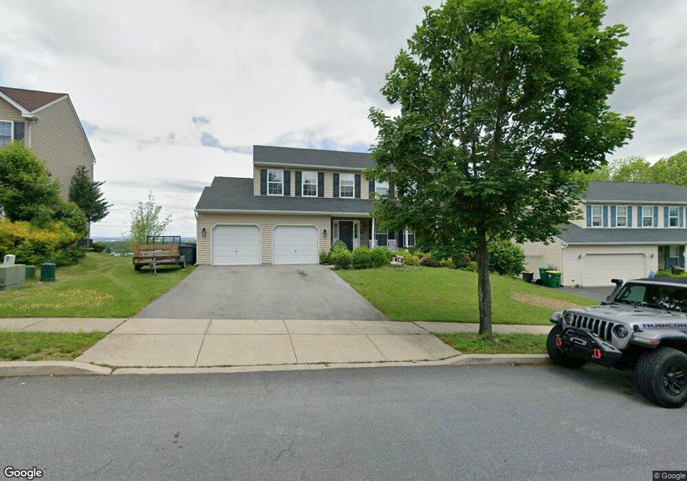
7015 Lincoln Dr Macungie, PA 18062
Lower Macungie Township West NeighborhoodEstimated Value: $475,124 - $541,000
4
Beds
3
Baths
2,289
Sq Ft
$223/Sq Ft
Est. Value
About This Home
This home is located at 7015 Lincoln Dr, Macungie, PA 18062 and is currently estimated at $510,031, approximately $222 per square foot. 7015 Lincoln Dr is a home located in Lehigh County with nearby schools including Shoemaker Elementary School, Eyer Middle School, and Emmaus High School.
Ownership History
Date
Name
Owned For
Owner Type
Purchase Details
Closed on
Sep 29, 2012
Sold by
Dressler Benjamin D
Bought by
Dressler Benjamin D and Dressler Jessica L
Current Estimated Value
Purchase Details
Closed on
Jul 31, 2007
Sold by
Lutts Jeffrey W
Bought by
Dressler Benjamin D
Home Financials for this Owner
Home Financials are based on the most recent Mortgage that was taken out on this home.
Original Mortgage
$247,600
Interest Rate
6.73%
Mortgage Type
New Conventional
Purchase Details
Closed on
Apr 15, 2005
Sold by
T H Properties Lp
Bought by
Lutts Jeffrey W and Lutts Audrey K
Home Financials for this Owner
Home Financials are based on the most recent Mortgage that was taken out on this home.
Original Mortgage
$108,000
Interest Rate
5.95%
Mortgage Type
Fannie Mae Freddie Mac
Create a Home Valuation Report for This Property
The Home Valuation Report is an in-depth analysis detailing your home's value as well as a comparison with similar homes in the area
Home Values in the Area
Average Home Value in this Area
Purchase History
| Date | Buyer | Sale Price | Title Company |
|---|---|---|---|
| Dressler Benjamin D | -- | -- | |
| Dressler Benjamin D | $309,500 | -- | |
| Lutts Jeffrey W | $266,864 | -- |
Source: Public Records
Mortgage History
| Date | Status | Borrower | Loan Amount |
|---|---|---|---|
| Previous Owner | Dressler Benjamin D | $247,600 | |
| Previous Owner | Lutts Jeffrey W | $108,000 |
Source: Public Records
Tax History Compared to Growth
Tax History
| Year | Tax Paid | Tax Assessment Tax Assessment Total Assessment is a certain percentage of the fair market value that is determined by local assessors to be the total taxable value of land and additions on the property. | Land | Improvement |
|---|---|---|---|---|
| 2025 | $5,629 | $220,500 | $25,000 | $195,500 |
| 2024 | $5,446 | $220,500 | $25,000 | $195,500 |
| 2023 | $5,338 | $220,500 | $25,000 | $195,500 |
| 2022 | $5,211 | $220,500 | $195,500 | $25,000 |
| 2021 | $5,100 | $220,500 | $25,000 | $195,500 |
| 2020 | $5,052 | $220,500 | $25,000 | $195,500 |
| 2019 | $4,966 | $220,500 | $25,000 | $195,500 |
| 2018 | $4,901 | $220,500 | $25,000 | $195,500 |
| 2017 | $4,815 | $220,500 | $25,000 | $195,500 |
| 2016 | -- | $220,500 | $25,000 | $195,500 |
| 2015 | -- | $220,500 | $25,000 | $195,500 |
| 2014 | -- | $220,500 | $25,000 | $195,500 |
Source: Public Records
Map
Nearby Homes
- 3814 Clay Dr
- 6903 Lincoln Dr
- 0 Clauss Hunt Knight Dr Unit 10 Units 763578
- 6709 Mountain Rd
- 0 Mountain Lot 1
- 6405 Robin Rd
- 167 Aspen Ln
- Lot 1 Mountain Rd
- 7230 Pioneer Dr
- 211 S Church St
- 6672 Pioneer Dr
- 2845 Donegal Dr
- 2840 Donegal Dr
- 6635 Blue Heather Ct
- 4759 Sheep Rock Rd
- 204 Ridings Cir Unit F204
- 2879 Sequoia Dr
- 6528 Carmel Dr
- 353 Abby Rd Unit Lot 40
- 353 Abby Rd
- 7007 Lincoln Dr
- 7023 Lincoln Dr
- 6999 Lincoln Dr
- 7031 Lincoln Dr
- 3744 Notch St
- 3789 Rittenhouse Rd
- 6991 Lincoln Dr
- 7039 Lincoln Dr
- 3752 Notch St
- 3797 Rittenhouse Rd
- 6983 Lincoln Dr
- 3743 Notch St
- 3805 Rittenhouse Rd
- 7047 Lincoln Dr
- 3760 Notch St
- 3790 Rittenhouse Rd
- 3751 Notch St
- 3798 Rittenhouse Rd
- 6975 Lincoln Dr
- 7055 Lincoln Dr