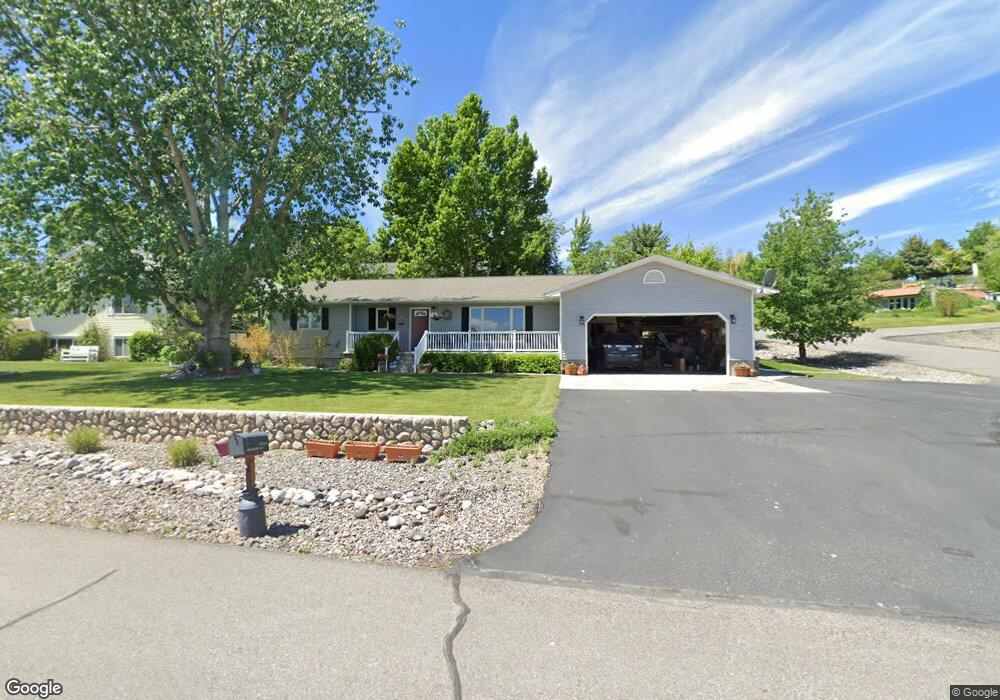
7015 Moonlite Dr Manhattan, MT 59741
Amsterdam-Churchill NeighborhoodEstimated Value: $579,138 - $716,000
5
Beds
3
Baths
2,904
Sq Ft
$229/Sq Ft
Est. Value
About This Home
This home is located at 7015 Moonlite Dr, Manhattan, MT 59741 and is currently estimated at $663,785, approximately $228 per square foot. 7015 Moonlite Dr is a home located in Gallatin County with nearby schools including Amsterdam School, Manhattan High School, and Manhattan Christian School.
Ownership History
Date
Name
Owned For
Owner Type
Purchase Details
Closed on
Oct 9, 2020
Sold by
Dykema Kenneth S
Bought by
Dam Timothy Van and Dam Jana Van
Current Estimated Value
Purchase Details
Closed on
May 31, 2011
Sold by
Klein Patrick T
Bought by
Van Dam Timothy and Van Dam Jana
Home Financials for this Owner
Home Financials are based on the most recent Mortgage that was taken out on this home.
Original Mortgage
$50,000
Interest Rate
4.84%
Mortgage Type
New Conventional
Purchase Details
Closed on
Sep 14, 2009
Sold by
Campbell Investments Llc
Bought by
Klein Patrick T
Purchase Details
Closed on
Sep 15, 2008
Sold by
Robert Duffin Living Trust
Bought by
Campbell Investments Llc
Purchase Details
Closed on
May 9, 2008
Sold by
Duffin Robert L and Duffin Linda D
Bought by
Robert Duffin Living Trust
Create a Home Valuation Report for This Property
The Home Valuation Report is an in-depth analysis detailing your home's value as well as a comparison with similar homes in the area
Home Values in the Area
Average Home Value in this Area
Purchase History
We collect this data history from publicly available records. To have your information removed, we recommend requesting removal directly through your county’s website.
| Date | Buyer | Sale Price | Title Company |
|---|---|---|---|
| Dam Timothy Van | -- | American Land Title Company | |
| Van Dam Timothy | -- | Montana Title & Escrow | |
| Klein Patrick T | -- | Stewart Title Of Bozeman | |
| Campbell Investments Llc | -- | Stewart Title Of Bozeman | |
| Robert Duffin Living Trust | -- | None Available |
Source: Public Records
Mortgage History
We collect this data history from publicly available records. To have your information removed, we recommend requesting removal directly through your county’s website.
| Date | Status | Borrower | Loan Amount |
|---|---|---|---|
| Previous Owner | Van Dam Timothy | $50,000 |
Source: Public Records
Tax History
| Year | Tax Paid | Tax Assessment Tax Assessment Total Assessment is a certain percentage of the fair market value that is determined by local assessors to be the total taxable value of land and additions on the property. | Land | Improvement |
|---|---|---|---|---|
| 2025 | $2,042 | $570,900 | $0 | $0 |
| 2024 | $3,156 | $568,200 | $0 | $0 |
| 2023 | $3,369 | $568,200 | $0 | $0 |
| 2022 | $2,503 | $362,400 | $0 | $0 |
| 2021 | $2,716 | $362,400 | $0 | $0 |
| 2020 | $2,866 | $339,500 | $0 | $0 |
| 2019 | $2,905 | $339,500 | $0 | $0 |
| 2018 | $2,647 | $277,900 | $0 | $0 |
| 2017 | $2,364 | $277,900 | $0 | $0 |
| 2016 | $2,563 | $257,500 | $0 | $0 |
| 2015 | $2,459 | $257,500 | $0 | $0 |
| 2014 | $2,234 | $148,771 | $0 | $0 |
Source: Public Records
Map
Nearby Homes
- 8685 Churchill Rd
- Deville Lot: 2
- Lot 2 Deville
- 7055 Skylark Dr
- 7915 Churchill Rd
- Tract 5 (81 Acres) Churchill Rd
- Tract 4 (46 Acres) Churchill Rd
- 374 Cushing Ln
- NHN Cushing Ln
- 245 Kunje Blvd
- 50 Cushing Ln
- Lot 3 Dyksterhouse Ln
- Lot 4 Dkysterhouse Ln
- Lot 1 Ln
- 478 Pacer Landing
- 8555 Camp Creek Rd
- 9670 Prairie Rd
- 110 Double L Ln
- 3455 Linney Rd
- 285 Waterfowl Way
- 7035 Moonlite Dr
- 6050 Monarch Dr
- 6041 Pearl Dr
- 6542 Imperial Place
- 6075 Monarch Dr
- 6070 Century Dr
- 7033 Imperial Place
- 8715 Churchill Rd
- 8715 Churchill Rd
- 7085 Moonlight Dr
- 7085 Moonlite Dr
- 7085 Moonlite Dr
- 7035 Imperial Place
- 6950 Deville St
- 6090 Century Dr
- 7050 Skylark Dr
- 6105 Monarch Dr
- 7105 Moonlite Dr
- 6120 Monarch Dr
- 6060 Pearl Dr
Your Personal Tour Guide
Ask me questions while you tour the home.