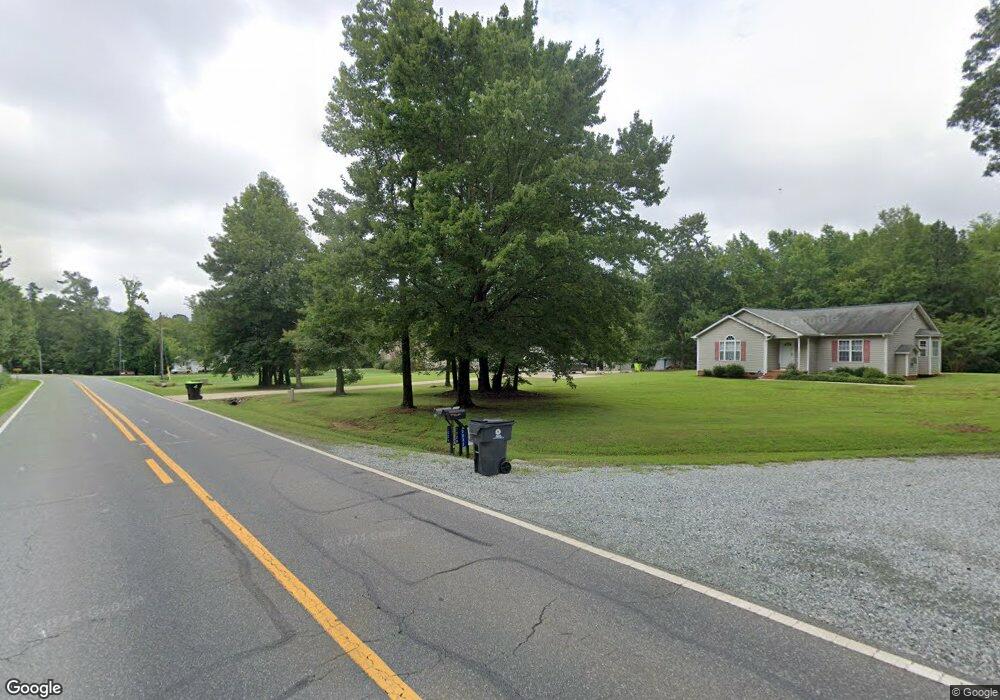
7016 Nc Highway 49 S Snow Camp, NC 27349
Estimated Value: $261,000 - $288,000
3
Beds
2
Baths
1,206
Sq Ft
$229/Sq Ft
Est. Value
About This Home
This home is located at 7016 Nc Highway 49 S, Snow Camp, NC 27349 and is currently estimated at $275,758, approximately $228 per square foot. 7016 Nc Highway 49 S is a home located in Alamance County with nearby schools including Edwin M. Holt Elementary School, Southern Alamance Middle School, and Southern Alamance High School.
Ownership History
Date
Name
Owned For
Owner Type
Purchase Details
Closed on
Jul 19, 2002
Sold by
Anderson Thomas L
Bought by
Anderson Sharon W
Current Estimated Value
Purchase Details
Closed on
Jul 16, 1999
Sold by
G W Wagoner Jr Bldrs Inc
Bought by
Anderson Thomas L
Home Financials for this Owner
Home Financials are based on the most recent Mortgage that was taken out on this home.
Original Mortgage
$105,600
Interest Rate
7.43%
Create a Home Valuation Report for This Property
The Home Valuation Report is an in-depth analysis detailing your home's value as well as a comparison with similar homes in the area
Home Values in the Area
Average Home Value in this Area
Purchase History
| Date | Buyer | Sale Price | Title Company |
|---|---|---|---|
| Anderson Sharon W | -- | -- | |
| Anderson Thomas L | $109,000 | -- |
Source: Public Records
Mortgage History
| Date | Status | Borrower | Loan Amount |
|---|---|---|---|
| Previous Owner | Anderson Thomas L | $105,600 |
Source: Public Records
Tax History Compared to Growth
Tax History
| Year | Tax Paid | Tax Assessment Tax Assessment Total Assessment is a certain percentage of the fair market value that is determined by local assessors to be the total taxable value of land and additions on the property. | Land | Improvement |
|---|---|---|---|---|
| 2025 | $1,470 | $243,753 | $26,156 | $217,597 |
| 2024 | $1,336 | $243,753 | $26,156 | $217,597 |
| 2023 | $1,240 | $243,753 | $26,156 | $217,597 |
| 2022 | $980 | $128,336 | $24,690 | $103,646 |
| 2021 | $993 | $128,336 | $24,690 | $103,646 |
| 2020 | $1,006 | $128,336 | $24,690 | $103,646 |
| 2019 | $1,011 | $128,336 | $24,690 | $103,646 |
| 2018 | $0 | $128,336 | $24,690 | $103,646 |
| 2017 | $895 | $128,336 | $24,690 | $103,646 |
| 2016 | $901 | $131,097 | $24,690 | $106,407 |
| 2015 | $897 | $131,097 | $24,690 | $106,407 |
| 2014 | -- | $131,097 | $24,690 | $106,407 |
Source: Public Records
Map
Nearby Homes
- 2832 Russell McPherson Rd
- 6439 Beale Rd
- 2668 Ashewood Dr
- 4021 Swannie Coble Rd
- 0 Boulder Rd
- 4070 Swannie Coble Rd
- 2475 Adams Farm Ct
- 6715 Cottonwood Dr
- 5923 Wild Horse Canyon Rd
- 5313 Bass Mountain Rd
- 0 W Greensboro Chapel Hill Rd Unit 1198406
- 0 W Greensboro Chapel Hill Rd Unit 10126305
- 0 Bass Mountain Rd Unit 10128813
- 0 Bass Mountain Rd Unit 1199025
- 0 Bass Mountain Rd Unit 10124655
- 5303 Bass Mountain Rd
- 5464 Bass Mountain Rd
- 3669 W Greensboro Chapel Hill Rd
- 6242 Wild Horse Canyon Rd
- 5507 Eagles Nest Trail
- 7016 State Highway 49
- 7004 Nc Highway 49 S
- 7024 Nc Highway 49 S
- 7024 State Highway 49
- 6998 Nc Highway 49 S
- 0 Nc 49 Hwy Unit TR1972591
- 0 Nc 49 Hwy Unit TR2000987
- 0 Nc 49 Hwy Unit TR2000955
- 6925 Nc Highway 49 S
- 7028 Nc Highway 49 S
- 6960 Nc Highway 49 S
- 6948 State Highway 49
- 6948 Nc Highway 49 S
- 7032 Nc Highway 49 S
- 0 Songbird Place
- 7032 State Highway 49
- 6940 Nc Highway 49 S
- 3104 Isley Dr
- 2846 Charley Ln
- 2886 Charley Ln