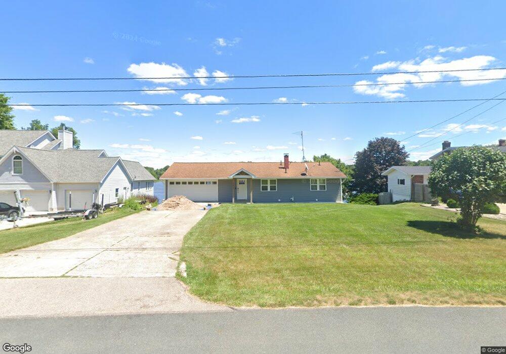
7017 Westgate Dr Laingsburg, MI 48848
Estimated Value: $322,000 - $488,000
2
Beds
2
Baths
1,740
Sq Ft
$222/Sq Ft
Est. Value
About This Home
This home is located at 7017 Westgate Dr, Laingsburg, MI 48848 and is currently estimated at $386,444, approximately $222 per square foot. 7017 Westgate Dr is a home located in Clinton County with nearby schools including Laingsburg Elementary School, Laingsburg Middle School, and Laingsburg High School.
Ownership History
Date
Name
Owned For
Owner Type
Purchase Details
Closed on
Apr 28, 2014
Sold by
Holcomb Donna I and Fair Ledonna J
Bought by
Good Monika
Current Estimated Value
Home Financials for this Owner
Home Financials are based on the most recent Mortgage that was taken out on this home.
Original Mortgage
$171,000
Outstanding Balance
$130,322
Interest Rate
4.33%
Mortgage Type
New Conventional
Estimated Equity
$256,122
Purchase Details
Closed on
Oct 30, 2007
Sold by
Holcomb Claude E and Holcomb Donna I
Bought by
Holcomb Claude E and Holcomb Donna I
Create a Home Valuation Report for This Property
The Home Valuation Report is an in-depth analysis detailing your home's value as well as a comparison with similar homes in the area
Home Values in the Area
Average Home Value in this Area
Purchase History
| Date | Buyer | Sale Price | Title Company |
|---|---|---|---|
| Good Monika | $180,000 | Transnation Title Agency | |
| Holcomb Claude E | -- | None Available |
Source: Public Records
Mortgage History
| Date | Status | Borrower | Loan Amount |
|---|---|---|---|
| Open | Good Monika | $171,000 |
Source: Public Records
Tax History Compared to Growth
Tax History
| Year | Tax Paid | Tax Assessment Tax Assessment Total Assessment is a certain percentage of the fair market value that is determined by local assessors to be the total taxable value of land and additions on the property. | Land | Improvement |
|---|---|---|---|---|
| 2025 | $4,193 | $146,100 | $55,000 | $91,100 |
| 2024 | $1,368 | $142,900 | $52,500 | $90,400 |
| 2023 | $1,296 | $132,900 | $0 | $0 |
| 2022 | $3,828 | $126,100 | $47,500 | $78,600 |
| 2021 | $3,345 | $119,300 | $45,000 | $74,300 |
| 2020 | $3,109 | $110,300 | $42,500 | $67,800 |
| 2019 | $3,131 | $107,600 | $41,000 | $66,600 |
| 2018 | $2,810 | $98,700 | $41,000 | $57,700 |
| 2017 | $2,778 | $96,000 | $41,000 | $55,000 |
| 2016 | $2,684 | $92,600 | $41,000 | $51,600 |
| 2015 | $2,672 | $92,500 | $0 | $0 |
| 2011 | -- | $82,500 | $0 | $0 |
Source: Public Records
Map
Nearby Homes
- 9195 Westchester Dr
- 0 Peninsula Way
- V/L Victoria Shore Dr
- Parcel B S Hollister Rd
- 702 N Oakland Dr
- 9457 S Hollister Rd
- 780 N West St
- V/L W 2nd St N
- 8584 E Parker Rd
- 0 Doyle Rd Unit 291996
- 302 N Shiawassee St
- 7599 Alward Rd
- 407 S Woodhull Rd
- 7370 Cross Creek Dr
- 0 Laingsburg Rd
- 6706 E Price Rd
- V/L S Shepardsville Rd
- 3525 S Hollister Rd
- 5025 S Saint Clair Rd
- 4101 Shaftsburg Rd
- 7025 Westgate Dr
- 7007 Westgate Dr
- 0 Lancaster Rd
- 7033 Westgate Dr
- 6985 Westgate Dr
- 7039 Westgate Dr
- 7036 Westgate Dr
- 6971 Westgate Dr
- 9385 Lancaster Rd
- 7048 Westgate Dr
- 7049 Westgate Dr
- 6940 Westgate Dr
- 6957 Westgate Dr
- 7060 Westgate Dr
- 9517 Buckingham Cir
- 9513 Buckingham Cir
- 7055 Westgate Dr
- 9499 Buckingham Cir
- 7072 Westgate Dr
- 6914 Westgate Dr