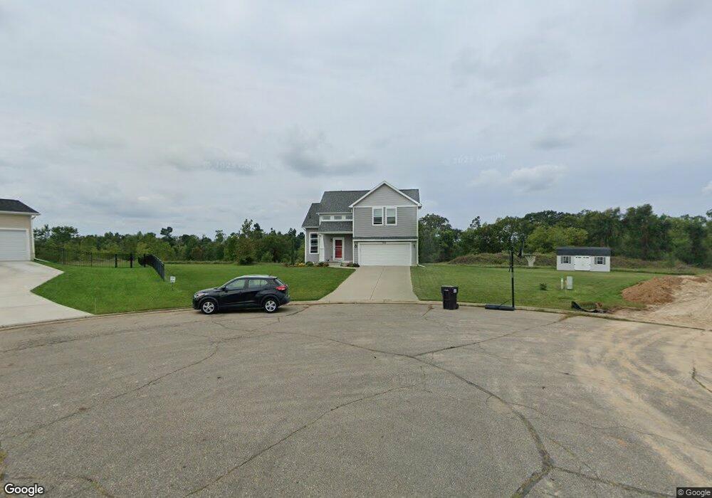
7018 Jason Dr Jackson, MI 49201
Estimated Value: $351,000 - $463,000
3
Beds
3
Baths
1,600
Sq Ft
$244/Sq Ft
Est. Value
About This Home
This home is located at 7018 Jason Dr, Jackson, MI 49201 and is currently estimated at $390,358, approximately $243 per square foot. 7018 Jason Dr is a home located in Jackson County with nearby schools including Ezra Eby Elementary School, Napoleon Middle School, and Napoleon High School.
Ownership History
Date
Name
Owned For
Owner Type
Purchase Details
Closed on
May 21, 2018
Sold by
Country View Estates Llc
Bought by
Payer Kimberly A
Current Estimated Value
Home Financials for this Owner
Home Financials are based on the most recent Mortgage that was taken out on this home.
Original Mortgage
$186,727
Outstanding Balance
$160,778
Interest Rate
4.4%
Mortgage Type
New Conventional
Estimated Equity
$229,580
Purchase Details
Closed on
Nov 2, 2017
Sold by
Tokarski Kevin Vincent and Tokarski Sandra Kay
Bought by
Dirt Works Excavating Llc
Purchase Details
Closed on
Aug 15, 2012
Sold by
Coffman Karen
Bought by
Tokarski Kevin Vincent and Tokarski Sandra Kay
Create a Home Valuation Report for This Property
The Home Valuation Report is an in-depth analysis detailing your home's value as well as a comparison with similar homes in the area
Home Values in the Area
Average Home Value in this Area
Purchase History
| Date | Buyer | Sale Price | Title Company |
|---|---|---|---|
| Payer Kimberly A | $184,860 | Cnfc Title | |
| Estates Llc | -- | Cnfc Title | |
| Dirt Works Excavating Llc | $8,500 | First Amer Title Ins Co | |
| Tokarski Kevin Vincent | $950 | None Available |
Source: Public Records
Mortgage History
| Date | Status | Borrower | Loan Amount |
|---|---|---|---|
| Open | Payer Kimberly A | $186,727 |
Source: Public Records
Tax History
| Year | Tax Paid | Tax Assessment Tax Assessment Total Assessment is a certain percentage of the fair market value that is determined by local assessors to be the total taxable value of land and additions on the property. | Land | Improvement |
|---|---|---|---|---|
| 2025 | $4,971 | $186,200 | $186,200 | $0 |
| 2024 | $30 | $177,400 | $0 | $0 |
| 2023 | $2,827 | $158,600 | $0 | $0 |
| 2022 | $4,303 | $132,400 | $0 | $0 |
| 2021 | $4,248 | $130,300 | $0 | $0 |
| 2020 | $4,312 | $125,300 | $0 | $0 |
| 2019 | $3,781 | $108,400 | $0 | $0 |
| 2018 | $516 | $13,275 | $0 | $0 |
| 2017 | $557 | $10,100 | $0 | $0 |
| 2016 | $364 | $10,089 | $10,089 | $0 |
| 2015 | $525 | $10,532 | $10,532 | $0 |
| 2014 | $525 | $9,735 | $0 | $0 |
| 2013 | -- | $9,735 | $9,735 | $0 |
Source: Public Records
Map
Nearby Homes
- 8373 S Stoney Lake Rd
- V/L Nottawasepee
- 118 N East St
- 208 Plymouth St
- 8654 Cady Rd
- 34 Skylark Dr
- VL Pleasant View Ln Unit 21
- VL Pleasant View Ln Unit 22
- VL Pleasant View Ln Unit 24
- VL Pleasant View Ln Unit 23
- VL Pleasant View Ln Unit 20
- VL Pleasant View Ln Unit 18
- 0 Silkworth Blvd Unit 25050358
- 0 Silkworth Blvd Unit 25007599
- 10411 Cady Rd
- 5820 Squires Rd
- 7003 Country View Blvd
- 6800 Wheaton Rd
- 10552 Cady Rd
- 9538 Peterson Rd
- 7018 Jason Dr Unit 47
- 7019 Jason Dr Unit 48
- 7019 Jason Dr
- 0 Jason Dr
- 7015 Jason Dr Unit 49
- 7015 Jason Dr
- 7007 Solitude Dr
- 7016 Jason Dr
- 7009 Solitude Dr Unit 41
- 7011 Jason Dr
- 8064 Jordan Rd
- 8060 Jordan Rd Unit 55
- 8060 Jordan Rd
- 7006 Jason Dr Unit 44
- 7005 Solitude Dr Unit 42
- 7005 Solitude Dr Unit 42 bRENDAN EST
- 8055 Jason Dr
- 8059 Jason Dr
- 8055 Jason Dr Unit 49
- 8060 Jason Dr Unit 47