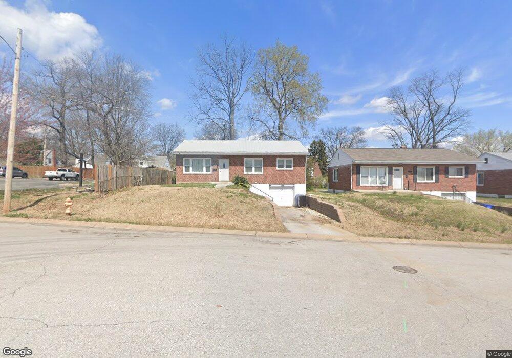
7019 Roberts Ct Saint Louis, MO 63130
Estimated Value: $118,000 - $139,019
3
Beds
1
Bath
960
Sq Ft
$136/Sq Ft
Est. Value
About This Home
This home is located at 7019 Roberts Ct, Saint Louis, MO 63130 and is currently estimated at $130,505, approximately $135 per square foot. 7019 Roberts Ct is a home located in St. Louis County with nearby schools including Pershing Elementary School, Brittany Woods Middle School, and University City High School.
Ownership History
Date
Name
Owned For
Owner Type
Purchase Details
Closed on
Nov 14, 2022
Sold by
Fitzgibbon Michael and Fitzgibbon Rachel
Bought by
If The Home Fitz Llc
Current Estimated Value
Home Financials for this Owner
Home Financials are based on the most recent Mortgage that was taken out on this home.
Original Mortgage
$131,200
Outstanding Balance
$127,227
Interest Rate
7.08%
Mortgage Type
New Conventional
Estimated Equity
$3,278
Purchase Details
Closed on
Oct 12, 2021
Sold by
Mcclain Carl E and Mcclain Birdie Mae
Bought by
Fitzgibbon Michael and Fitzgibbon Rachel
Create a Home Valuation Report for This Property
The Home Valuation Report is an in-depth analysis detailing your home's value as well as a comparison with similar homes in the area
Home Values in the Area
Average Home Value in this Area
Purchase History
| Date | Buyer | Sale Price | Title Company |
|---|---|---|---|
| If The Home Fitz Llc | -- | -- | |
| Fitzgibbon Michael | -- | Freedom Title |
Source: Public Records
Mortgage History
| Date | Status | Borrower | Loan Amount |
|---|---|---|---|
| Open | If The Home Fitz Llc | $131,200 |
Source: Public Records
Tax History Compared to Growth
Tax History
| Year | Tax Paid | Tax Assessment Tax Assessment Total Assessment is a certain percentage of the fair market value that is determined by local assessors to be the total taxable value of land and additions on the property. | Land | Improvement |
|---|---|---|---|---|
| 2025 | $1,698 | $24,020 | $5,780 | $18,240 |
| 2024 | $1,698 | $23,390 | $9,610 | $13,780 |
| 2023 | $1,696 | $23,390 | $9,610 | $13,780 |
| 2022 | $1,202 | $15,260 | $5,000 | $10,260 |
| 2021 | $1,190 | $15,260 | $5,000 | $10,260 |
| 2020 | $1,248 | $15,620 | $5,740 | $9,880 |
| 2019 | $1,236 | $15,620 | $5,740 | $9,880 |
| 2018 | $1,170 | $13,640 | $4,980 | $8,660 |
| 2017 | $1,172 | $13,640 | $4,980 | $8,660 |
| 2016 | $783 | $8,530 | $3,460 | $5,070 |
| 2015 | $786 | $8,530 | $3,460 | $5,070 |
| 2014 | $708 | $7,490 | $2,380 | $5,110 |
Source: Public Records
Map
Nearby Homes
- 1209 Griefield Place
- 7032 Canton Ave
- 7048 Raymond Ave
- 7012 Melrose Ave
- 1207 Buckner Place
- 6934 Julian Ave
- 7039 Plymouth Ave
- 7055 Plymouth Ave
- 6954 Plymouth Ave
- 6821 Raymond Ave
- 6922 Plymouth Ave
- 1529 Nixon Ave
- 7171 White Oak Ln
- 6996 Robbins Ave
- 6759 Raymond Ave
- 6757 Raymond Ave
- 6937 Etzel Ave
- 6903 Etzel Ave
- 1085 Pennsylvania Ave
- 1520 Purdue Ave
- 7015 Roberts Ct
- 7011 Roberts Ct
- 7018 Dover Ct
- 7024 Dover Ct
- 7028 Dover Ct
- 7007 Roberts Ct
- 7012 Dover Ct
- 7032 Dover Ct
- 7014 Roberts Ct
- 7018 Roberts Ct
- 7010 Roberts Ct
- 1283 Pennsylvania Ave
- 1281 Pennsylvania Ave
- 7006 Roberts Ct
- 7036 Dover Ct
- 1285 Pennsylvania Ave
- 1287 Pennsylvania Ave
- 1279 Pennsylvania Ave
- 1340 Partridge Ave
- 7040 Dover Ct