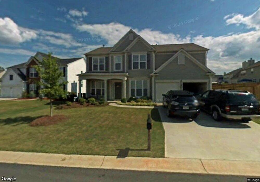
702 Aroura Dr Woodstock, GA 30188
Estimated Value: $546,000 - $547,982
4
Beds
3
Baths
2,364
Sq Ft
$231/Sq Ft
Est. Value
About This Home
This home is located at 702 Aroura Dr, Woodstock, GA 30188 and is currently estimated at $546,991, approximately $231 per square foot. 702 Aroura Dr is a home located in Cherokee County with nearby schools including Little River Elementary, Mill Creek Middle School, and River Ridge High School.
Ownership History
Date
Name
Owned For
Owner Type
Purchase Details
Closed on
Mar 22, 2006
Sold by
Pulte Hm Corp
Bought by
Milton Tiffani N
Current Estimated Value
Home Financials for this Owner
Home Financials are based on the most recent Mortgage that was taken out on this home.
Original Mortgage
$182,970
Outstanding Balance
$100,980
Interest Rate
5.87%
Mortgage Type
New Conventional
Estimated Equity
$446,011
Create a Home Valuation Report for This Property
The Home Valuation Report is an in-depth analysis detailing your home's value as well as a comparison with similar homes in the area
Home Values in the Area
Average Home Value in this Area
Purchase History
| Date | Buyer | Sale Price | Title Company |
|---|---|---|---|
| Milton Tiffani N | $258,000 | -- |
Source: Public Records
Mortgage History
| Date | Status | Borrower | Loan Amount |
|---|---|---|---|
| Open | Milton Tiffani N | $182,970 |
Source: Public Records
Tax History Compared to Growth
Tax History
| Year | Tax Paid | Tax Assessment Tax Assessment Total Assessment is a certain percentage of the fair market value that is determined by local assessors to be the total taxable value of land and additions on the property. | Land | Improvement |
|---|---|---|---|---|
| 2025 | $4,934 | $217,240 | $42,800 | $174,440 |
| 2024 | $4,653 | $202,840 | $42,800 | $160,040 |
| 2023 | $471 | $188,160 | $41,200 | $146,960 |
| 2022 | $3,878 | $154,080 | $33,200 | $120,880 |
| 2021 | $3,131 | $134,160 | $28,000 | $106,160 |
| 2020 | $3,683 | $123,440 | $25,600 | $97,840 |
| 2019 | $2,862 | $120,680 | $25,600 | $95,080 |
| 2018 | $2,780 | $115,760 | $24,000 | $91,760 |
| 2017 | $2,687 | $275,300 | $24,000 | $86,120 |
| 2016 | $2,646 | $267,600 | $22,400 | $84,640 |
| 2015 | $2,550 | $252,900 | $18,000 | $83,160 |
| 2014 | $2,396 | $236,700 | $18,000 | $76,680 |
Source: Public Records
Map
Nearby Homes
- 215 Revillion Way
- 154 Towey Trail
- 144 Towey Trail
- 116 Neetle Close Dr
- 205 Deerchase Dr
- 536 Bluff Ct
- 166 Churchcliff Dr
- 321 Burdock Trace
- 236 Persimmon Dr
- 319 Dexter Dr
- 120 Cornerstone Place
- 606 Bluff Dr
- 230 Apple Branch Dr
- 205 Balaban Cir
- 140 Apple Valley Dr
- 321 Knollwood Ln
- 110 Normandy Dr
- 202 Kigian Trail
- 237 Kigian Trail
- 238 Balaban Cir
- 704 Aroura Dr
- 810 Lazarus Dr
- 808 Lazarus Dr
- 706 Aroura Dr
- 806 Lazarus Dr
- 523 Papillion Trace
- 521 Papillion Trace
- 703 Aroura Dr
- 527 Papillion Trace
- 705 Aroura Dr
- 708 Aroura Dr
- 701 Aroura Dr
- 519 Papillion Trace
- 709 Aroura Dr Unit 637
- 709 Aroura Dr
- 529 Papillion Trace
- 815 Lazarus Dr
- 813 Lazarus Dr
- 817 Lazarus Dr
- 710 Aroura Dr