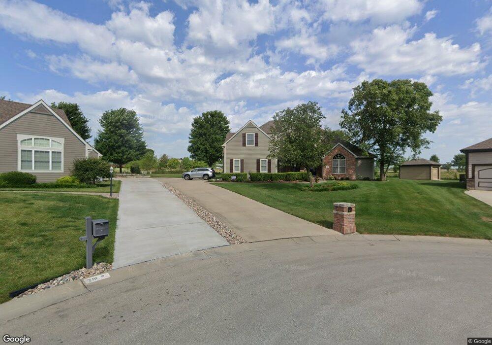
702 Bobwhite Cir Eudora, KS 66025
Estimated Value: $507,000 - $607,000
5
Beds
4
Baths
2,654
Sq Ft
$208/Sq Ft
Est. Value
About This Home
This home is located at 702 Bobwhite Cir, Eudora, KS 66025 and is currently estimated at $551,727, approximately $207 per square foot. 702 Bobwhite Cir is a home located in Douglas County with nearby schools including Eudora Elementary School, Eudora Middle School, and Eudora High School.
Ownership History
Date
Name
Owned For
Owner Type
Purchase Details
Closed on
Nov 2, 2006
Sold by
Martin Grant S and Martin Ginger L
Bought by
Martin Grant S and Martin Ginger L
Current Estimated Value
Purchase Details
Closed on
Sep 4, 2003
Sold by
Meadowlark Development Group Llc
Bought by
Martin Grant S
Home Financials for this Owner
Home Financials are based on the most recent Mortgage that was taken out on this home.
Original Mortgage
$225,000
Outstanding Balance
$103,228
Interest Rate
6.08%
Mortgage Type
Purchase Money Mortgage
Estimated Equity
$448,499
Create a Home Valuation Report for This Property
The Home Valuation Report is an in-depth analysis detailing your home's value as well as a comparison with similar homes in the area
Home Values in the Area
Average Home Value in this Area
Purchase History
| Date | Buyer | Sale Price | Title Company |
|---|---|---|---|
| Martin Grant S | -- | First American Title | |
| Martin Grant S | -- | -- |
Source: Public Records
Mortgage History
| Date | Status | Borrower | Loan Amount |
|---|---|---|---|
| Open | Martin Grant S | $225,000 |
Source: Public Records
Tax History
| Year | Tax Paid | Tax Assessment Tax Assessment Total Assessment is a certain percentage of the fair market value that is determined by local assessors to be the total taxable value of land and additions on the property. | Land | Improvement |
|---|---|---|---|---|
| 2025 | $9,846 | $64,458 | $6,900 | $57,558 |
| 2024 | $8,907 | $58,869 | $6,613 | $52,256 |
| 2023 | $8,358 | $53,740 | $6,613 | $47,127 |
| 2022 | $7,688 | $49,907 | $5,175 | $44,732 |
| 2021 | $7,314 | $45,608 | $5,175 | $40,433 |
| 2020 | $7,059 | $44,280 | $5,175 | $39,105 |
| 2019 | $6,803 | $42,171 | $5,175 | $36,996 |
| 2018 | $6,443 | $40,067 | $4,589 | $35,478 |
| 2017 | $5,792 | $35,869 | $4,589 | $31,280 |
| 2016 | $5,683 | $35,869 | $4,599 | $31,270 |
| 2015 | $5,381 | $35,305 | $4,599 | $30,706 |
| 2014 | $4,908 | $33,718 | $4,599 | $29,119 |
Source: Public Records
Map
Nearby Homes
- 2501 Elm St
- 2513 Elm St
- 104 W 18th St
- 341 W 25th St
- 337 W 25th St
- 107 W 16th Terrace
- 1413 Arrowwood Dr
- 2757 Shadow Ridge Place
- 826 E 14th Terrace
- 2700 S Fir Terrace
- 1310 Tallgrass Ct
- 1230 Helen Ct
- 1424 Acorn St
- 5 W 13th St
- 1615 Savage St
- 1402 Cedar St
- 1228 Walnut St
- 1311 Cherry St
- 1119 Fir St
- 202 E 9th St
- 710 Bobwhite Cir
- Lot 15 Bobwhite Cir Unit Blk B
- Lot 11 Bobwhite Cir Unit Blk B
- 0 Bobwhite Unit 129052
- Lot 15 Bobwhite Cir
- Lot 11 Bobwhite Cir
- 701 Bobwhite Cir
- 714 22nd Street Terrace
- 714 E 22nd St Terrace
- 2201 Country Dr
- 709 Bobwhite Cir
- 718 E 22nd St Terrace
- 718 E 22 Terrace
- 718 E 22nd Terrace
- 2205 Country Dr
- 722 22nd Street Terrace
- 722 E 22nd St Terrace
- 722 E 22 Terrace
- 722 E 22nd Terrace
- Block 4, L 22nd
Your Personal Tour Guide
Ask me questions while you tour the home.