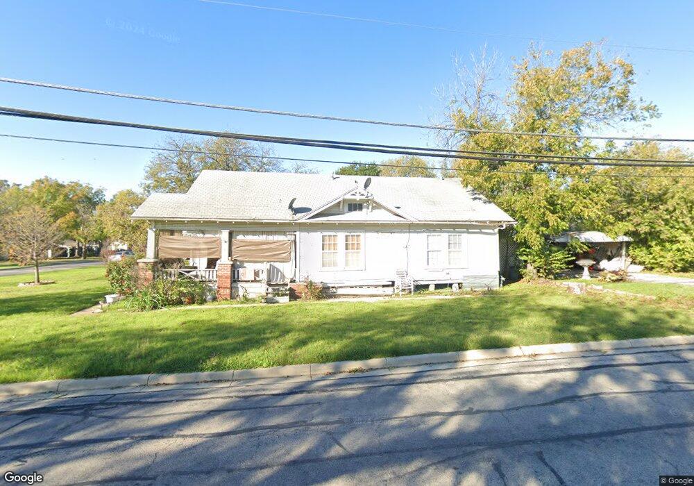
702 Bonham St Grand Prairie, TX 75050
Estimated Value: $234,000 - $260,000
3
Beds
1
Bath
1,258
Sq Ft
$197/Sq Ft
Est. Value
About This Home
This home is located at 702 Bonham St, Grand Prairie, TX 75050 and is currently estimated at $248,122, approximately $197 per square foot. 702 Bonham St is a home located in Dallas County with nearby schools including Crosswinds High School, Delmas Morton Elementary School, and Digital Arts & Technology Academy at Adams Middle.
Ownership History
Date
Name
Owned For
Owner Type
Purchase Details
Closed on
Nov 15, 2006
Sold by
Ayers Mary Anna and Fuller Jackey Douglas
Bought by
Ritchey David
Current Estimated Value
Home Financials for this Owner
Home Financials are based on the most recent Mortgage that was taken out on this home.
Original Mortgage
$80,000
Outstanding Balance
$47,453
Interest Rate
6.26%
Mortgage Type
Purchase Money Mortgage
Estimated Equity
$200,669
Purchase Details
Closed on
Jan 12, 2006
Sold by
Gibson Patricia Jane
Bought by
Fuller Jackey Douglas
Create a Home Valuation Report for This Property
The Home Valuation Report is an in-depth analysis detailing your home's value as well as a comparison with similar homes in the area
Home Values in the Area
Average Home Value in this Area
Purchase History
| Date | Buyer | Sale Price | Title Company |
|---|---|---|---|
| Ritchey David | -- | Ctic | |
| Fuller Jackey Douglas | -- | None Available |
Source: Public Records
Mortgage History
| Date | Status | Borrower | Loan Amount |
|---|---|---|---|
| Open | Ritchey David | $80,000 |
Source: Public Records
Tax History Compared to Growth
Tax History
| Year | Tax Paid | Tax Assessment Tax Assessment Total Assessment is a certain percentage of the fair market value that is determined by local assessors to be the total taxable value of land and additions on the property. | Land | Improvement |
|---|---|---|---|---|
| 2025 | $3,347 | $272,680 | $122,500 | $150,180 |
| 2024 | $3,347 | $217,120 | $87,500 | $129,620 |
| 2023 | $3,347 | $217,120 | $87,500 | $129,620 |
| 2022 | $5,085 | $200,480 | $87,500 | $112,980 |
| 2021 | $4,715 | $177,390 | $78,750 | $98,640 |
| 2020 | $4,357 | $154,520 | $78,750 | $75,770 |
| 2019 | $3,433 | $117,500 | $27,000 | $90,500 |
| 2018 | $2,673 | $91,490 | $27,000 | $64,490 |
| 2017 | $2,673 | $91,490 | $27,000 | $64,490 |
| 2016 | $2,332 | $79,860 | $27,000 | $52,860 |
| 2015 | $2,094 | $74,830 | $27,000 | $47,830 |
| 2014 | $2,094 | $74,830 | $27,000 | $47,830 |
Source: Public Records
Map
Nearby Homes
- 1218 W Church St
- 322 Hill St
- 505 N Carrier Pkwy
- 226 SW 4th St
- 405 SW 6th St
- 720 Burleson St
- 645 NW 10th St
- 805 NW 9th St
- 2434 Starlight St
- 3682 Zenith Rd
- 1101 Fort Worth St
- 601 Shawnee Trace
- 1153 College St
- 202 North St
- 701 SW 5th St
- 1202 W Strong Pkwy
- 1002 Capetown Dr
- 1109 Capetown Dr
- 1005 Capetown Dr
- 825 Apache Trace