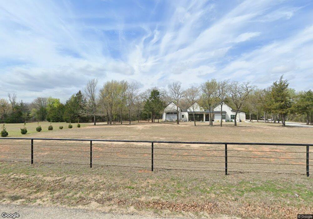
702 County Road 2311 Decatur, TX 76234
Estimated Value: $764,000 - $1,192,645
--
Bed
1
Bath
4,402
Sq Ft
$213/Sq Ft
Est. Value
About This Home
This home is located at 702 County Road 2311, Decatur, TX 76234 and is currently estimated at $939,548, approximately $213 per square foot. 702 County Road 2311 is a home with nearby schools including Decatur High School.
Ownership History
Date
Name
Owned For
Owner Type
Purchase Details
Closed on
Apr 7, 2020
Sold by
Stoker Daniel and Stoker Lisa
Bought by
Quarles Brent and Quarles Stephanie
Current Estimated Value
Purchase Details
Closed on
Apr 28, 2016
Sold by
Spiuriki Ltd
Bought by
Stoker Daniel
Home Financials for this Owner
Home Financials are based on the most recent Mortgage that was taken out on this home.
Original Mortgage
$798,724
Interest Rate
3.73%
Mortgage Type
Purchase Money Mortgage
Create a Home Valuation Report for This Property
The Home Valuation Report is an in-depth analysis detailing your home's value as well as a comparison with similar homes in the area
Home Values in the Area
Average Home Value in this Area
Purchase History
| Date | Buyer | Sale Price | Title Company |
|---|---|---|---|
| Quarles Brent | -- | Wct | |
| Stoker Daniel | -- | Wise County Title Company |
Source: Public Records
Mortgage History
| Date | Status | Borrower | Loan Amount |
|---|---|---|---|
| Previous Owner | Stoker Daniel | $798,724 |
Source: Public Records
Tax History Compared to Growth
Tax History
| Year | Tax Paid | Tax Assessment Tax Assessment Total Assessment is a certain percentage of the fair market value that is determined by local assessors to be the total taxable value of land and additions on the property. | Land | Improvement |
|---|---|---|---|---|
| 2025 | $8,508 | $808,023 | $24,428 | $783,595 |
| 2024 | $8,508 | $809,326 | $24,345 | $784,981 |
| 2023 | $9,222 | $1,043,036 | $0 | $0 |
| 2022 | $10,650 | $954,346 | $0 | $0 |
| 2021 | $10,115 | $814,680 | $197,750 | $616,930 |
| 2020 | $9,093 | $717,290 | $165,590 | $551,700 |
| 2019 | $9,685 | $725,120 | $173,420 | $551,700 |
| 2018 | $8,623 | $668,520 | $194,500 | $474,020 |
| 2017 | $8,281 | $602,000 | $163,480 | $438,520 |
| 2016 | $7,056 | $578,530 | $140,010 | $438,520 |
| 2015 | -- | $496,710 | $139,010 | $357,700 |
Source: Public Records
Map
Nearby Homes
- 0 Highway 287 Unit 21102120
- 0 Highway 287 Unit 21094377
- 853 County Road 2215
- 167 Pr-2313
- 0000 Fm N 730
- TBD County Rd 2735
- 124 Blackstar Ln
- 116 Blackstar Ln
- 132 Blackstar Ln
- 159 Blackstar Ln
- 4002 E Highway 380
- 130 Nicholas Way
- 1395 Private Road 4011
- 124 Llanos Dr
- 125 Pampas Ct
- The Salado Plan at Hillcrest Meadows North
- 126 Range Ln
- The Colorado II Plan at Hillcrest Meadows North
- 2375 County Road 4010
- 2267 County Road 4010
- 632 County Road 2311
- 620 County Road 2311
- 999 County Road 2311
- 0 County Road 2311 Unit 14173181
- 538 County Road 2311
- 185 Private Road 2310
- 791 County Road 2311
- 447 County Road 2311
- 447 County Road 2311
- 257 Private Road 2310
- 9999 County Rd 2311
- 000 County Road 2311
- 000 County Road 2311
- 00 County Road 2311
- 9999 Cr 2311
- 9999 Cr 2311
- TBD County Road 2311
- Tract2 County Road 2311
- Tract4 County Road 2311
- Tract1 County Road 2311