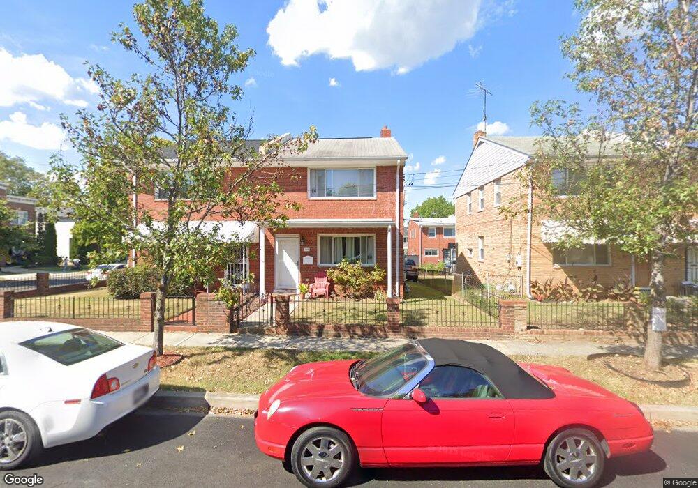
702 Decatur St NE Washington, DC 20017
Michigan Park NeighborhoodEstimated Value: $499,410 - $551,000
3
Beds
2
Baths
1,188
Sq Ft
$445/Sq Ft
Est. Value
About This Home
This home is located at 702 Decatur St NE, Washington, DC 20017 and is currently estimated at $528,603, approximately $444 per square foot. 702 Decatur St NE is a home located in District of Columbia with nearby schools including Bunker Hill Elementary School, Brookland Middle School, and Dunbar High School.
Ownership History
Date
Name
Owned For
Owner Type
Purchase Details
Closed on
Jun 15, 2011
Sold by
Federal National Mortgage Association
Bought by
Harper Karyn
Current Estimated Value
Purchase Details
Closed on
Sep 7, 2010
Sold by
Clarke Sub Tr James E and Davis Jourdan A
Bought by
Federal National Mortgage Association
Purchase Details
Closed on
Feb 20, 2008
Sold by
Adio-Moses Adeyanju
Bought by
Davis Jourdan
Home Financials for this Owner
Home Financials are based on the most recent Mortgage that was taken out on this home.
Original Mortgage
$385,000
Interest Rate
5.9%
Mortgage Type
New Conventional
Purchase Details
Closed on
Dec 4, 1995
Sold by
Ramkissoon Kaywal K
Bought by
Eruanga Edekin
Home Financials for this Owner
Home Financials are based on the most recent Mortgage that was taken out on this home.
Original Mortgage
$117,200
Interest Rate
7.37%
Create a Home Valuation Report for This Property
The Home Valuation Report is an in-depth analysis detailing your home's value as well as a comparison with similar homes in the area
Home Values in the Area
Average Home Value in this Area
Purchase History
| Date | Buyer | Sale Price | Title Company |
|---|---|---|---|
| Harper Karyn | $180,200 | -- | |
| Federal National Mortgage Association | $361,371 | -- | |
| Davis Jourdan | $385,000 | -- | |
| Eruanga Edekin | $118,900 | -- |
Source: Public Records
Mortgage History
| Date | Status | Borrower | Loan Amount |
|---|---|---|---|
| Previous Owner | Davis Jourdan | $385,000 | |
| Previous Owner | Eruanga Edekin | $117,200 |
Source: Public Records
Tax History Compared to Growth
Tax History
| Year | Tax Paid | Tax Assessment Tax Assessment Total Assessment is a certain percentage of the fair market value that is determined by local assessors to be the total taxable value of land and additions on the property. | Land | Improvement |
|---|---|---|---|---|
| 2025 | $3,888 | $547,290 | $303,590 | $243,700 |
| 2024 | $3,838 | $538,550 | $302,070 | $236,480 |
| 2023 | $3,678 | $516,690 | $293,810 | $222,880 |
| 2022 | $3,469 | $486,860 | $276,600 | $210,260 |
| 2021 | $3,341 | $469,360 | $269,720 | $199,640 |
| 2020 | $3,286 | $462,260 | $267,430 | $194,830 |
| 2019 | $3,043 | $432,820 | $243,890 | $188,930 |
| 2018 | $2,854 | $409,130 | $0 | $0 |
| 2017 | $2,621 | $380,840 | $0 | $0 |
| 2016 | $0 | $368,110 | $0 | $0 |
| 2015 | -- | $342,670 | $0 | $0 |
| 2014 | -- | $305,070 | $0 | $0 |
Source: Public Records
Map
Nearby Homes
- 4717 7th St NE
- 723 Emerson St NE
- 735 Emerson St NE
- 642 Faraday Place NE
- 832 Delafield St NE
- 719 Farragut Place NE
- 838 Buchanan St NE
- 4803 10th St NE
- 5031 S Dakota Ave NE
- 5008 10th St NE
- 5051 8th St NE
- 5024 10th St NE
- 314 Farragut St NW
- 4822 S Dakota Ave NE
- 4937 11th St NE
- 5008 11th St NE
- 4913 12th St NE
- 4306 Varnum Place NE
- 227 Hawaii Ave NE
- 215 Hawaii Ave NE
- 706 Decatur St NE
- 700 Decatur St NE
- 708 Decatur St NE
- 712 Decatur St NE
- 703 Decatur Place NE
- 701 Decatur Place NE
- 707 Decatur Place NE
- 714 Decatur St NE
- 709 Decatur Place NE
- 4831 7th St NE
- 711 Decatur Place NE
- 718 Decatur St NE
- 715 Decatur Place NE
- 4829 7th St NE
- 4906 7th St NE
- 4904 7th St NE
- 717 Decatur Place NE
- 4908 7th St NE
- 4902 7th St NE
- 4821 7th St NE