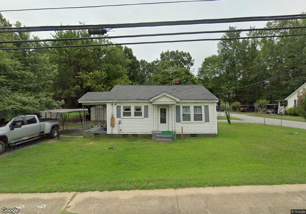
702 E Curtis St Simpsonville, SC 29681
Estimated Value: $138,000 - $212,000
2
Beds
1
Bath
840
Sq Ft
$201/Sq Ft
Est. Value
About This Home
This home is located at 702 E Curtis St, Simpsonville, SC 29681 and is currently estimated at $168,872, approximately $201 per square foot. 702 E Curtis St is a home located in Greenville County with nearby schools including Simpsonville Elementary, Bryson Middle School, and Hillcrest High School.
Ownership History
Date
Name
Owned For
Owner Type
Purchase Details
Closed on
Jul 24, 2025
Sold by
Mcculloch Andrew D
Bought by
Mcculloch Family Trust and Mcculloch
Current Estimated Value
Purchase Details
Closed on
Mar 9, 2012
Sold by
Brown Paul S and Brown Ernest D
Bought by
Mcculloch Andrew D
Home Financials for this Owner
Home Financials are based on the most recent Mortgage that was taken out on this home.
Original Mortgage
$49,500
Interest Rate
4%
Mortgage Type
New Conventional
Purchase Details
Closed on
Nov 16, 2010
Sold by
Estate Of Pauline Brown Cox and Brown Paul S
Bought by
Brown Paul S and Brown Ernest D
Create a Home Valuation Report for This Property
The Home Valuation Report is an in-depth analysis detailing your home's value as well as a comparison with similar homes in the area
Home Values in the Area
Average Home Value in this Area
Purchase History
| Date | Buyer | Sale Price | Title Company |
|---|---|---|---|
| Mcculloch Family Trust | -- | None Listed On Document | |
| Mcculloch Andrew D | $66,000 | -- | |
| Brown Paul S | -- | -- |
Source: Public Records
Mortgage History
| Date | Status | Borrower | Loan Amount |
|---|---|---|---|
| Previous Owner | Mcculloch Andrew D | $49,500 |
Source: Public Records
Tax History
| Year | Tax Paid | Tax Assessment Tax Assessment Total Assessment is a certain percentage of the fair market value that is determined by local assessors to be the total taxable value of land and additions on the property. | Land | Improvement |
|---|---|---|---|---|
| 2025 | $1,832 | $5,400 | $2,820 | $2,580 |
| 2024 | $1,775 | $4,700 | $1,860 | $2,840 |
| 2023 | $1,775 | $4,700 | $1,860 | $2,840 |
| 2022 | $1,704 | $4,700 | $1,860 | $2,840 |
| 2021 | $1,683 | $4,700 | $1,860 | $2,840 |
| 2020 | $1,572 | $4,090 | $1,620 | $2,470 |
| 2019 | $1,572 | $4,090 | $1,620 | $2,470 |
| 2018 | $1,413 | $4,090 | $1,620 | $2,470 |
| 2017 | $1,392 | $4,090 | $1,620 | $2,470 |
| 2016 | $1,339 | $68,130 | $27,000 | $41,130 |
| 2015 | $1,339 | $68,130 | $27,000 | $41,130 |
| 2014 | $1,158 | $59,700 | $13,500 | $46,200 |
Source: Public Records
Map
Nearby Homes
- 116 Bell Dr
- 206 Wemberly Dr
- 3 Ruby Bay Ln Unit E702
- 106 Stonegate Ct
- 512 Wemberly Ln
- 104 Brendle Dr
- 208 S Pliney Cir
- 110 Bonwood Ave
- 619 Autumn Lake Rd
- 520 Pennystone Ln
- 613 Autumn Lake Rd
- 611 Autumn Lake Rd
- 607 Autumn Lake Rd
- 605 Autumn Lake Rd
- 603 Autumn Lake Rd
- 601 Autumn Lake Rd
- 114 Cross Arbor Dr
- 512 Hillpine Dr
- 23 Ivyberry Rd
- 502 S Almond Dr
- 704 E Curtis St
- 311 Eastview Dr
- 312 Eastview Dr
- 708 E Curtis St
- 703 E Curtis St
- 313 Eastview Dr
- 701 E Curtis St
- 705 E Curtis St
- 600 E Curtis St
- 103 Oakland Ave
- 710 E Curtis St
- 107 Eastview Cir
- 106 Howard Cir
- 707 E Curtis St
- 109 Eastview Cir
- 202 Eastview Dr
- 712 E Curtis St
- 102 Edmunds St
- 105 Oakland Ave
- 108 Howard Cir
Your Personal Tour Guide
Ask me questions while you tour the home.