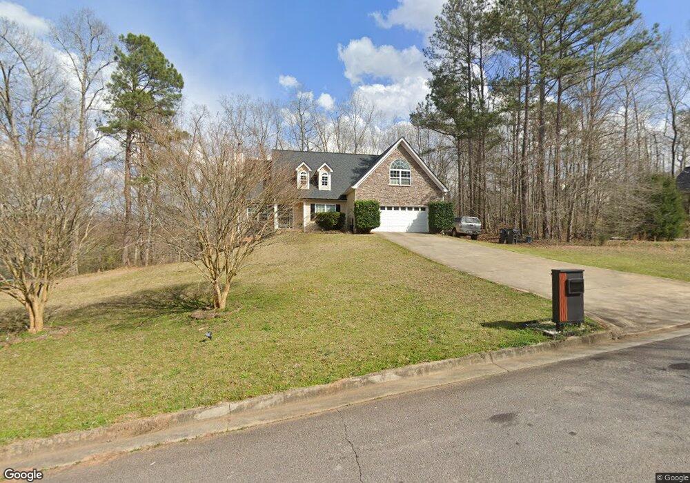
702 Emertrey Dr Unit 534 Locust Grove, GA 30248
Estimated Value: $334,000 - $375,000
3
Beds
2
Baths
1,895
Sq Ft
$184/Sq Ft
Est. Value
About This Home
This home is located at 702 Emertrey Dr Unit 534, Locust Grove, GA 30248 and is currently estimated at $348,515, approximately $183 per square foot. 702 Emertrey Dr Unit 534 is a home located in Henry County with nearby schools including Unity Grove Elementary School, Locust Grove Middle School, and Locust Grove High School.
Ownership History
Date
Name
Owned For
Owner Type
Purchase Details
Closed on
Jul 2, 2018
Sold by
Simms Virgil R
Bought by
Lowe Rob and Eveie Lowe
Current Estimated Value
Home Financials for this Owner
Home Financials are based on the most recent Mortgage that was taken out on this home.
Original Mortgage
$186,067
Outstanding Balance
$164,356
Interest Rate
5.5%
Mortgage Type
FHA
Estimated Equity
$184,159
Purchase Details
Closed on
May 9, 2005
Sold by
Simms Virgil R
Bought by
Simms Virgil R and Simms Lorraine
Home Financials for this Owner
Home Financials are based on the most recent Mortgage that was taken out on this home.
Original Mortgage
$176,938
Interest Rate
5.98%
Mortgage Type
VA
Create a Home Valuation Report for This Property
The Home Valuation Report is an in-depth analysis detailing your home's value as well as a comparison with similar homes in the area
Home Values in the Area
Average Home Value in this Area
Purchase History
| Date | Buyer | Sale Price | Title Company |
|---|---|---|---|
| Lowe Rob | $189,500 | -- | |
| Simms Virgil R | -- | -- | |
| Simms Virgil R | $173,300 | -- |
Source: Public Records
Mortgage History
| Date | Status | Borrower | Loan Amount |
|---|---|---|---|
| Open | Lowe Rob | $186,067 | |
| Previous Owner | Simms Virgil R | $176,938 |
Source: Public Records
Tax History Compared to Growth
Tax History
| Year | Tax Paid | Tax Assessment Tax Assessment Total Assessment is a certain percentage of the fair market value that is determined by local assessors to be the total taxable value of land and additions on the property. | Land | Improvement |
|---|---|---|---|---|
| 2025 | $3,842 | $127,420 | $16,000 | $111,420 |
| 2024 | $3,842 | $148,080 | $16,000 | $132,080 |
| 2023 | $3,299 | $122,400 | $14,800 | $107,600 |
| 2022 | $3,616 | $114,440 | $14,800 | $99,640 |
| 2021 | $2,986 | $89,040 | $14,800 | $74,240 |
| 2020 | $2,848 | $83,200 | $12,000 | $71,200 |
| 2019 | $2,938 | $75,560 | $12,000 | $63,560 |
| 2018 | $2,816 | $72,360 | $10,800 | $61,560 |
| 2016 | $2,481 | $63,640 | $10,000 | $53,640 |
| 2015 | $2,248 | $55,840 | $10,000 | $45,840 |
| 2014 | $2,204 | $54,080 | $10,000 | $44,080 |
Source: Public Records
Map
Nearby Homes
- 604 Onieda Dr
- 305 Annie Ln Unit 2
- 165 Caraway Rd
- 601 Amerigo Ct
- 218 Baxter Ln
- 108 Caraway Rd
- 230 Leguin Mill Rd
- 521 Deadwood Trail
- 1850 Old Jackson Rd
- 1627 Leguin Mill Rd
- 705 Seabolt Rd
- 678 Seabolt Rd
- 1000 Coan Dr
- 143 Kimbell Farm Dr
- 1680 Leguin Mill Rd
- 100 Harbin Trail
- 1126 Old Jackson Rd
- 943 Colvin Dr
- 121, 125, 129 Case Dr
- 976 S Laney Rd
- 702 Emertrey Dr
- 704 Emertrey Dr
- 64 Kimbell Farm Dr
- 62 Kimbell Farm Dr
- 705 Emertrey Dr
- 703 Emertrey Dr
- 708 Emertrey Dr
- 0 Kimbell Farm Dr Unit 7117288
- 0 Kimbell Farm Dr Unit 7132720
- 0 Kimbell Farm Dr Unit 8635556
- 0 Kimbell Farm Dr Unit 8395773
- 0 Kimbell Farm Dr Unit 8711862
- 0 Kimbell Farm Dr Unit 8658230
- 0 Kimbell Farm Dr Unit 8391715
- 0 Kimbell Farm Dr Unit 7396385
- 0 Kimbell Farm Dr Unit 8961918
- 0 Kimbell Farm Dr Unit 9024061
- 0 Kimbell Farm Dr Unit 8761888
- 0 Kimbell Farm Dr Unit 8884361
- 0 Kimbell Farm Dr Unit 8893304