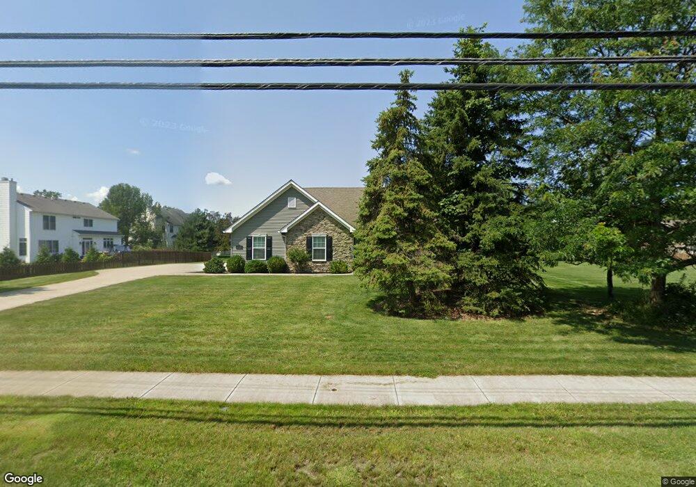
702 Lear Rd Avon Lake, OH 44012
Estimated Value: $368,000 - $502,000
3
Beds
2
Baths
1,673
Sq Ft
$248/Sq Ft
Est. Value
About This Home
This home is located at 702 Lear Rd, Avon Lake, OH 44012 and is currently estimated at $415,372, approximately $248 per square foot. 702 Lear Rd is a home with nearby schools including Eastview Elementary School, Troy Intermediate Elementary School, and Learwood Middle School.
Ownership History
Date
Name
Owned For
Owner Type
Purchase Details
Closed on
Nov 21, 2013
Sold by
King Paul J
Bought by
King Paul J
Current Estimated Value
Home Financials for this Owner
Home Financials are based on the most recent Mortgage that was taken out on this home.
Original Mortgage
$159,200
Outstanding Balance
$118,723
Interest Rate
4.23%
Mortgage Type
Future Advance Clause Open End Mortgage
Estimated Equity
$296,649
Purchase Details
Closed on
Jul 16, 2013
Sold by
Butts Thomas L and Butts Bonnie L
Bought by
King Paul J
Purchase Details
Closed on
Dec 17, 2007
Sold by
Butts Thomas L and Butts Bonnie L
Bought by
Butts Thomas L and Butts Bonnie L
Purchase Details
Closed on
Jan 22, 2003
Sold by
Margam Investment Ltd
Bought by
Butts Thomas L
Purchase Details
Closed on
Jan 14, 2003
Sold by
Briarwood Investments Inc
Bought by
Margam Investment Ltd
Create a Home Valuation Report for This Property
The Home Valuation Report is an in-depth analysis detailing your home's value as well as a comparison with similar homes in the area
Home Values in the Area
Average Home Value in this Area
Purchase History
| Date | Buyer | Sale Price | Title Company |
|---|---|---|---|
| King Paul J | $199,000 | Lawyers Title Co | |
| King Paul J | $41,000 | None Available | |
| Butts Thomas L | -- | Attorney | |
| Butts Thomas L | $45,000 | Lorain County Title Co Inc | |
| Margam Investment Ltd | -- | Lorain County Title Co Inc |
Source: Public Records
Mortgage History
| Date | Status | Borrower | Loan Amount |
|---|---|---|---|
| Open | King Paul J | $159,200 |
Source: Public Records
Tax History Compared to Growth
Tax History
| Year | Tax Paid | Tax Assessment Tax Assessment Total Assessment is a certain percentage of the fair market value that is determined by local assessors to be the total taxable value of land and additions on the property. | Land | Improvement |
|---|---|---|---|---|
| 2024 | $5,707 | $103,271 | $40,250 | $63,021 |
| 2023 | $5,149 | $81,379 | $28,021 | $53,358 |
| 2022 | $5,104 | $81,379 | $28,021 | $53,358 |
| 2021 | $5,094 | $81,379 | $28,021 | $53,358 |
| 2020 | $4,790 | $70,040 | $24,120 | $45,920 |
| 2019 | $4,770 | $70,040 | $24,120 | $45,920 |
| 2018 | $4,783 | $70,040 | $24,120 | $45,920 |
| 2017 | $5,370 | $74,040 | $23,040 | $51,000 |
| 2016 | $5,348 | $74,040 | $23,040 | $51,000 |
| 2015 | $5,369 | $74,040 | $23,040 | $51,000 |
| 2014 | $5,171 | $67,490 | $21,000 | $46,490 |
| 2013 | $1,942 | $16,800 | $16,800 | $0 |
Source: Public Records
Map
Nearby Homes
- 32041 Kossuth Dr
- 761 Rock Harbor
- 765 Rock Harbor
- 588 S Port Dr
- 561 Monticello Dr
- 611 Arborside Ln
- 502 Port Side Dr
- 522 S Port Dr
- 643 Brownstone Cir
- 604 Bar Harbor
- 531 Port Side Dr
- 31772 Gardenside Dr
- 558 Brennans Ct
- 32584 Royal Troon Dr
- 620 Congressional Ln
- 670 Innisbrook Ln
- 32054 Tuscan Ln Unit L-2
- 32080 Tuscan Ln Unit M-2
- 401 Bounty Way Unit 232
- 401 Bounty Way Unit 213
- 32070 Deerfield Dr
- 712 Sawmill Dr
- 714 Sawmill Dr
- 688 Lear Rd
- 32080 Deerfield Dr
- 716 Sawmill Dr
- 699 Lear Rd
- 686 Lear Rd
- 32069 Deerfield Dr
- 718 Sawmill Dr
- 719 Sawmill Dr
- 32079 Deerfield Dr
- 32110 Deerfield Dr
- V-L Lear Rd
- 32184 Teasel Ct
- 32099 Deerfield Dr
- 684 Lear Rd
- 32182 Teasel Ct
- 720 Sawmill Dr
- 730 Lear Rd