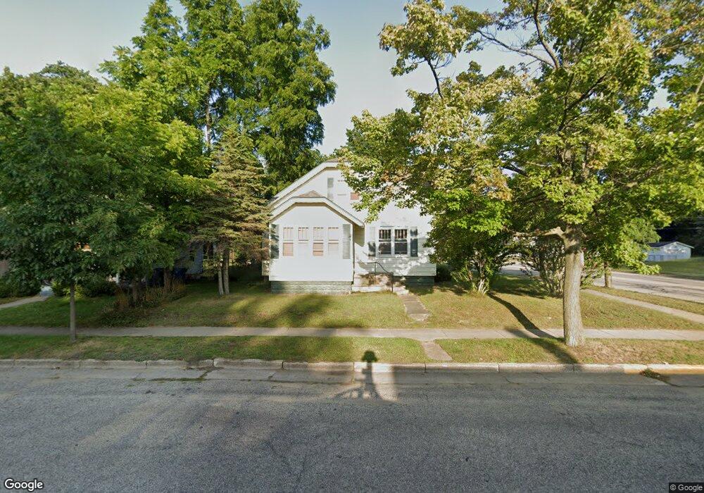
702 N James St Ludington, MI 49431
Estimated Value: $234,228 - $311,000
5
Beds
1
Bath
3,766
Sq Ft
$74/Sq Ft
Est. Value
About This Home
This home is located at 702 N James St, Ludington, MI 49431 and is currently estimated at $278,057, approximately $73 per square foot. 702 N James St is a home located in Mason County with nearby schools including Ludington Elementary School, Franklin Elementary School, and O.J. DeJonge Middle School.
Ownership History
Date
Name
Owned For
Owner Type
Purchase Details
Closed on
Jun 5, 2009
Sold by
St Augustine Properties Ltd
Bought by
Orvis Thomas D and Kroeger Helga
Current Estimated Value
Home Financials for this Owner
Home Financials are based on the most recent Mortgage that was taken out on this home.
Original Mortgage
$92,800
Outstanding Balance
$58,885
Interest Rate
4.85%
Mortgage Type
New Conventional
Estimated Equity
$219,172
Purchase Details
Closed on
Sep 4, 2007
Sold by
Mikula Lavern Joseph and Mikula Loretta Louise
Bought by
St Augustine Properties Llc
Create a Home Valuation Report for This Property
The Home Valuation Report is an in-depth analysis detailing your home's value as well as a comparison with similar homes in the area
Home Values in the Area
Average Home Value in this Area
Purchase History
| Date | Buyer | Sale Price | Title Company |
|---|---|---|---|
| Orvis Thomas D | $116,000 | Lighthouse Title | |
| St Augustine Properties Llc | $91,750 | Lighthouse Title |
Source: Public Records
Mortgage History
| Date | Status | Borrower | Loan Amount |
|---|---|---|---|
| Open | Orvis Thomas D | $92,800 |
Source: Public Records
Tax History Compared to Growth
Tax History
| Year | Tax Paid | Tax Assessment Tax Assessment Total Assessment is a certain percentage of the fair market value that is determined by local assessors to be the total taxable value of land and additions on the property. | Land | Improvement |
|---|---|---|---|---|
| 2025 | $3,029 | $99,500 | $99,500 | $0 |
| 2024 | -- | $90,700 | $90,700 | $0 |
| 2023 | -- | $77,800 | $77,800 | $0 |
| 2022 | -- | $62,600 | $0 | $0 |
| 2021 | -- | $57,700 | $0 | $0 |
| 2020 | $241 | $56,700 | $0 | $0 |
| 2019 | -- | -- | $0 | $0 |
| 2018 | -- | -- | $0 | $0 |
| 2017 | -- | -- | $0 | $0 |
| 2016 | -- | -- | $0 | $0 |
| 2015 | -- | -- | $0 | $0 |
| 2013 | -- | -- | $0 | $0 |
Source: Public Records
Map
Nearby Homes
- 601 N Rath Ave
- 416 N Rath Ave
- 802 N Rath Ave
- 420 N Robert St
- VL 8 N Rath Ave
- VL 7 N Rath Ave
- VL 4 and 5 N Rath Ave
- VL 6 N Rath Ave
- VL 3 N Rath Ave
- VL 2 N Rath Ave
- 319 N Rowe St
- 207 N Rath Ave
- 1010 N Rath Ave Unit 1
- VL James
- 501 N Ferry St
- 200 S Robert St Unit 54
- 210 N Lavinia St
- 404 W Court St
- 1009 N Ferry St
- 612 N Lakeshore Dr
- 704 N James St
- 1003 N James St
- 2055 N James St
- 703 N James St
- 701 N James St
- 706 N James St
- 705 N James St
- 708 N James St
- 707 N James St
- 612 N James St
- 611 N James St
- 105 E Tinkham Ave
- 710 N James St
- 609 N James St
- 709 N James St
- 608 N James St
- 712 N James St
- 703 N Harrison St
- 707 N Harrison St
- 110 E Tinkham Ave