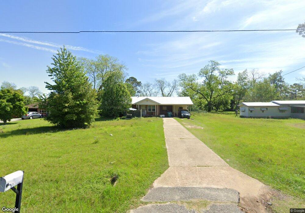
702 N Marlin St Doerun, GA 31744
Estimated Value: $84,504 - $171,000
--
Bed
2
Baths
1,008
Sq Ft
$143/Sq Ft
Est. Value
About This Home
This home is located at 702 N Marlin St, Doerun, GA 31744 and is currently estimated at $144,126, approximately $142 per square foot. 702 N Marlin St is a home located in Colquitt County with nearby schools including Doerun Elementary School, C.A. Gray Junior High School, and Willie J. Williams Middle School.
Ownership History
Date
Name
Owned For
Owner Type
Purchase Details
Closed on
Sep 4, 2008
Sold by
Msj Investments Llc
Bought by
Pate Roy W
Current Estimated Value
Purchase Details
Closed on
Apr 5, 2007
Sold by
Davidson Earl Ronald
Bought by
Msj Investments Llc
Purchase Details
Closed on
Dec 19, 2002
Sold by
Bridges Wilburn Life Est
Bought by
Davidson C W
Purchase Details
Closed on
Nov 19, 1999
Sold by
Bridges Wilburn
Bought by
Bridges Wilburn Life Est
Purchase Details
Closed on
Aug 22, 1995
Bought by
Bridges Wilburn
Purchase Details
Closed on
Sep 22, 1994
Bought by
Miller David J
Create a Home Valuation Report for This Property
The Home Valuation Report is an in-depth analysis detailing your home's value as well as a comparison with similar homes in the area
Home Values in the Area
Average Home Value in this Area
Purchase History
| Date | Buyer | Sale Price | Title Company |
|---|---|---|---|
| Pate Roy W | $55,000 | -- | |
| Msj Investments Llc | $50,000 | -- | |
| Davidson C W | $45,000 | -- | |
| Bridges Wilburn Life Est | -- | -- | |
| Bridges Wilburn | $36,300 | -- | |
| Miller David J | $32,500 | -- |
Source: Public Records
Tax History Compared to Growth
Tax History
| Year | Tax Paid | Tax Assessment Tax Assessment Total Assessment is a certain percentage of the fair market value that is determined by local assessors to be the total taxable value of land and additions on the property. | Land | Improvement |
|---|---|---|---|---|
| 2024 | $735 | $25,110 | $1,914 | $23,196 |
| 2023 | $649 | $23,768 | $1,914 | $21,854 |
| 2022 | $656 | $22,134 | $1,914 | $20,220 |
| 2021 | $668 | $22,067 | $1,914 | $20,153 |
| 2020 | $681 | $22,067 | $1,914 | $20,153 |
| 2019 | $748 | $21,977 | $1,914 | $20,063 |
| 2018 | $729 | $21,567 | $1,504 | $20,063 |
| 2017 | $724 | $21,567 | $1,504 | $20,063 |
| 2016 | $729 | $21,567 | $1,504 | $20,063 |
| 2015 | -- | $21,567 | $1,504 | $20,063 |
| 2014 | -- | $21,567 | $1,504 | $20,063 |
| 2013 | -- | $21,567 | $1,504 | $20,062 |
Source: Public Records
Map
Nearby Homes
- 825 N Green St
- 104 Union Ln
- 715 W Robinson Ave
- 511 W Broad Ave
- 417 W Bay Ave
- 318 E Culpepper Ave
- 512 Hagin Still Rd
- 0 Sam Sells Rd
- 2329 Evergreen Rd
- 340 Belk Rd
- 1791 Funston Sigsbee Rd
- 4409 Georgia 112
- 712 Blackberry Rd
- 1485 Bay Rd
- 0 Brest Station Rd Unit 10642758
- 156 E Maple St
- 155 N Kreuger St
- 9765 Morey Hill Rd
- 378 Old S R 33
- 330/332 Debbie Ln
- 618 N Marlin St
- 716 N Marlin St
- 715 N Green St
- 701 N Green St
- 707 N Green St
- 615 N Green St
- 711 N Marlin St
- 723 N Green St
- 553 N Marlin St
- 518 W Leverett Ave
- 602 W Leverett Ave
- 605 N Green St
- 803 N Green St
- 614 N Green St
- 706 N Green St
- 622 N Green St
- 714 N Green St
- 722 N Green St
- 723 W Leverett Ave
- 819 N Green St