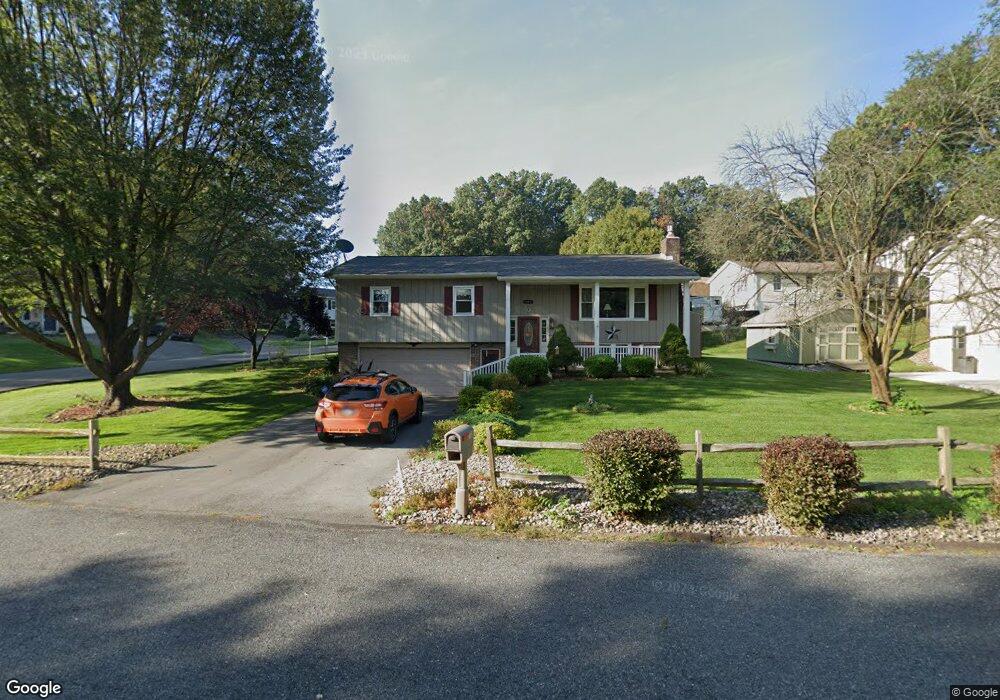
702 Picnic Ln Selinsgrove, PA 17870
Estimated Value: $171,178 - $291,000
--
Bed
--
Bath
--
Sq Ft
0.3
Acres
About This Home
This home is located at 702 Picnic Ln, Selinsgrove, PA 17870 and is currently estimated at $243,545. 702 Picnic Ln is a home located in Snyder County with nearby schools including Selinsgrove Area Elementary School, Selinsgrove Intermediate School, and Selinsgrove Area Middle School.
Ownership History
Date
Name
Owned For
Owner Type
Purchase Details
Closed on
Jun 9, 2022
Sold by
Davis Judith A
Bought by
Davis Judith A and Davis Billy
Current Estimated Value
Purchase Details
Closed on
Mar 23, 2014
Sold by
Lawerence D and Lawerence D
Bought by
Davis Judith A
Create a Home Valuation Report for This Property
The Home Valuation Report is an in-depth analysis detailing your home's value as well as a comparison with similar homes in the area
Home Values in the Area
Average Home Value in this Area
Purchase History
| Date | Buyer | Sale Price | Title Company |
|---|---|---|---|
| Davis Judith A | -- | None Listed On Document | |
| Davis Judith A | $154,000 | -- |
Source: Public Records
Tax History Compared to Growth
Tax History
| Year | Tax Paid | Tax Assessment Tax Assessment Total Assessment is a certain percentage of the fair market value that is determined by local assessors to be the total taxable value of land and additions on the property. | Land | Improvement |
|---|---|---|---|---|
| 2025 | $3,340 | $34,390 | $5,280 | $29,110 |
| 2024 | $3,243 | $34,390 | $5,280 | $29,110 |
| 2023 | $819 | $34,390 | $5,280 | $29,110 |
| 2022 | $3,088 | $34,390 | $5,280 | $29,110 |
| 2021 | $3,088 | $34,390 | $5,280 | $29,110 |
| 2020 | $3,088 | $34,390 | $5,280 | $29,110 |
| 2019 | $3,088 | $34,390 | $5,280 | $29,110 |
| 2018 | $3,003 | $33,440 | $5,280 | $28,160 |
| 2017 | $2,970 | $33,440 | $5,280 | $28,160 |
| 2016 | $863 | $33,440 | $5,280 | $28,160 |
| 2015 | $72,941 | $33,440 | $5,280 | $28,160 |
| 2014 | $72,941 | $33,440 | $5,280 | $28,160 |
Source: Public Records
Map
Nearby Homes
- 20 Banyan St
- 25 Banyan St
- Phase 4 N Oakwood Ln
- 71 N Oakwood Ln
- 2103 N Susquehanna Trail
- 5 Runyan Rd
- 15 Greenbrier Ave
- 7 Lost Creek Dr
- 0 Roosevelt Ave
- 594 Augusta Dr
- 0 Mill Rd
- 84 Limerick Ln
- 86 Limerick Ln
- 88 Limerick Ln
- 90 Limerick Ln
- 2677 N Old Trail
- 79 Saint Andrews Way
- 81 Saint Andrews Way
- 107 Saint Andrews Way
- 1262 N Old Trail