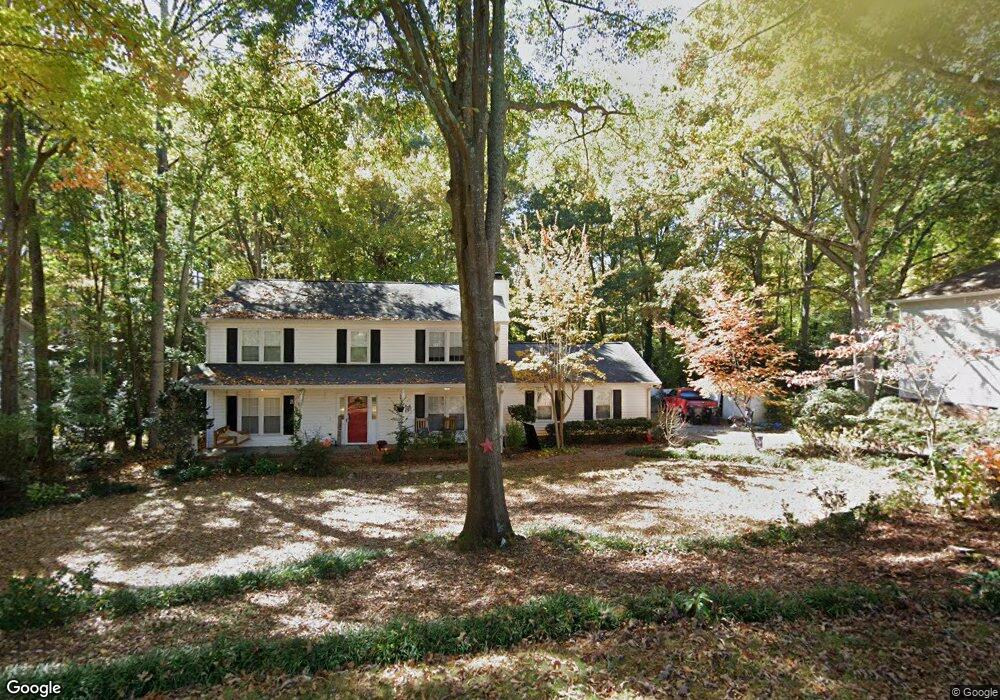
702 S Almond Dr Simpsonville, SC 29681
Estimated Value: $294,000 - $350,596
3
Beds
2
Baths
2,246
Sq Ft
$141/Sq Ft
Est. Value
About This Home
This home is located at 702 S Almond Dr, Simpsonville, SC 29681 and is currently estimated at $315,899, approximately $140 per square foot. 702 S Almond Dr is a home located in Greenville County with nearby schools including Simpsonville Elementary, Bryson Middle School, and Hillcrest High School.
Ownership History
Date
Name
Owned For
Owner Type
Purchase Details
Closed on
Nov 19, 2024
Sold by
Curtis Christopher and Curtis Marisa
Bought by
Baker Scott Preston and Baker Cara
Current Estimated Value
Home Financials for this Owner
Home Financials are based on the most recent Mortgage that was taken out on this home.
Original Mortgage
$203,000
Outstanding Balance
$201,054
Interest Rate
6.32%
Mortgage Type
New Conventional
Estimated Equity
$114,845
Purchase Details
Closed on
May 4, 2018
Sold by
Ashe James N and Ashe Kay H
Bought by
Curtis Christopher and Curtis Marisa
Create a Home Valuation Report for This Property
The Home Valuation Report is an in-depth analysis detailing your home's value as well as a comparison with similar homes in the area
Home Values in the Area
Average Home Value in this Area
Purchase History
| Date | Buyer | Sale Price | Title Company |
|---|---|---|---|
| Baker Scott Preston | $290,000 | None Listed On Document | |
| Curtis Christopher | $172,050 | None Available |
Source: Public Records
Mortgage History
| Date | Status | Borrower | Loan Amount |
|---|---|---|---|
| Open | Baker Scott Preston | $203,000 |
Source: Public Records
Tax History Compared to Growth
Tax History
| Year | Tax Paid | Tax Assessment Tax Assessment Total Assessment is a certain percentage of the fair market value that is determined by local assessors to be the total taxable value of land and additions on the property. | Land | Improvement |
|---|---|---|---|---|
| 2024 | $4,182 | $11,830 | $1,920 | $9,910 |
| 2023 | $4,182 | $11,830 | $1,920 | $9,910 |
| 2022 | $4,003 | $11,830 | $1,920 | $9,910 |
| 2021 | $3,951 | $11,830 | $1,920 | $9,910 |
| 2020 | $3,887 | $11,010 | $1,620 | $9,390 |
| 2019 | $3,888 | $11,010 | $1,620 | $9,390 |
| 2018 | $1,052 | $7,340 | $1,080 | $6,260 |
| 2017 | $1,052 | $7,340 | $1,080 | $6,260 |
| 2016 | $1,003 | $183,430 | $27,000 | $156,430 |
| 2015 | $1,003 | $183,430 | $27,000 | $156,430 |
| 2014 | $818 | $159,510 | $29,000 | $130,510 |
Source: Public Records
Map
Nearby Homes
- 304 Chancellors Park Ct
- 214 Appomattox Dr
- 216 Banbury Cir
- 415 Raleighwood Ln
- 100 Bonwood Ave
- 103 Silver Falls Dr
- 1024 Powderhorn Rd
- 203 W Fernwood Rd
- 251 Oak Branch Dr
- 8 Valeria Place
- 222 Raleighwood Ln
- 377 Heritage Point Dr
- 33 Golden Acre Ct
- 106 Stonegate Ct
- 304 Tollgate Rd
- 157 Heritage Point Dr
- 202 Wemberly Dr
- 112 Cook St
- 102 Sunshine Dr
- 113 Market Bay Ct
- 702 S Almond Dr
- 604 S Almond Dr
- 704 S Almond Dr
- 110 Canebreak Ln
- 108 Canebreak Ln
- 706 N Almond Dr
- 706 S Almond Dr
- 112 Canebreak Ln
- 703 S Almond Dr
- 703 S Almond Dr
- 106 Canebreak Ln
- 603 S Almond Dr
- 5 Chickamauga Ln
- 506 S Almond Dr
- 705 S Almond Dr
- 107 Canebreak Ln
- 104 Canebreak Ln
- 708 S Almond Dr
- 3 Chickamauga Ln
- 105 Canebreak Ln