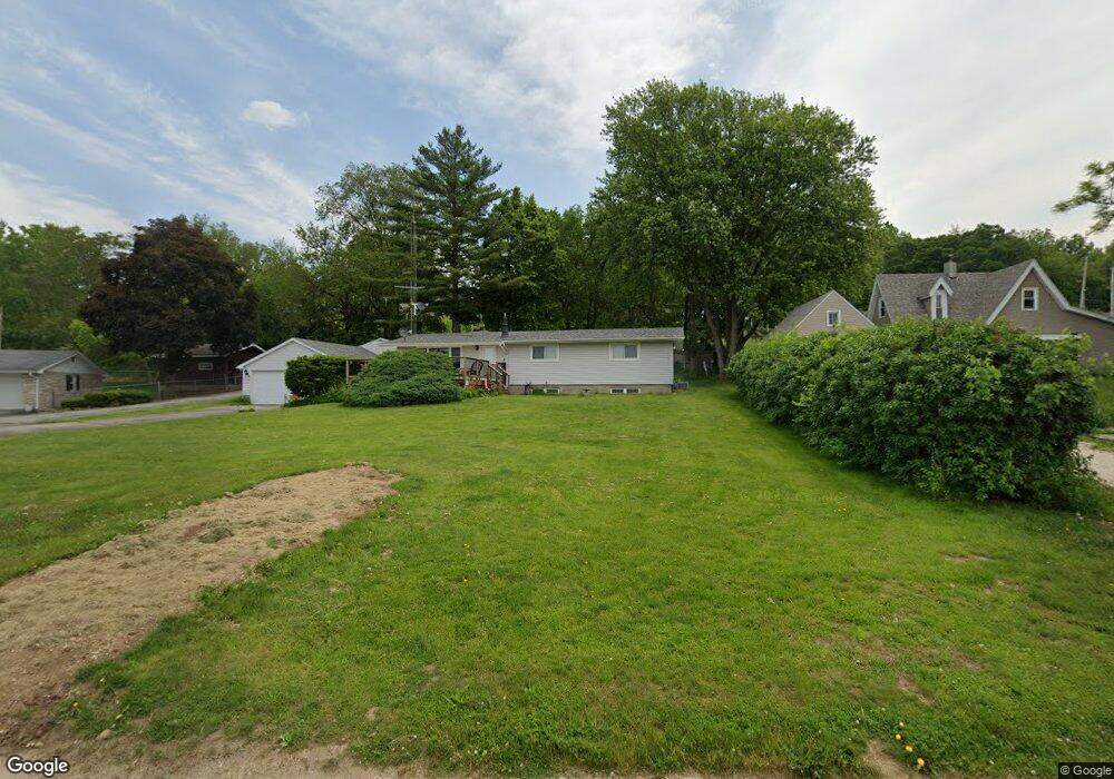
702 S Main St Port Byron, IL 61275
Estimated Value: $210,000 - $217,000
3
Beds
3
Baths
1,700
Sq Ft
$126/Sq Ft
Est. Value
About This Home
This home is located at 702 S Main St, Port Byron, IL 61275 and is currently estimated at $214,244, approximately $126 per square foot. 702 S Main St is a home located in Rock Island County with nearby schools including Riverdale Elementary School, Riverdale Middle School, and Riverdale Senior High School.
Create a Home Valuation Report for This Property
The Home Valuation Report is an in-depth analysis detailing your home's value as well as a comparison with similar homes in the area
Home Values in the Area
Average Home Value in this Area
Tax History Compared to Growth
Tax History
| Year | Tax Paid | Tax Assessment Tax Assessment Total Assessment is a certain percentage of the fair market value that is determined by local assessors to be the total taxable value of land and additions on the property. | Land | Improvement |
|---|---|---|---|---|
| 2024 | $4,186 | $63,183 | $12,237 | $50,946 |
| 2023 | $4,186 | $57,966 | $11,227 | $46,739 |
| 2022 | $3,722 | $55,285 | $10,708 | $44,577 |
| 2021 | $3,606 | $52,403 | $10,150 | $42,253 |
| 2020 | $354 | $51,629 | $10,000 | $41,629 |
| 2019 | $3,553 | $51,629 | $10,000 | $41,629 |
| 2018 | $3,363 | $50,019 | $13,853 | $36,166 |
| 2017 | $3,313 | $50,019 | $13,853 | $36,166 |
| 2016 | $3,275 | $49,329 | $13,662 | $35,667 |
| 2015 | $3,160 | $47,510 | $13,158 | $34,352 |
| 2014 | $602 | $46,578 | $12,900 | $33,678 |
| 2013 | $602 | $46,578 | $12,900 | $33,678 |
Source: Public Records
Map
Nearby Homes