Estimated Value: $350,000 - $420,000
Studio
--
Bath
3,208
Sq Ft
$124/Sq Ft
Est. Value
About This Home
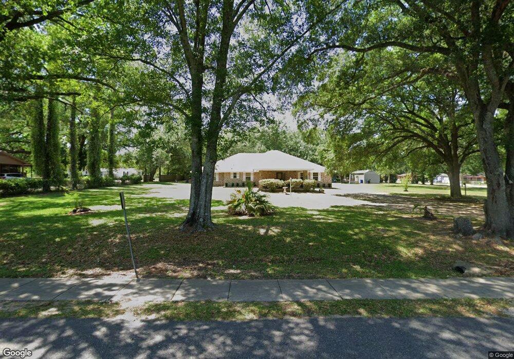
This home is located at 702 S Maple St, Foley, AL 36535 and is currently estimated at $396,270, approximately $123 per square foot. 702 S Maple St is a home located in Baldwin County with nearby schools including Foley Elementary School, Foley Middle School, and Foley High School.
Ownership History
Date
Name
Owned For
Owner Type
Purchase Details
Closed on
Jul 24, 2023
Sold by
Friend Melilasa
Bought by
Thomas Recarter and Thomas Curtis
Current Estimated Value
Purchase Details
Closed on
Nov 5, 2021
Sold by
Brooks Bernice and Friend Melilasa
Bought by
Dinkins Marcus
Home Financials for this Owner
Home Financials are based on the most recent Mortgage that was taken out on this home.
Original Mortgage
$325,000
Interest Rate
2.88%
Purchase Details
Closed on
Sep 7, 2013
Sold by
Brooks Bernice
Bought by
Brooks Gearette
Create a Home Valuation Report for This Property
The Home Valuation Report is an in-depth analysis detailing your home's value as well as a comparison with similar homes in the area
Home Values in the Area
Average Home Value in this Area
Purchase History
| Date | Buyer | Sale Price | Title Company |
|---|---|---|---|
| Thomas Recarter | $3,500 | None Listed On Document | |
| Dinkins Marcus | $4,000 | None Available | |
| Brooks Gearette | $198,300 | None Available |
Source: Public Records
Mortgage History
| Date | Status | Borrower | Loan Amount |
|---|---|---|---|
| Previous Owner | Dinkins Marcus | $325,000 |
Source: Public Records
Tax History
| Year | Tax Paid | Tax Assessment Tax Assessment Total Assessment is a certain percentage of the fair market value that is determined by local assessors to be the total taxable value of land and additions on the property. | Land | Improvement |
|---|---|---|---|---|
| 2024 | $1,162 | $36,580 | $2,960 | $33,620 |
| 2023 | $1,202 | $37,800 | $3,500 | $34,300 |
| 2022 | $779 | $24,980 | $0 | $0 |
| 2021 | $693 | $21,840 | $0 | $0 |
| 2020 | $644 | $20,880 | $0 | $0 |
| 2019 | $696 | $22,440 | $0 | $0 |
| 2018 | $689 | $20,880 | $0 | $0 |
| 2017 | $0 | $19,840 | $0 | $0 |
| 2016 | $0 | $19,440 | $0 | $0 |
| 2015 | -- | $19,260 | $0 | $0 |
| 2014 | -- | $17,840 | $0 | $0 |
| 2013 | -- | $34,340 | $0 | $0 |
Source: Public Records
Map
Nearby Homes
- 201 S Stuart St
- 615 E Pedigo Ave
- 1524 Kairos Loop
- 801 S Juniper St
- 1452 Kairos Loop
- 603 E Walker Ave
- 1166 Pheasant Cir
- 704 Mayflower Dr
- 808 Orchard Ln
- 12215 Robert Lane Dr
- 0 E Azalea Ave
- 502 E Myrtle Ave
- 21815 US Highway 98 Unit 2
- 637 Revere St
- 503 Meadow Ln
- 112 S Juniper St
- 652 Mayflower Dr
- 644 Mayflower Dr
- 639 Mayflower Dr
- 631 Mayflower Dr
- 706 S Maple St
- 1010 E Azalea Ave
- 703 S Maple St
- 1013 E Azalea Ave
- 707 S Maple St
- 1008 E Azalea Ave
- 720 S Maple St S
- 709 S Maple St
- 921 E Azalea Ave
- 921 Azalea St
- 1105 E Jefferson Ave
- 12080 E Azalea Ave
- 1105 E Jackson Ave
- 12054 S Pecan St
- 901 S Pecan St
- 805 S Pecan St
- 805 S Pecan St
- 713 S Pecan St
- 809 S Maple St
- 903 S Pecan St
Your Personal Tour Guide
Ask me questions while you tour the home.