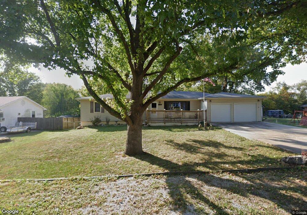
702 SW Maple Ln Oak Grove, MO 64075
Estimated Value: $248,000 - $273,307
5
Beds
3
Baths
1,680
Sq Ft
$154/Sq Ft
Est. Value
About This Home
This home is located at 702 SW Maple Ln, Oak Grove, MO 64075 and is currently estimated at $258,077, approximately $153 per square foot. 702 SW Maple Ln is a home located in Jackson County with nearby schools including Oak Grove Primary School, Oak Grove Elementary School, and Oak Grove Middle School.
Ownership History
Date
Name
Owned For
Owner Type
Purchase Details
Closed on
Jan 18, 2022
Sold by
Costigan Joseph P and Ashcraft Mary
Bought by
Vanspeybroeck David and Stone Adrienne
Current Estimated Value
Home Financials for this Owner
Home Financials are based on the most recent Mortgage that was taken out on this home.
Original Mortgage
$254,600
Outstanding Balance
$235,670
Interest Rate
3.45%
Mortgage Type
New Conventional
Estimated Equity
$22,407
Purchase Details
Closed on
Nov 12, 2019
Sold by
Demoss Marion K and Demoss Ursula
Bought by
Demoss Marion Ken and Demoss Ursula
Purchase Details
Closed on
Dec 8, 2010
Sold by
Federal Home Loan Mortgage Corporation
Bought by
Demoss Marion K
Home Financials for this Owner
Home Financials are based on the most recent Mortgage that was taken out on this home.
Original Mortgage
$84,000
Interest Rate
4.41%
Mortgage Type
New Conventional
Purchase Details
Closed on
May 30, 1997
Sold by
Robinson Wayne Matt
Bought by
Robinson Sheryl Ann
Create a Home Valuation Report for This Property
The Home Valuation Report is an in-depth analysis detailing your home's value as well as a comparison with similar homes in the area
Home Values in the Area
Average Home Value in this Area
Purchase History
| Date | Buyer | Sale Price | Title Company |
|---|---|---|---|
| Vanspeybroeck David | -- | Security 1St Title | |
| Vanspeybroeck David | -- | Security 1St Title | |
| Demoss Marion Ken | -- | None Available | |
| Demoss Marion Ken | -- | None Available | |
| Demoss Marion K | -- | Stewart Title | |
| Robinson Sheryl Ann | -- | -- |
Source: Public Records
Mortgage History
| Date | Status | Borrower | Loan Amount |
|---|---|---|---|
| Open | Vanspeybroeck David | $254,600 | |
| Closed | Vanspeybroeck David | $254,600 | |
| Previous Owner | Demoss Marion K | $84,000 |
Source: Public Records
Tax History Compared to Growth
Tax History
| Year | Tax Paid | Tax Assessment Tax Assessment Total Assessment is a certain percentage of the fair market value that is determined by local assessors to be the total taxable value of land and additions on the property. | Land | Improvement |
|---|---|---|---|---|
| 2025 | $2,585 | $35,178 | $5,200 | $29,978 |
| 2024 | $2,585 | $33,271 | $5,692 | $27,579 |
| 2023 | $2,560 | $33,271 | $5,381 | $27,890 |
| 2022 | $2,242 | $26,600 | $4,583 | $22,017 |
| 2021 | $2,193 | $26,600 | $4,583 | $22,017 |
| 2020 | $2,142 | $25,305 | $4,583 | $20,722 |
| 2019 | $2,038 | $25,305 | $4,583 | $20,722 |
| 2018 | $1,690 | $22,024 | $3,989 | $18,035 |
| 2017 | $1,662 | $22,024 | $3,989 | $18,035 |
| 2016 | $1,662 | $20,995 | $3,021 | $17,974 |
| 2014 | $1,463 | $18,427 | $3,546 | $14,881 |
Source: Public Records
Map
Nearby Homes
- 704 SW Clinton St
- TBD SW 5th St
- 1705 Locust St
- 1312 SW Clinton St
- 1212 SW 5th St
- 1001 SW Powell Dr
- 1106 SW 10th St
- 400 SW Powell Dr
- 1501 SW Stonewall Dr
- 1700 SW Stonewall Dr
- 1606 SW Stonewall Dr
- 508 SE 12th St
- 708 SW Whitetail Dr
- 303 SW 17th St
- Lot 19 TBD SE Holstein Dr
- 1201 SW 4th St
- 113 N Austin St
- TBD N Broadway St
- 1202 SW Cardinal Ct
- 1108 SE Oak Ridge Dr
- 704 SW Maple Ln
- 401 SW 7th St
- 705 SW Maple Ln
- 703 Sheridan St
- 403 SW 7th St
- 705 Sheridan St
- 400 SW 8th St
- 707 SW Maple Ln
- 703 SW Maple Ln
- 502 SW 8th St
- 701 SW Maple Ln
- 709 SW Maple Ln
- 702 Sheridan St
- 702 SW Locust St
- 704 SW Locust St
- 700 Sheridan St
- 706 Sheridan St
- 706 SW Locust St
- 708 Sheridan St
- 700 SW Locust St