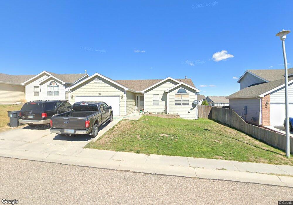
702 Teton St Cheyenne, WY 82007
Estimated Value: $275,000 - $344,000
--
Bed
--
Bath
1,167
Sq Ft
$274/Sq Ft
Est. Value
About This Home
This home is located at 702 Teton St, Cheyenne, WY 82007 and is currently estimated at $319,749, approximately $273 per square foot. 702 Teton St is a home located in Laramie County with nearby schools including Arp Elementary School, Johnson Junior High School, and South High School.
Ownership History
Date
Name
Owned For
Owner Type
Purchase Details
Closed on
Apr 25, 2017
Sold by
Dehal Holdings Llc
Bought by
Hansen Harold Lynn and Hansen Debra E
Current Estimated Value
Purchase Details
Closed on
Feb 22, 2008
Sold by
Hansen Harold L and Hansen Debra E
Bought by
Dehal Holdings Llc
Purchase Details
Closed on
Jan 25, 2005
Sold by
Bruso Homes Inc
Bought by
Hansen Harold L and Hansen Debra E
Create a Home Valuation Report for This Property
The Home Valuation Report is an in-depth analysis detailing your home's value as well as a comparison with similar homes in the area
Home Values in the Area
Average Home Value in this Area
Purchase History
| Date | Buyer | Sale Price | Title Company |
|---|---|---|---|
| Hansen Harold Lynn | -- | None Available | |
| Dehal Holdings Llc | -- | None Available | |
| Hansen Harold L | -- | -- |
Source: Public Records
Tax History Compared to Growth
Tax History
| Year | Tax Paid | Tax Assessment Tax Assessment Total Assessment is a certain percentage of the fair market value that is determined by local assessors to be the total taxable value of land and additions on the property. | Land | Improvement |
|---|---|---|---|---|
| 2025 | $1,765 | $18,650 | $2,708 | $15,942 |
| 2024 | $1,765 | $24,959 | $3,611 | $21,348 |
| 2023 | $1,789 | $25,297 | $3,611 | $21,686 |
| 2022 | $1,603 | $22,208 | $3,611 | $18,597 |
| 2021 | $1,453 | $20,085 | $3,611 | $16,474 |
| 2020 | $1,396 | $19,358 | $3,611 | $15,747 |
| 2019 | $1,284 | $17,780 | $3,611 | $14,169 |
| 2018 | $1,182 | $16,526 | $3,552 | $12,974 |
| 2017 | $1,190 | $16,490 | $3,552 | $12,938 |
| 2016 | $1,168 | $16,171 | $3,403 | $12,768 |
| 2015 | $1,195 | $16,549 | $3,403 | $13,146 |
| 2014 | $1,176 | $16,184 | $3,403 | $12,781 |
Source: Public Records
Map
Nearby Homes
- 317 Southern View Dr
- 139 Bear River Ave
- 128 Medicine Bow Ave
- 506 Queens Rd
- 813 Covered Wagon Dr
- 714 Broken Wheel Ct
- 824 Owl Creek Ave
- 702 E 2nd St
- 406 Avenue C
- TBD Avenue C
- 714 E Gopp Ct
- 809 E 5th St
- TBD Pack Saddle Rd
- TBD Jefferson Rd
- 821 E 6th St
- 508 E 5th St
- 615 Avenue C
- 751 Avenue C Unit 19
- 751 Avenue C Unit 35
- 1207 E 7th St